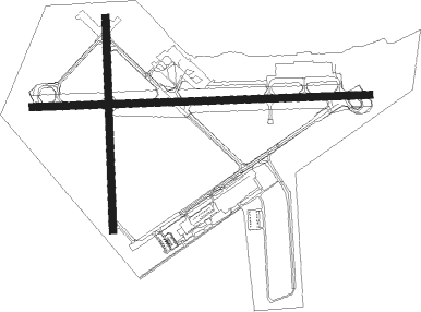
Elizabeth City - Elizabeth City Cgas Rgnl
Airport details
| Country | United States of America |
| State | North Carolina |
| Region | K7 |
| Airspace | Washington Ctr |
| Municipality | Pasquotank County |
| Elevation | 12ft (4m) |
| Timezone | GMT -5 |
| Coordinates | 36.26263, -76.17580 |
| Magnetic var | |
| Type | land |
| Available since | X-Plane v10.40 |
| ICAO code | KECG |
| IATA code | ECG |
| FAA code | ECG |
Communication
| ELIZABETH CITY CGAS RGNL ASOS | 124.375 |
| ELIZABETH CITY CGAS RGNL UNICOM | 122.950 |
| ELIZABETH CITY CGAS RGNL CTAF | 120.500 |
| ELIZABETH CITY CGAS RGNL Ground Control | 121.900 |
| ELIZABETH CITY CGAS RGNL Tower | 120.500 |
| ELIZABETH CITY CGAS RGNL NORFOLK Approach/Departure | 119.550 |
Approach frequencies
| ILS-cat-I | RW10 | 111.35 | 18.00mi |
| 3° GS | RW10 | 111.35 | 18.00mi |
Nearby Points of Interest:
Riverside Historic District
-Episcopal Cemetery
-Elizabeth City Historic District
-Northside Historic District
-Elizabeth City Water Plant
-Norfolk Southern Passenger Station
-Camden County Jail
-Camden County Courthouse
-Caleb Grandy House
-Milford
-Stockton
-Culong
-Newland Road Site
-Land's End
-Shaw House
-Twin Houses
-Sutton-Newby House
-Murfreesboro Historic District
-Coinjock Colored School
-William Riley Abbott House
-Morgan House
-Cove Grove
-Currituck County Courthouse and Jail
-Newbold-White House
-Grandy School

Nearby beacons
| code | identifier | dist | bearing | frequency |
|---|---|---|---|---|
| ECG | ELIZABETH CITY VOR/DME | 0.3 | 178° | 112.50 |
| LLW | WOODVILLE (ELIZABETH CITY) NDB | 5.9 | 270° | 254 |
| NFE | CHESAPEAKE TACAN | 26.1 | 5° | 108.25 |
| RBX | WRIGHT BROTHERS (MANTEO) VOR/DME | 31 | 126° | 111.60 |
| MQI | MANTEO NDB | 31.2 | 126° | 370 |
| CVI | COFIELD VORTAC | 34.3 | 279° | 114.60 |
| NTU | OCEANA TACAN | 34.3 | 14° | 116.60 |
| OR | INGLE (NORFOLK) NDB | 34.8 | 353° | 329 |
| ORF | NORFOLK VORTAC | 37.8 | 358° | 116.90 |
| NGU | CHAMBERS (NORFOLK) TACAN | 40.9 | 351° | 113.95 |
| FKN | FRANKLIN VORTAC | 48.6 | 298° | 110.60 |
| LFI | LANGLEY (HAMPTON) TACAN | 50.2 | 347° | 112.30 |
| AKQ | WAKEFIELD NDB | 58.7 | 311° | 274 |
| RNW | CHOCOWINITY NDB | 64 | 231° | 388 |
Instrument approach procedures
| runway | airway (heading) | route (dist, bearing) |
|---|---|---|
| RW01 | NORTN (306°) | NORTN CEGRU (13mi, 283°) 2000ft |
| RNAV | CEGRU 2000ft FOSOP (6mi, 338°) 1200ft KECG (4mi, 349°) 54ft (4738mi, 115°) 411ft GEDLE (4739mi, 296°) 2100ft GEDLE (turn) | |
| RW10 | ISUBE (91°) | ISUBE 2000ft |
| RW10 | SUNNS (118°) | SUNNS SAGOE (7mi, 130°) 2000ft ISUBE (5mi, 183°) 2000ft |
| RW10 | WINAL (67°) | WINAL ISUBE (7mi, 10°) 2000ft |
| RNAV | ISUBE 2000ft MOTUE (6mi, 92°) 1600ft KECG (5mi, 91°) 69ft (4738mi, 115°) 261ft WAXUB (4732mi, 295°) HEGUX (7mi, 339°) SUNNS (20mi, 280°) 2000ft SUNNS (turn) | |
| RW19 | ECG (358°) | ECG GEDLE (11mi, 2°) 2100ft GEDLE (turn) 2100ft |
| RW19 | SUNNS (118°) | SUNNS ODGOE (11mi, 88°) 2100ft GEDLE (5mi, 92°) 2100ft |
| RNAV | GEDLE 2100ft BESRE (6mi, 183°) 1600ft KECG (5mi, 181°) 52ft (4738mi, 115°) 900ft GEDLE (4739mi, 296°) 2100ft GEDLE (turn) | |
| RW28 | NORTN (306°) | NORTN REXUE (8mi, 331°) 2000ft LIBLE (5mi, 3°) 2000ft |
| RW28 | SUNNS (118°) | SUNNS NETUE (28mi, 100°) 2000ft LIBLE (5mi, 183°) 2000ft |
| RNAV | LIBLE 2000ft GUDLE (6mi, 272°) 1600ft KECG (6mi, 273°) 61ft (4738mi, 115°) 800ft NETUE (4727mi, 296°) 2000ft NETUE (turn) |
Disclaimer
The information on this website is not for real aviation. Use this data with the X-Plane flight simulator only! Data taken with kind consent from X-Plane 12 source code and data files. Content is subject to change without notice.