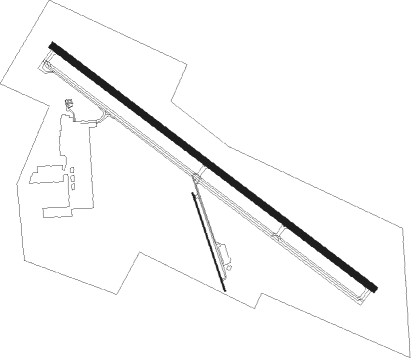
Austin - Austin Executive
Airport details
| Country | United States of America |
| State | Texas |
| Region | K4 |
| Airspace | Houston Oceanic Ctr |
| Municipality | Travis County |
| Elevation | 620ft (189m) |
| Timezone | GMT -6 |
| Coordinates | 30.40110, -97.57269 |
| Magnetic var | |
| Type | land |
| Available since | X-Plane v10.40 |
| ICAO code | KEDC |
| IATA code | n/a |
| FAA code | EDC |
Communication
| Austin Executive AWOS-3 | 118.825 |
| Austin Executive Executive Clearance Del | 126.025 |
| Austin Executive Executive Ground | 119.450 |
| Austin Executive Executive Tower | 120.300 |
| Austin Executive Austin App/Dep | 127.225 |
Nearby Points of Interest:
Aynesworth-Wright House
-Barton Springs
-Page-Gilbert House
-Hildreth-Flanagan-Heierman House
-Frank M. and Annie G. Covert House
-Col. Monroe M. Shipe House
-Smith-Marcuse-Lowry House
-Peter and Clotilde Shipe Mansbendel House
-Austin State Hospital
-Cox-Craddock House
-Worrell-Ettlinger House
-J. Frank Dobie House
-Scottish Rite Dormitory
-Southgate-Lewis House
-Camp Mabry
-Littlefield House
-Little Campus
-Battle Hall
-Connelly-Yerwood House
-Wesley United Methodist Church
-Anthony and Louise Viaer Alumni Hall
-Cambridge Tower
-Victory Grill
-Arnold Bakery
-Haehnel Building
Nearby beacons
| code | identifier | dist | bearing | frequency |
|---|---|---|---|---|
| CWK | CENTEX VORTAC | 2.6 | 118° | 112.80 |
| RU | GARYS (AUSTIN) NDB | 32.9 | 220° | 272 |
| IL | IRESH (KILLEEN) NDB | 38 | 348° | 278 |
| GRK | GRAY (FORT HOOD) VOR/DME | 39.9 | 339° | 111.80 |
| TPL | DME | 49.1 | 10° | 110.40 |
| AGJ | GOOCH SPRINGS VORTAC | 55.5 | 324° | 112.50 |
| DHK | RANDOLPH TACAN | 63.2 | 219° | 109.90 |
| RND | RANDOLPH VORTAC | 64.6 | 219° | 112.30 |
| SAT | SAN ANTONIO VORTAC | 64.8 | 230° | 116.80 |
| AN | ALAMO (SAN ANTONIO) NDB | 70.4 | 231° | 368 |
Departure and arrival routes
| Transition altitude | 18000ft |
| Transition level | 18000ft |
| SID end points | distance | outbound heading | |
|---|---|---|---|
| RW13 | |||
| SAYBR3 | 44mi | 43° | |
| ILEXY3 | 79mi | 94° | |
| BNDIA3 | 65mi | 230° | |
| MUCKY3 | 67mi | 271° | |
| AEROZ2 | 160mi | 289° | |
| ELOEL3 | 55mi | 330° | |
| RW31 | |||
| SAYBR3 | 44mi | 43° | |
| ILEXY3 | 79mi | 94° | |
| BNDIA3 | 65mi | 230° | |
| MUCKY3 | 67mi | 271° | |
| AEROZ2 | 160mi | 289° | |
| ELOEL3 | 55mi | 330° | |
| STAR starting points | distance | inbound heading | |
|---|---|---|---|
| ALL | |||
| BLEWE4 | 51.9 | 204° | |
| BITER9, POTRR1 | 42.1 | 297° | |
Instrument approach procedures
| runway | airway (heading) | route (dist, bearing) |
|---|---|---|
| RW13 | DARTE (198°) | DARTE CUSAT (15mi, 230°) 3000ft FESIS (5mi, 225°) 2500ft |
| RNAV | FESIS 2500ft IKOXE (6mi, 127°) 2200ft JIDKI (2mi, 127°) 1380ft KEDC (2mi, 129°) 659ft CIRMU (11mi, 127°) 2100ft CIRMU (turn) | |
| RW31 | SCOLL (263°) | SCOLL EFVEP (8mi, 230°) 2200ft CIRMU (6mi, 231°) 2100ft |
| RNAV | CIRMU 2100ft HIDSU (6mi, 307°) 2000ft ASESY (3mi, 307°) 1140ft KEDC (2mi, 305°) 637ft (5797mi, 107°) 812ft GUKWI (5800mi, 287°) DARTE (21mi, 28°) 3500ft DARTE (turn) |
Holding patterns
| STAR name | hold at | type | turn | heading* | altitude | leg | speed limit |
|---|---|---|---|---|---|---|---|
| BITER9 | WLEEE | VHF | left | 101 (281)° | 1.0min timed | ICAO rules | |
| BLEWE4 | SEWZY | VHF | left | 12 (192)° | 1.0min timed | ICAO rules | |
| *) magnetic outbound (inbound) holding course | |||||||
Disclaimer
The information on this website is not for real aviation. Use this data with the X-Plane flight simulator only! Data taken with kind consent from X-Plane 12 source code and data files. Content is subject to change without notice.

