Edenton - Northeastern Regl
Airport details
| Country | United States of America |
| State | North Carolina |
| Region | K7 |
| Airspace | Washington Ctr |
| Municipality | Edenton |
| Elevation | 20ft (6m) |
| Timezone | GMT -5 |
| Coordinates | 36.02773, -76.56709 |
| Magnetic var | |
| Type | land |
| Available since | X-Plane v10.40 |
| ICAO code | KEDE |
| IATA code | EDE |
| FAA code | EDE |
Communication
| Northeastern Regl AWOS 3 | 121.125 |
| Northeastern Regl CTAF/UNICOM | 123.000 |
Approach frequencies
| ILS-cat-I | RW19 | 110.95 | 18.00mi |
| 3° GS | RW19 | 110.95 | 18.00mi |
Nearby Points of Interest:
Athol
-Mulberry Hill
-Hayes Plantation
-Edenton Cotton Mill Historic District
-Sandy Point
-Strawberry Hill
-Barker House
-Chowan County Courthouse
-Wessington House
-James Iredell House
-Pembroke Hall
-Edenton Historic District
-Myers-White House
-Isaac White House
-Newbold-White House
-Perquimans County Courthouse
-Cullen and Elizabeth Jones House
-Cove Grove
-Creswell Historic District
-Sutton-Newby House
-Belvidere
-Mitchell-Ward House
-Stockton
-Scuppernong River Bridge
-Columbia Historic District
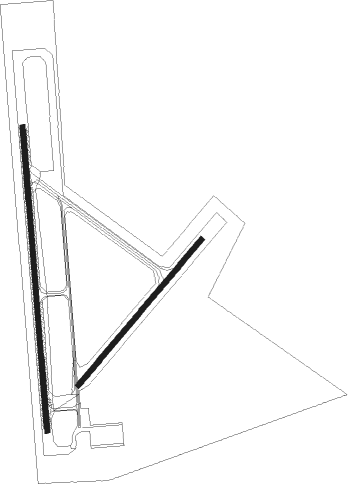
Runway info
Runway 1 / 19  | ||
| length | 1833m (6014ft) | |
| bearing | 360° / 180° | |
| width | 30m (100ft) | |
| surface | asphalt | |
| blast zone | 152m (499ft) / 255m (837ft) | |
| Runway 05 / 23 | ||
| length | 1145m (3757ft) | |
| bearing | 51° / 231° | |
| width | 30m (100ft) | |
| surface | gravel | |
Nearby beacons
| code | identifier | dist | bearing | frequency |
|---|---|---|---|---|
| LLW | WOODVILLE (ELIZABETH CITY) NDB | 19.2 | 49° | 254 |
| ECG | ELIZABETH CITY VOR/DME | 23.4 | 60° | 112.50 |
| CVI | COFIELD VORTAC | 25.4 | 319° | 114.60 |
| RNW | CHOCOWINITY NDB | 40.7 | 226° | 388 |
| RBX | WRIGHT BROTHERS (MANTEO) VOR/DME | 42.7 | 97° | 111.60 |
| MQI | MANTEO NDB | 42.9 | 97° | 370 |
| AQE | ALWOOD (GREENVILLE) NDB | 43.6 | 248° | 230 |
| NFE | CHESAPEAKE TACAN | 45.2 | 33° | 108.25 |
| FKN | FRANKLIN VORTAC | 46.5 | 327° | 110.60 |
| OR | INGLE (NORFOLK) NDB | 51.1 | 21° | 329 |
| NTU | OCEANA TACAN | 54.2 | 34° | 116.60 |
| ORF | NORFOLK VORTAC | 54.8 | 23° | 116.90 |
| NGU | CHAMBERS (NORFOLK) TACAN | 56.5 | 18° | 113.95 |
| AKQ | WAKEFIELD NDB | 61 | 336° | 274 |
| EWN | NEW BERN VOR/DME | 61.9 | 207° | 113.60 |
| ISO | KINSTON VORTAC | 62.3 | 236° | 109.60 |
Instrument approach procedures
| runway | airway (heading) | route (dist, bearing) |
|---|---|---|
| RW01 | PEARS (58°) | PEARS ACOTO (10mi, 77°) 3000ft JETZO (4mi, 85°) 1800ft |
| RNAV | JETZO 1800ft ZOYKO (6mi, 35°) 1800ft IVOTY (5mi, 18°) 214ft (4755mi, 115°) 420ft UKAMY (4754mi, 295°) 4000ft UKAMY (turn) | |
| RW19 | CVI (139°) | CVI IDWAP (17mi, 117°) 2500ft |
| RW19 | ECG (240°) | ECG OJGAL (15mi, 276°) 2500ft IDWAP (6mi, 230°) 2500ft |
| RW19 | IDWAP (179°) | IDWAP 2500ft |
| RW19 | SUNNS (188°) | SUNNS IDWAP (14mi, 196°) 2500ft |
| RNAV | IDWAP 2500ft EYUFI (6mi, 180°) 1600ft ZAKUN (3mi, 180°) 560ft KEDE (2mi, 176°) 60ft (4755mi, 115°) 600ft IDWAP (4757mi, 295°) 2500ft IDWAP (turn) |
Disclaimer
The information on this website is not for real aviation. Use this data with the X-Plane flight simulator only! Data taken with kind consent from X-Plane 12 source code and data files. Content is subject to change without notice.