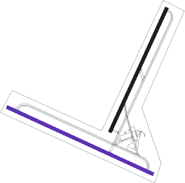
Needles
Airport details
| Country | United States of America |
| State | California |
| Region | K2 |
| Airspace | Los Angeles Ctr |
| Municipality | Needles |
| Elevation | 981ft (299m) |
| Timezone | GMT -8 |
| Coordinates | 34.76635, -114.62328 |
| Magnetic var | |
| Type | land |
| Available since | X-Plane v10.40 |
| ICAO code | KEED |
| IATA code | EED |
| FAA code | EED |
Communication
| Needles ASOS | 128.325 |
| Needles CTAF/UNICOM | 123.000 |
| Needles LOS ANGELES CNTR | 134.650 |
Nearby beacons
| code | identifier | dist | bearing | frequency |
|---|---|---|---|---|
| EED | NEEDLES VORTAC | 7.3 | 90° | 115.20 |
| GFS | GOFFS VORTAC | 34.9 | 303° | 114.40 |
| PKE | PARKER VORTAC | 40 | 185° | 117.90 |
| IGM | KINGMAN VOR/DME | 45 | 54° | 108.80 |
Instrument approach procedures
| runway | airway (heading) | route (dist, bearing) |
|---|---|---|
| RW29 | EED (270°) | EED HAVOX (5mi, 127°) 3800ft HAVOX (turn) 3800ft |
| RW29 | MEMPE (271°) | MEMPE HAVOX (13mi, 260°) 3800ft |
| RNAV | HAVOX 3800ft TOPIE (5mi, 282°) 3000ft ADUXE (6mi, 282°) 1087ft (6607mi, 107°) 1383ft EED (6600mi, 287°) 6000ft EED (turn) |
Disclaimer
The information on this website is not for real aviation. Use this data with the X-Plane flight simulator only! Data taken with kind consent from X-Plane 12 source code and data files. Content is subject to change without notice.

