Keene - Dillant Hopkins
Airport details
| Country | United States of America |
| State | New Hampshire |
| Region | K6 |
| Airspace | Boston Ctr |
| Municipality | Swanzey |
| Elevation | 486ft (148m) |
| Timezone | GMT -5 |
| Coordinates | 42.89839, -72.27077 |
| Magnetic var | |
| Type | land |
| Available since | X-Plane v10.30 |
| ICAO code | KEEN |
| IATA code | EEN |
| FAA code | EEN |
Communication
| Dillant Hopkins AWOS 3 | 119.025 |
| Dillant Hopkins CTAF/UNICOM | 123.000 |
| Dillant Hopkins BOSTON APCH/Departure | 123.750 |
Approach frequencies
| ILS-cat-I | RW02 | 108.9 | 18.00mi |
| 3° GS | RW02 | 108.9 | 18.00mi |
Nearby Points of Interest:
Dr. Daniel Adams House
-Wyman Tavern
-Golden Rod Grange No. 114
-Elliot Mansion
-President's House
-Dinsmoor-Hale House
-Beaver Mills
-Colony's Block
-Faulkner & Colony Woolen Mill
-Cheshire County Courthouse
-Colony House
-Sawyer Tavern
-Noah Cooke House
-Lawrence Farm
-Buckminster-Kingsbury Farm
-Smith-Mason Farm
-Stone Farm
-Stone-Darracott House
-Needham House
-Ballou-Newbegin House
-Willard Homestead
-Troy Village Historic District
-Mason-Watkins House
-John Adams Homestead-Wellscroft
-Elbridge G. Bemis House
Runway info
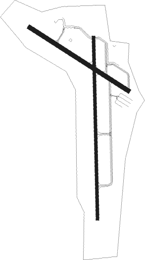
Runway 2 / 20  | ||
| length | 1892m (6207ft) | |
| bearing | 4° / 184° | |
| width | 30m (98ft) | |
| surface | asphalt | |
| Runway 14 / 32 | ||
| length | 1218m (3996ft) | |
| bearing | 119° / 299° | |
| width | 46m (151ft) | |
| surface | asphalt | |
| displ threshold | 0m (0ft) / 335m (1099ft) | |
Nearby beacons
| code | identifier | dist | bearing | frequency |
|---|---|---|---|---|
| EEN | DME | 6.3 | 191° | 109.40 |
| GDM | GARDNER VOR/DME | 23.1 | 149° | 110.60 |
| CNH | CLAREMONT NDB | 28.6 | 348° | 233 |
| MJ | FITZY (MANCHESTER) NDB | 32.7 | 93° | 209 |
| CON | CONCORD VOR/DME | 36.1 | 65° | 112.90 |
| CO | EPSOM (CONCORD) NDB | 38.2 | 75° | 216 |
| MHT | MANCHESTER VOR/DME | 39.7 | 92° | 114.40 |
| CEF | WESTOVER(SPRINGFIELD/CHIC TACAN | 43.5 | 200° | 114 |
| LEB | DME | 46.9 | 4° | 113.70 |
| CTR | CHESTER VOR/DME | 47.2 | 228° | 115.10 |
| RUT | DME | 48 | 313° | 111 |
| BAF | BARNES (WESTFIELD/SPRINGF VORTAC | 48.4 | 211° | 113 |
| LAH | HANOVER (LEBANON) NDB | 48.4 | 7° | 276 |
| LC | BLNAP (LACONIA) NDB | 50 | 49° | 328 |
| DYO | SMUTO (RUTLAND) NDB | 57 | 320° | 221 |
| PUT | PUTNAM VOR/DME | 59.7 | 156° | 117.40 |
Instrument approach procedures
| runway | airway (heading) | route (dist, bearing) |
|---|---|---|
| RW02 | JUNPU (4°) | JUNPU 3400ft |
| RW02 | TESCO (328°) | TESCO JUNPU (7mi, 272°) 3400ft |
| RW02 | ZORFO (39°) | ZORFO JUNPU (7mi, 92°) 3400ft |
| RNAV | JUNPU 3400ft JURGI (6mi, 4°) 2600ft CEYAK (2mi, 4°) 1920ft KEEN (5mi, 4°) 531ft (4631mi, 121°) 1600ft JUNPU (4629mi, 301°) 3400ft JUNPU (turn) |
Disclaimer
The information on this website is not for real aviation. Use this data with the X-Plane flight simulator only! Data taken with kind consent from X-Plane 12 source code and data files. Content is subject to change without notice.