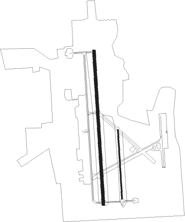
Crestview - Duke Field
Airport details
| Country | United States of America |
| State | Florida |
| Region | K7 |
| Airspace | Jacksonville Ctr |
| Municipality | Okaloosa County |
| Elevation | 188ft (57m) |
| Timezone | GMT -6 |
| Coordinates | 30.64859, -86.52196 |
| Magnetic var | |
| Type | land |
| Available since | X-Plane v10.40 |
| ICAO code | KEGI |
| IATA code | EGI |
| FAA code | EGI |
Communication
| Duke Field Ground | 123.250 |
| Duke Field Tower | 133.200 |
| Duke Field Approach | 125.100 |
| Duke Field Departure | 124.050 |
Approach frequencies
| ILS-cat-I | RW18 | 111.7 | 18.00mi |
| 3° GS | RW18 | 111.7 | 18.00mi |
Nearby Points of Interest:
Crestview Commercial Historic District
-Eglin Field Historic District
-McKinley Climatic Laboratory
-Camp Pinchot Historic District
-Gulfview Hotel Historic District
-Governor Stone
-Sun Bright
-Perry L. Biddle House
-St. Agatha's Episcopal Church
-DeFuniak Springs Historic District
-Louisville and Nashville Depot
-Ollinger-Cobb House
-Milton Historic District
-Mt. Pilgrim African Baptist Church
-Arcadia Sawmill and Arcadia Cotton Mill

Nearby beacons
| code | identifier | dist | bearing | frequency |
|---|---|---|---|---|
| DWG | WARRINGTON (VALPARAISO) TACAN | 10.2 | 180° | 134.50 |
| CE | KOBRA (CRESTVIEW) NDB | 12.2 | 356° | 201 |
| CEW | CRESTVIEW VORTAC | 13.4 | 318° | 115.90 |
| HRT | HURLBURT (MARY ESTHER) TACAN | 15.8 | 217° | 110.80 |
| NGS | SANTA ROSA (MILTON) TACAN | 21.5 | 265° | 133.60 |
| NSE | WHITING (MILTON) TACAN | 26 | 279° | 112.30 |
| PKZ | PICKENS (PENSACOLA) NDB | 36.2 | 252° | 326 |
| JUY | JUDD (ANDALUSIA) NDB | 40 | 11° | 264 |
| PFN | LYNNE (PANAMA CITY) NDB | 42.8 | 114° | 278 |
| NUN | SAUFLEY (PENSACOLA) VOR | 43.4 | 258° | 108.80 |
| NPA | PENSACOLA TACAN | 44.6 | 250° | 117.20 |
| BVG | BOLL WEEVIL (ENTERPRISE) NDB | 49.9 | 38° | 352 |
| OZ | RUCKR (FT RUCKER) NDB | 50.2 | 51° | 212 |
| EDN | ENTERPRISE VOR | 50.3 | 44° | 116.60 |
| OZR | CAIRNS (FT RUCKER) VOR/DME | 55.3 | 52° | 111.20 |
| LOR | LOWE (FORT RUCKER) NDB | 58.6 | 48° | 269 |
| PAM | TYNDALL (PANAMA CITY) TACAN | 60 | 121° | 133.70 |
| HEY | HANCHEY (FT RUCKER) VOR | 62.4 | 50° | 110.60 |
| HYE | HANCHEY (FT RUCKER) NDB | 62.4 | 50° | 221 |
| MVC | MONROEVILLE VORTAC | 64.7 | 314° | 116.80 |
Instrument approach procedures
| runway | airway (heading) | route (dist, bearing) |
|---|---|---|
| RW18 | JIVES (216°) | JIVES 3000ft JAROV (9mi, 271°) 2200ft |
| RW18 | OWNEE (146°) | OWNEE 3000ft JAROV (9mi, 91°) 2200ft |
| RNAV | JAROV 2200ft ROXXI (9mi, 181°) 2100ft KEGI (7mi, 181°) 246ft WUTAR (14mi, 181°) 3000ft WUTAR (turn) | |
| RW36 | DNESS (24°) | DNESS 1800ft JRAYY (8mi, 54°) 1800ft |
| RW36 | JONYJ (338°) | JONYJ 1800ft JRAYY (8mi, 306°) 1800ft |
| RNAV | JRAYY 1800ft HIMUM (6mi, 1°) 1800ft KEGI (6mi, 2°) 240ft MUMMA (13mi, 357°) 2000ft MUMMA (turn) 4000ft |
Disclaimer
The information on this website is not for real aviation. Use this data with the X-Plane flight simulator only! Data taken with kind consent from X-Plane 12 source code and data files. Content is subject to change without notice.