Emmetsburg - Emmetsburg Muni
Airport details
| Country | United States of America |
| State | Iowa |
| Region | K3 |
| Airspace | Minneapolis Ctr |
| Municipality | Palo Alto County |
| Elevation | 1206ft (368m) |
| Timezone | GMT -6 |
| Coordinates | 43.10205, -94.70453 |
| Magnetic var | |
| Type | land |
| Available since | X-Plane v10.40 |
| ICAO code | KEGQ |
| IATA code | n/a |
| FAA code | EGQ |
Communication
| Emmetsburg Muni CTAF/UNICOM | 122.800 |
Nearby Points of Interest:
Emmetsburg Public Library
-Logan Center School No.5
-Laurens Carnegie Free Library
-Clay County Courthouse
-Henry Adams Building
-Gerome Clark House
-Pocahontas County Courthouse
-Saints Peter and Paul Catholic Church
-Spirit Lake Massacre Log Cabin
-Spirit Lake Public Library
-Dickinson County Courthouse
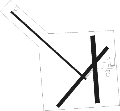
Runway info
Runway 13 / 31  | ||
| length | 1038m (3406ft) | |
| bearing | 128° / 308° | |
| width | 18m (60ft) | |
| surface | concrete | |
| Runway 04 / 22 | ||
| length | 774m (2539ft) | |
| bearing | 53° / 233° | |
| width | 37m (120ft) | |
| surface | grass | |
| Runway 17 / 35 | ||
| length | 658m (2159ft) | |
| bearing | 181° / 1° | |
| width | 46m (150ft) | |
| surface | grass | |
Nearby beacons
| code | identifier | dist | bearing | frequency |
|---|---|---|---|---|
| EGQ | EMMETSBURG NDB | 0.1 | 250° | 410 |
| SPW | SPENCER VOR/DME | 22 | 277° | 110 |
| SP | SNORE (SPENCER) NDB | 28.4 | 282° | 394 |
| FQ | MONTZ (FAIRMONT) NDB | 32.9 | 39° | 420 |
| FNX | DME | 34.5 | 29° | 114.25 |
| FOD | FORT DODGE VORTAC | 34.5 | 140° | 113.50 |
| FRM | DME | 34.9 | 27° | 110.20 |
| FO | BARRO (FORT DODGE) NDB | 39.4 | 146° | 341 |
| OT | WONDD (WORTHINGTON) NDB | 45.3 | 304° | 277 |
| OTG | WORTHINGTON VOR/DME | 50.3 | 302° | 110.60 |
Instrument approach procedures
| runway | airway (heading) | route (dist, bearing) |
|---|---|---|
| RW13 | COVUP (107°) | COVUP 3800ft ZERGA (5mi, 55°) 3800ft |
| RW13 | ULBOW (153°) | ULBOW 3800ft ZERGA (5mi, 235°) 3800ft |
| RW13 | ZERGA (128°) | ZERGA 3800ft |
| RNAV | ZERGA 3800ft FOROV (6mi, 128°) 2900ft ISEPE (3mi, 128°) 1900ft KEGQ (3mi, 127°) 1246ft HIVEN (11mi, 128°) 3800ft HIVEN (turn) | |
| RW31 | EHZET (334°) | EHZET 3800ft HIVEN (5mi, 55°) 3800ft |
| RW31 | HIVEN (308°) | HIVEN 3800ft |
| RW31 | OGILY (287°) | OGILY 3800ft HIVEN (5mi, 235°) 3800ft |
| RNAV | HIVEN 3800ft JIBAM (6mi, 308°) 2900ft KOKAW (3mi, 308°) 2000ft KEGQ (3mi, 308°) 1245ft ZERGA (12mi, 308°) 3800ft ZERGA (turn) |
Disclaimer
The information on this website is not for real aviation. Use this data with the X-Plane flight simulator only! Data taken with kind consent from X-Plane 12 source code and data files. Content is subject to change without notice.