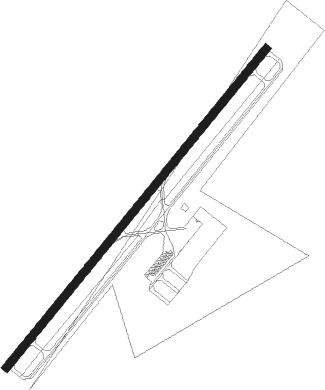
Shelby - Shelby Cleveland County Regl
Airport details
| Country | United States of America |
| State | North Carolina |
| Region | K7 |
| Airspace | Atlanta Ctr |
| Municipality | Shelby |
| Elevation | 847ft (258m) |
| Timezone | GMT -5 |
| Coordinates | 35.25575, -81.60075 |
| Magnetic var | |
| Type | land |
| Available since | X-Plane v10.40 |
| ICAO code | KEHO |
| IATA code | n/a |
| FAA code | EHO |
Communication
| Shelby Cleveland County Regl AWOS 3 | 118.425 |
| Shelby Cleveland County Regl CTAF/UNICOM | 122.800 |
| Shelby Cleveland County Regl CHARLOTTE Approach/Departure | 134.750 |
Nearby beacons
| code | identifier | dist | bearing | frequency |
|---|---|---|---|---|
| SLP | FIRST RIVER (SHELBY) NDB | 0.2 | 148° | 417 |
| SPA | SPARTANBURG VORTAC | 20.8 | 236° | 115.70 |
| GHJ | STONIA (GASTONIA) NDB | 22 | 98° | 260 |
| FIQ | FIDDLERS (MORGANTON) NDB | 27.5 | 351° | 391 |
| CLT | CHARLOTTE VOR/DME | 32 | 96° | 115 |
| UZ | RALLY (ROCK HILL) NDB | 33.6 | 125° | 227 |
| SUG | SUGARLOAF MT. (ASHEVILLE) VORTAC | 33.9 | 283° | 112.20 |
| UOT | UNION COUNTY NDB | 34.3 | 184° | 326 |
| DCM | CHESTER NDB | 34.4 | 140° | 220 |
| HK | TAWBA (HICKORY) NDB | 34.9 | 29° | 332 |
| BZM | BARRETTS MOUNTAIN (HICKOR VOR/DME | 40.8 | 30° | 113.75 |
| BRA | BROAD RIVER (ASHEVILLE) NDB | 42.6 | 271° | 379 |
| GM | JUDKY (GREENVILLE) NDB | 46.6 | 238° | 521 |
| LKR | LANCASTER NDB | 48.5 | 126° | 400 |
| IM | KEANS (ASHEVILLE) NDB | 51 | 286° | 357 |
| GY | DYANA (GREENVILLE) NDB | 53.5 | 236° | 338 |
| BAR | HEMLOCK (BANNER ELK) NDB | 55.6 | 343° | 320 |
| EOE | ENOREE (NEWBERRY) NDB | 56.7 | 182° | 278 |
Departure and arrival routes
| Transition altitude | 18000ft |
| Transition level | 18000ft |
| STAR starting points | distance | inbound heading | |
|---|---|---|---|
| ALL | |||
| UNARM6 | 36.1 | 4° | |
| LIINN3 | 23.0 | 137° | |
| MAJIC4 | 65.9 | 244° | |
| RASLN3 | 69.9 | 289° | |
| CHPTR3 | 44.4 | 353° | |
Instrument approach procedures
| runway | airway (heading) | route (dist, bearing) |
|---|---|---|
| RW05 | SPA (56°) | SPA ZISUG (8mi, 66°) 3000ft |
| RW05 | ZISUG (49°) | ZISUG 3000ft |
| RNAV | ZISUG 3000ft UPCEG (6mi, 49°) 3000ft YIGUG (5mi, 50°) 1540ft KEHO (3mi, 50°) 875ft (4994mi, 113°) 1084ft JIRUL (4990mi, 293°) LINCO (9mi, 46°) 4000ft LINCO (turn) | |
| RW23 | LINCO (227°) | LINCO 4000ft |
| RNAV | LINCO 4000ft JIRUL (9mi, 226°) 2500ft ZEMRO (3mi, 230°) 1600ft KEHO (3mi, 230°) 877ft (4994mi, 113°) 1087ft ZISUG (5002mi, 293°) 3000ft ZISUG (turn) |
Holding patterns
| STAR name | hold at | type | turn | heading* | altitude | leg | speed limit |
|---|---|---|---|---|---|---|---|
| CHPTR3 | EYPAD | VHF | right | 218 (38)° | DME 10.0mi | ICAO rules | |
| CHPTR3 | GRD | NDB | right | 227 (47)° | < 17999ft | 1.0min timed | ICAO rules |
| LIINN3 | LIINN | VHF | right | 302 (122)° | DME 10.0mi | ICAO rules | |
| MAJIC4 | KELLS | VHF | right | 39 (219)° | DME 15.0mi | ICAO rules | |
| MAJIC4 | MAJIC | VHF | left | 39 (219)° | DME 10.0mi | ICAO rules | |
| RASLN3 | DSTEE | VHF | left | 141 (321)° | DME 4.0mi | ICAO rules | |
| RASLN3 | FLO | NDB | left | 140 (320)° | 1.0min timed | ICAO rules | |
| RASLN3 | RODEZ | VHF | left | 141 (321)° | DME 5.0mi | ICAO rules | |
| UNARM6 | GRD | NDB | right | 227 (47)° | < 17999ft | 1.0min timed | ICAO rules |
| UNARM6 | LOCKS | VHF | right | 232 (52)° | < 17999ft | 1.0min timed | ICAO rules |
| UNARM6 | UNARM | VHF | right | 233 (53)° | DME 4.0mi | ICAO rules | |
| *) magnetic outbound (inbound) holding course | |||||||
Disclaimer
The information on this website is not for real aviation. Use this data with the X-Plane flight simulator only! Data taken with kind consent from X-Plane 12 source code and data files. Content is subject to change without notice.
