Erie - Erie Muni
Airport details
| Country | United States of America |
| State | Colorado |
| Region | K2 |
| Airspace | Denver Ctr |
| Municipality | Erie |
| Elevation | 5119ft (1560m) |
| Timezone | GMT -7 |
| Coordinates | 40.01025, -105.04808 |
| Magnetic var | |
| Type | land |
| Available since | X-Plane v10.40 |
| ICAO code | KEIK |
| IATA code | n/a |
| FAA code | EIK |
Communication
| Erie Muni AWOS 3 | 133.825 |
| Erie Muni CTAF/UNICOM | 123.000 |
| Erie Muni DENVER Approach/Departure | 126.100 |
Nearby Points of Interest:
Boulder Valley Grange No. 131
-Boulder County Poor Farm
-Thede Farmhouse
-McKenzie Well
-Longmont Fire Department
-St. Stephen's Episcopal Church
-Longmont College
-William J. Gregory House
-Rocky Flats Plant
-Carnegie Library
-Harris Park School
-Bowles House
-Arvada Downtown
-Arvada Flour Mill
-Walker Ranch
-Pioneer Sod House
-United Church of Christ of Highlandlake
-Highlands Masonic Lodge
-All Saints Episcopal Church
-St. Dominic's Church
-Tower of Memories
-Little Church in the Pines
-Salina School
-Temple Emanuel
-Frederick W. Neef House
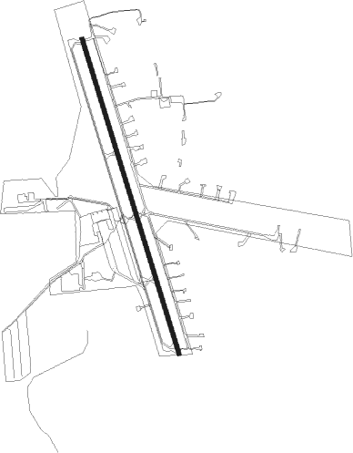
Runway info
| Runway 15 / 33 | ||
| length | 1435m (4708ft) | |
| bearing | 164° / 344° | |
| width | 18m (60ft) | |
| surface | concrete | |
Nearby beacons
| code | identifier | dist | bearing | frequency |
|---|---|---|---|---|
| BJC | JEFFCO (DENVER) VOR/DME | 7.1 | 223° | 115.40 |
| DVV | MILE HIGH (DENVER) VORTAC | 20.7 | 105° | 114.70 |
| DEN | DENVER VOR/DME | 21.4 | 117° | 117.90 |
| FN | COLLN (FT COLLINS-LOVELAND) NDB | 21.4 | 12° | 400 |
| BKF | BUCKLEY (AURORA) TACAN | 22.7 | 136° | 109.60 |
| FQF | FALCON (DENVER) VORTAC | 27.5 | 127° | 116.30 |
| GLL | GILL VOR/DME | 37.3 | 45° | 114.20 |
Instrument approach procedures
| runway | airway (heading) | route (dist, bearing) |
|---|---|---|
| RWNVB | BJC (43°) | BJC ZABNI (20mi, 41°) 8000ft ZABNI (turn) 7300ft |
| RNAV | ZABNI 7300ft SHATZ (6mi, 221°) 7300ft MAGIH (6mi, 221°) 5880ft (6094mi, 111°) 5880ft ZABNI (6086mi, 291°) 7300ft ZABNI (turn) |
Disclaimer
The information on this website is not for real aviation. Use this data with the X-Plane flight simulator only! Data taken with kind consent from X-Plane 12 source code and data files. Content is subject to change without notice.