Eureka - Murray Fld
Airport details
| Country | United States of America |
| State | California |
| Region | K2 |
| Airspace | Seattle Ctr |
| Municipality | Eureka |
| Elevation | 5ft (2m) |
| Timezone | GMT -8 |
| Coordinates | 40.80339, -124.11279 |
| Magnetic var | |
| Type | land |
| Available since | X-Plane v10.40 |
| ICAO code | KEKA |
| IATA code | EKA |
| FAA code | EKA |
Communication
| Murray Fld CTAF/UNICOM | 122.700 |
| Murray Fld SEATTLE CNTR | 124.850 |
Nearby Points of Interest:
George McFarlan House
-Thomas F. Ricks House
-United States Post Office and Courthouse
-Eureka
-Carnegie Free Library
-Eureka Theater
-Odd Fellows Hall
-E. Janssen Building
-William S. Clark House
-Humboldt Bay Woolen Mill
-Old Jacoby Creek School
-Pythian Castle
-Ferndale Main Street Historic District
-Fernbridge
-F. W. Andreasen-John Rossen House
-Trinidad Head Light
-Ferndale Library
-Alford-Nielson House
-Shaw House
-A. Berding House
-Masonic Temple
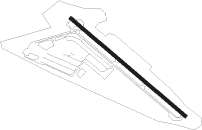
Runway info
| Runway 12 / 30 | ||
| length | 917m (3009ft) | |
| bearing | 127° / 307° | |
| width | 23m (75ft) | |
| surface | asphalt | |
Nearby beacons
| code | identifier | dist | bearing | frequency |
|---|---|---|---|---|
| FOT | FORTUNA VORTAC | 9.6 | 223° | 114 |
| ACV | ARCATA VOR/DME | 10.6 | 1° | 115.05 |
| CEC | CRESCENT CITY VORTAC | 58.9 | 353° | 109 |
Instrument approach procedures
| runway | airway (heading) | route (dist, bearing) |
|---|---|---|
| RW12 | FOT (43°) | FOT SCUPY (15mi, 345°) 3400ft SCUPY (turn) 3000ft |
| RW12 | TRIAL (154°) | TRIAL SCUPY (9mi, 205°) 3000ft |
| RNAV | SCUPY 3000ft WAVLI (6mi, 122°) 1600ft XUNXO (4mi, 122°) 291ft (6914mi, 108°) 411ft SCUPY (6919mi, 288°) 3000ft SCUPY (turn) | |
| RWNVB | FOT (43°) | FOT 3000ft CIRTO (4mi, 43°) 2300ft |
| RWNVB | TUNGS (24°) | TUNGS FOT (4mi, 329°) 3000ft CIRTO (4mi, 43°) 2300ft |
| RNAV | CIRTO 2300ft SHUKS (3mi, 43°) 1700ft MABFI (3mi, 43°) 1640ft (6914mi, 108°) 1640ft FOT (6922mi, 288°) 3000ft FOT (turn) |
Disclaimer
The information on this website is not for real aviation. Use this data with the X-Plane flight simulator only! Data taken with kind consent from X-Plane 12 source code and data files. Content is subject to change without notice.