Elkhart - Elkhart Muni
Airport details
| Country | United States of America |
| State | Indiana |
| Region | K5 |
| Airspace | Chicago Ctr |
| Municipality | Elkhart |
| Elevation | 776ft (237m) |
| Timezone | GMT -5 |
| Coordinates | 41.71941, -86.00322 |
| Magnetic var | |
| Type | land |
| Available since | X-Plane v10.40 |
| ICAO code | KEKM |
| IATA code | EKI |
| FAA code | EKM |
Communication
| Elkhart Muni AWOS 3 | 124.475 |
| Elkhart Muni CTAF | 119.500 |
| Elkhart Muni UNICOM | 122.950 |
| Elkhart Muni Clearance DEL | 119.700 |
| Elkhart Muni Ground Control | 121.800 |
| Elkhart Muni Tower | 119.500 |
| Elkhart Muni SOUTH BEND Approach/Departure | 118.550 |
Approach frequencies
| ILS-cat-I | RW27 | 111.5 | 18.00mi |
| 3° GS | RW27 | 111.5 | 18.00mi |
Nearby Points of Interest:
Dr. Havilah Beardsley House
-Emmanuel C. Bickel House
-Beardsley Avenue Historic District
-Ruthmere Mansion
-Charles Gerard Conn Mansion
-Mark L. and Harriet E. Monteith House
-Green Block
-Elkhart Downtown Commercial Historic District
-State Street-Division Street Historic District
-William and Helen Koerting House
-Morehous Residential Historic District
-Joseph and Sarah Puterbaugh Farm
-Mason District Number 5 Schoolhouse
-Solomon Fowler Mansion
-Normain Heights Historic District
-Eller-Hosford House
-Garth Stroup Home
-Dodge House
-Beiger Mansion
-St. John of the Cross Episcopal Church
-Old Mishawaka Carnegie Library
-Battell Park Historic District
-Kamm and Schellinger Brewery
-Ellis-Schindler House
-St. John's Lutheran Church
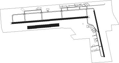
Runway info
Runway 9 / 27  | ||
| length | 1977m (6486ft) | |
| bearing | 90° / 270° | |
| width | 37m (120ft) | |
| surface | concrete | |
| blast zone | 61m (200ft) / 61m (200ft) | |
| Runway 18 / 36 | ||
| length | 1220m (4003ft) | |
| bearing | 169° / 349° | |
| width | 23m (75ft) | |
| surface | asphalt | |
| Runway 08 / 26 | ||
| length | 761m (2497ft) | |
| bearing | 90° / 270° | |
| width | 76m (250ft) | |
| surface | grass | |
Nearby beacons
| code | identifier | dist | bearing | frequency |
|---|---|---|---|---|
| SB | MISHA (SOUTH BEND) NDB | 9.7 | 266° | 341 |
| GSH | GOSHEN VORTAC | 11.7 | 187° | 113.70 |
| GIJ | GIPPER (NILES) VORTAC | 14.4 | 279° | 115.40 |
| ELX | KEELER VOR/DME | 26 | 344° | 116.60 |
| IRS | STURGIS NDB | 26.1 | 81° | 382 |
| AZ | AUSTN (KALAMAZOO) NDB | 32.5 | 49° | 371 |
| OLK | WEBSTER LAKE VOR | 36.3 | 133° | 110.40 |
| AZO | KALAMAZOO VOR/DME | 37 | 41° | 109 |
| OXI | KNOX VOR/DME | 37.5 | 238° | 115.60 |
| VP | SEDLY (VALPARAISO) NDB | 42.4 | 253° | 212 |
| PMM | PULLMAN VOR/DME | 45 | 352° | 112.10 |
| BT | BATOL (BATTLE CREEK) NDB | 53.1 | 52° | 272 |
| FWA | FORT WAYNE VORTAC | 57.6 | 132° | 117.80 |
Instrument approach procedures
| runway | airway (heading) | route (dist, bearing) |
|---|---|---|
| RW09 | GSH (7°) | GSH DUYAV (13mi, 295°) 3000ft ELUYE (5mi, 360°) 2500ft |
| RW09 | JJANN (184°) | JJANN FABKU (16mi, 239°) 4000ft ELUYE (5mi, 180°) 2500ft |
| RNAV | ELUYE 2500ft GUKGE (6mi, 90°) 2400ft KEKM (6mi, 91°) 820ft (5226mi, 116°) 1178ft CORYA (5222mi, 296°) JJANN (16mi, 342°) 4000ft JJANN (turn) | |
| RW18 | CEKMU (172°) | CEKMU 2500ft |
| RW18 | GIJ (99°) | GIJ CUBOR (11mi, 56°) 2500ft CEKMU (5mi, 84°) 2500ft |
| RW18 | VENTU (244°) | VENTU CIBIP (12mi, 273°) 2800ft CEKMU (5mi, 264°) 2500ft |
| RNAV | CEKMU 2500ft CODVA (6mi, 169°) 2400ft KEKM (5mi, 176°) 815ft (5226mi, 116°) 1178ft BUCGA (5223mi, 296°) 2500ft BUCGA (turn) | |
| RW27 | FEDIV (270°) | FEDIV 2500ft |
| RW27 | GSH (7°) | GSH DINYE (14mi, 67°) 2600ft FEDIV (5mi, 0°) 2500ft |
| RW27 | VENTU (244°) | VENTU GECET (8mi, 231°) 2600ft FEDIV (5mi, 180°) 2500ft |
| RNAV | FEDIV 2500ft COGNE (6mi, 270°) 2300ft KEKM (5mi, 269°) 822ft (5226mi, 116°) 1070ft CIGIP (5232mi, 296°) JJANN (17mi, 30°) 4000ft JJANN (turn) | |
| RW36 | BAGEL (298°) | BAGEL FIDNA (11mi, 275°) 2700ft BUCGA (5mi, 264°) 2500ft |
| RW36 | BUCGA (346°) | BUCGA 2500ft |
| RW36 | GIJ (99°) | GIJ DACAC (19mi, 135°) 3000ft BUCGA (5mi, 84°) 2500ft |
| RW36 | NOMES (68°) | NOMES DACAC (20mi, 91°) 2600ft BUCGA (5mi, 84°) 2500ft |
| RNAV | BUCGA 2500ft AYERU (6mi, 349°) 2500ft ECEBI (3mi, 349°) 1660ft KEKM (3mi, 338°) 818ft (5226mi, 116°) 1178ft CEKMU (5228mi, 296°) 2500ft CEKMU (turn) |
Disclaimer
The information on this website is not for real aviation. Use this data with the X-Plane flight simulator only! Data taken with kind consent from X-Plane 12 source code and data files. Content is subject to change without notice.