Elkins - Elkins-randolph Co-jennings Randolph Field
Airport details
| Country | United States of America |
| State | West Virginia |
| Region | K6 |
| Airspace | Washington Ctr |
| Municipality | Randolph County |
| Elevation | 1985ft (605m) |
| Timezone | GMT -5 |
| Coordinates | 38.88763, -79.85665 |
| Magnetic var | |
| Type | land |
| Available since | X-Plane v10.40 |
| ICAO code | KEKN |
| IATA code | EKN |
| FAA code | EKN |
Communication
| Elkins-Randolph Co-Jennings Randolph Field ASOS | 119.275 |
| Elkins-Randolph Co-Jennings Randolph Field CTAF | 123.600 |
| Elkins-Randolph Co-Jennings Randolph Field Clarksburg Approach | 121.150 |
| Elkins-Randolph Co-Jennings Randolph Field Clarksburg Departure | 121.150 |
Approach frequencies
| LDA | RW05 | 109.9 | 18.00mi |
Nearby Points of Interest:
Taylor-Condry House
-Scott Hill
-Gov. H. Guy Kump House
-Baldwin-Chandlee Supply Company-Valley Supply Company
-Elkins Milling Company
-Dr. John C. Irons House
-Randolph County Courthouse and Jail
-Downtown Elkins Historic District
-Riverside School
-Wees Historic District
-Warfield-Dye Residence
-Albert and Liberal Arts Halls
-Graceland
-Senator Stephen Benton Elkins House
-Davis and Elkins Historic District
-Pinecrest
-West Virginia Children's Home
-Blackman-Bosworth Store
-Bernard E. Wilmoth House
-Middle Mountain Cabins
-Western Maryland Depot
-Tucker County Courthouse and Jail
-Tucker County Bank Building
-Day-Vandevander Mill
-Carrollton Covered Bridge
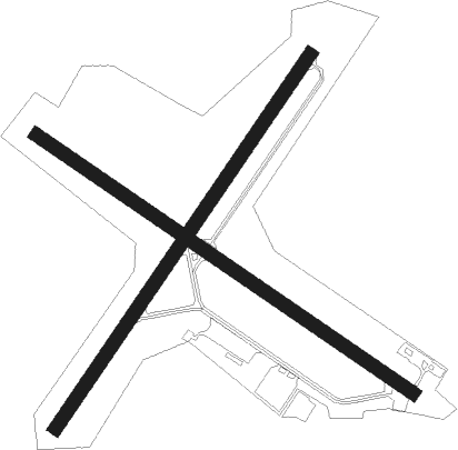
Runway info
Runway 5 / 23  | ||
| length | 1372m (4501ft) | |
| bearing | 46° / 226° | |
| width | 43m (140ft) | |
| surface | asphalt | |
| Runway 14 / 32 | ||
| length | 1384m (4541ft) | |
| bearing | 122° / 302° | |
| width | 43m (140ft) | |
| surface | asphalt | |
| displ threshold | 0m (0ft) / 424m (1391ft) | |
Nearby beacons
| code | identifier | dist | bearing | frequency |
|---|---|---|---|---|
| RQY | RANDOLPH CO. (ELKINS) NDB | 0.4 | 336° | 284 |
| EKN | ELKINS VORTAC | 11.4 | 276° | 114.20 |
| CKB | CLARKSBURG VOR/DME | 29.1 | 312° | 112.60 |
| MGW | MORGANTOWN VOR/DME | 40.1 | 360° | 111.60 |
| ESL | KESSEL VOR/DME | 45.2 | 69° | 110.80 |
| GRV | DME | 58.4 | 47° | 112.30 |
| SH | STAUT(STAUNTON-WAYNESBORO-HARR NDB | 59 | 127° | 375 |
| VV | CAMOR (CONNELLSVILLE) NDB | 59.9 | 6° | 299 |
| MOL | MONTEBELLO VOR/DME | 68.9 | 143° | 115.30 |
| RNL | RAINELLE VOR | 70.7 | 226° | 116.60 |
Instrument approach procedures
| runway | airway (heading) | route (dist, bearing) |
|---|---|---|
| RW05 | AHCIN (54°) | AHCIN DOFAD (5mi, 108°) 5900ft |
| RW05 | BOIER (338°) | BOIER KOZUL (11mi, 305°) 6900ft DOFAD (5mi, 289°) 5900ft |
| RNAV | DOFAD 5900ft ELEME (6mi, 31°) 4500ft JNIFR (2mi, 31°) 3700ft ZAROB (2mi, 31°) 3360ft KOBAH (3mi, 31°) 2215ft (4933mi, 116°) 2387ft YOLUY (4931mi, 296°) MUHAP (9mi, 32°) 5500ft MUHAP (turn) | |
| RW23 | CKB (132°) | CKB UGJOB (21mi, 91°) 6000ft MUHAP (11mi, 154°) 5000ft |
| RW23 | OMIYO (246°) | OMIYO EPXOP (16mi, 262°) 6000ft MUHAP (5mi, 262°) 5000ft |
| RNAV | MUHAP 5000ft ELUXY (6mi, 210°) 3900ft TYGRT (5mi, 210°) 2152ft (4932mi, 116°) 2387ft YUKNE (4933mi, 296°) BEVFE (6mi, 190°) 6300ft BEVFE (turn) 6300ft | |
| RWNVA | EKN (96°) | EKN JEPUS (25mi, 129°) 7300ft OMORE (5mi, 60°) 7300ft |
| RWNVA | UGJOB (185°) | UGJOB HURPI (34mi, 153°) 7300ft OMORE (5mi, 240°) 7300ft |
| RNAV | OMORE 7300ft UHHOZ (6mi, 316°) 6900ft TIVTE (5mi, 317°) 5300ft EPAHY (4mi, 317°) 3720ft (4931mi, 116°) 3720ft POHIC (4936mi, 296°) OBUNE (6mi, 311°) 4500ft OBUNE (turn) |
Disclaimer
The information on this website is not for real aviation. Use this data with the X-Plane flight simulator only! Data taken with kind consent from X-Plane 12 source code and data files. Content is subject to change without notice.