Elko - Elko Rgnl
Airport details
| Country | United States of America |
| State | Nevada |
| Region | K2 |
| Airspace | Salt Lake City Ctr |
| Municipality | Elko |
| Elevation | 5140ft (1567m) |
| Timezone | GMT -8 |
| Coordinates | 40.82496, -115.79144 |
| Magnetic var | |
| Type | land |
| Available since | X-Plane v10.40 |
| ICAO code | KEKO |
| IATA code | EKO |
| FAA code | EKO |
Communication
| Elko Rgnl ASOS | 119.275 |
| Elko Rgnl CTAF | 123.000 |
Approach frequencies
| LDA | RW24 | 108.5 | 18.00mi |
Nearby Points of Interest:
Elko Main Post Office
-Elko County Courthouse
-Ruby Valley Pony Express Station
-Ruby Crest National Recreation Trail
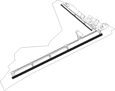
Runway info
Runway 6 / 24  | ||
| length | 2268m (7441ft) | |
| bearing | 73° / 253° | |
| width | 46m (151ft) | |
| surface | asphalt | |
| displ threshold | 0m (0ft) / 316m (1037ft) | |
| blast zone | 255m (837ft) / 142m (466ft) | |
| Runway 12 / 30 | ||
| length | 919m (3015ft) | |
| bearing | 127° / 307° | |
| width | 18m (60ft) | |
| surface | asphalt | |
| displ threshold | 276m (906ft) / 44m (144ft) | |
Nearby beacons
| code | identifier | dist | bearing | frequency |
|---|---|---|---|---|
| BQU | BULLION (ELKO) VOR/DME | 4.1 | 155° | 114.50 |
| LWL | WELLS VOR/DME | 41.6 | 69° | 114.20 |
Instrument approach procedures
| runway | airway (heading) | route (dist, bearing) |
|---|---|---|
| RW06 | ARAYI (228°) | ARAYI SAZTO (32mi, 241°) 10000ft SAZTO (turn) 10000ft |
| RNAV | SAZTO 10000ft EGOLY (9mi, 73°) 7300ft FATRO (2mi, 73°) 6600ft KEKO (5mi, 73°) 5092ft (6560mi, 109°) 6800ft SAZTO (6576mi, 289°) 10000ft SAZTO (turn) | |
| RW24 | JEBEG (328°) | JEBEG TEVOE (30mi, 21°) 12700ft SPEIL (7mi, 299°) 12300ft KOQHO (7mi, 299°) 9000ft |
| RW24 | VODOU (244°) | VODOU BUCAK (11mi, 224°) 9000ft KOQHO (8mi, 230°) 9000ft |
| RW24 | YOBBO (224°) | YOBBO BUCAK (13mi, 155°) 9000ft KOQHO (8mi, 230°) 9000ft |
| RNAV | KOQHO 9000ft LOYIW (5mi, 271°) 7600ft NIXIE (3mi, 262°) 6780ft ZOKEG (5mi, 262°) 5272ft (6559mi, 109°) 5540ft SAZTO (6576mi, 289°) 10000ft SAZTO (turn) |
Disclaimer
The information on this website is not for real aviation. Use this data with the X-Plane flight simulator only! Data taken with kind consent from X-Plane 12 source code and data files. Content is subject to change without notice.