Elmira/corning - Elmira Corning Rgnl
Airport details
| Country | United States of America |
| State | New York |
| Region | K6 |
| Airspace | New York Ctr |
| Municipality | Big Flats |
| Elevation | 954ft (291m) |
| Timezone | GMT -5 |
| Coordinates | 42.15985, -76.89175 |
| Magnetic var | |
| Type | land |
| Available since | X-Plane v10.40 |
| ICAO code | KELM |
| IATA code | ELM |
| FAA code | ELM |
Communication
| Elmira Corning Rgnl ATIS | 125.475 |
| Elmira Corning Rgnl UNICOM | 122.950 |
| Elmira Corning Rgnl CTAF | 122.400 |
| Elmira Corning Rgnl Ground Control/Clearance DEL | 121.900 |
| Elmira Corning Rgnl Tower | 121.100 |
| Elmira Corning Rgnl Approach/Departure | 119.450 |
| Elmira Corning Rgnl Approach/Departure | 118.150 |
Approach frequencies
| ILS-cat-I | RW24 | 109.1 | 18.00mi |
| ILS-cat-I | RW06 | 109.1 | 18.00mi |
| 3° GS | RW24 | 109.1 | 18.00mi |
| 3° GS | RW06 | 109.1 | 18.00mi |
Nearby Points of Interest:
Chemung Railway Depot-Horseheads
-Horseheads 1855 Extension Historic District
-Hanover Square Historic District
-Zimmerman House
-Elmira Heights Village Hall
-John W. Jones House
-Fire Station No. 4
-Elmira College Old Campus
-Near Westside Historic District
-Pratt House
-William S. Gerity House
-Quarry Farm
-Elmira Civic Historic District
-Chemung County Courthouse Complex
-Buildings at 104–116 West Water St.
-Chemung Canal Bank Building
-John Brand Jr. House
-Alexander Eustace House
-John Brand Sr. House
-Maple Avenue Historic District
-Corning Armory
-Market Street Historic District
-World War Memorial Library
-Southside Historic District
-United States Post Office
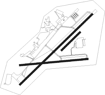
Runway info
Runway 10 / 28  | ||
| length | 1643m (5390ft) | |
| bearing | 89° / 269° | |
| width | 46m (151ft) | |
| surface | asphalt | |
| displ threshold | 0m (0ft) / 123m (404ft) | |
| blast zone | 0m (0ft) / 60m (197ft) | |
| Runway 6 / 24 | ||
| length | 2437m (7995ft) | |
| bearing | 58° / 238° | |
| width | 46m (151ft) | |
| surface | asphalt | |
| displ threshold | 183m (600ft) / 62m (203ft) | |
| blast zone | 0m (0ft) / 110m (361ft) | |
| Runway 05 / 23 | ||
| length | 614m (2014ft) | |
| bearing | 58° / 238° | |
| width | 46m (151ft) | |
| surface | grass | |
Nearby beacons
| code | identifier | dist | bearing | frequency |
|---|---|---|---|---|
| ULW | ELMIRA VOR/DME | 7.1 | 244° | 109.65 |
| ALP | ALPINE (ELMIRA) NDB | 7.3 | 58° | 245 |
| ITH | DME | 27.8 | 52° | 111.80 |
| IT | VRNAH (ITHACA) NDB | 28.3 | 63° | 266 |
| PYA | PENN YAN NDB | 29.9 | 341° | 260 |
| CFB | BINGHAMTON VOR/DME | 33.6 | 90° | 112.20 |
| SFK | STONYFORK VOR/DME | 36.5 | 229° | 108.60 |
| FQM | WILLIAMSPORT VOR/DME | 49.6 | 172° | 114.40 |
| GEE | GENESEO VOR/DME | 55 | 309° | 108.20 |
| ROC | ROCHESTER VOR/DME | 67 | 321° | 110 |
Instrument approach procedures
| runway | airway (heading) | route (dist, bearing) |
|---|---|---|
| RW06 | UNOLY (58°) | UNOLY 4000ft |
| RNAV | UNOLY 4000ft JOKEN (7mi, 58°) 3200ft CONAC (3mi, 58°) 2320ft KELM (5mi, 59°) 992ft (4824mi, 119°) 1144ft IREKE (4814mi, 299°) 4000ft IREKE (turn) | |
| RW10 | MIXUE (89°) | MIXUE 4000ft |
| RNAV | MIXUE 4000ft HABOM (6mi, 89°) 3400ft KELM (7mi, 89°) 984ft (4824mi, 119°) 1355ft CEKAN (4810mi, 299°) 4000ft CEKAN (turn) | |
| RW24 | IREKE (238°) | IREKE 4000ft |
| RNAV | IREKE 4000ft CERUP (7mi, 239°) 3200ft ERINN (4mi, 238°) 2040ft KELM (4mi, 238°) 1007ft (4824mi, 119°) 1154ft UNOLY (4834mi, 299°) 4000ft UNOLY (turn) | |
| RW28 | CEKAN (270°) | CEKAN 4000ft |
| RNAV | CEKAN 4000ft FIDON (6mi, 270°) 3400ft ZIGAN (3mi, 270°) 2320ft KELM (4mi, 271°) 994ft (4824mi, 119°) 1355ft MIXUE (4837mi, 299°) 4000ft MIXUE (turn) |
Disclaimer
The information on this website is not for real aviation. Use this data with the X-Plane flight simulator only! Data taken with kind consent from X-Plane 12 source code and data files. Content is subject to change without notice.