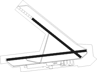
Ellensburg - Bowers Fld
Airport details
| Country | United States of America |
| State | Washington |
| Region | K1 |
| Airspace | Seattle Ctr |
| Municipality | Kittitas County |
| Elevation | 1763ft (537m) |
| Timezone | GMT -8 |
| Coordinates | 47.02963, -120.53849 |
| Magnetic var | |
| Type | land |
| Available since | X-Plane v10.40 |
| ICAO code | KELN |
| IATA code | ELN |
| FAA code | ELN |
Communication
| Bowers Fld ASOS | 118.375 |
| Bowers Fld CTAF/UNICOM | 123.000 |
Nearby beacons
| code | identifier | dist | bearing | frequency |
|---|---|---|---|---|
| ELN | ELLENSBURG (ELLENSBERG) VOR/DME | 3.2 | 94° | 117.90 |
| EAT | WENATCHEE VOR/DME | 25.9 | 42° | 111 |
| YKM | YAKIMA VORTAC | 27.8 | 168° | 116 |
Instrument approach procedures
| runway | airway (heading) | route (dist, bearing) |
|---|---|---|
| RW29 | AYISO (250°) | AYISO ELIYO (6mi, 118°) 6200ft LARDY (5mi, 228°) 4100ft NELUE (3mi, 303°) 3300ft |
| RW29 | BOVYA (264°) | BOVYA ELIYO (4mi, 229°) 6400ft LARDY (5mi, 228°) 4100ft NELUE (3mi, 303°) 3300ft |
| RNAV | NELUE 3300ft KITSE (2mi, 303°) 2800ft KELN (4mi, 296°) 1787ft (6622mi, 111°) 2170ft ELIYO (6614mi, 291°) 5400ft ELIYO (turn) | |
| RWNVC | BANDR (103°) | BANDR BEEZR (26mi, 103°) 8000ft ZOBIM (6mi, 77°) 6600ft |
| RWNVC | ELN (274°) | ELN ZOBIM (14mi, 295°) 6600ft ZOBIM (turn) 6600ft |
| RWNVC | WUSVI (92°) | WUSVI BEEZR (6mi, 44°) 8000ft ZOBIM (6mi, 77°) 6600ft |
| RNAV | ZOBIM 6600ft COBDI (4mi, 114°) 5300ft FOGIG (4mi, 122°) 3880ft KELN (4mi, 130°) 1803ft (6622mi, 111°) 2700ft GEBTE (6625mi, 291°) SELAH (10mi, 196°) 5500ft SELAH (turn) |
Disclaimer
The information on this website is not for real aviation. Use this data with the X-Plane flight simulator only! Data taken with kind consent from X-Plane 12 source code and data files. Content is subject to change without notice.

