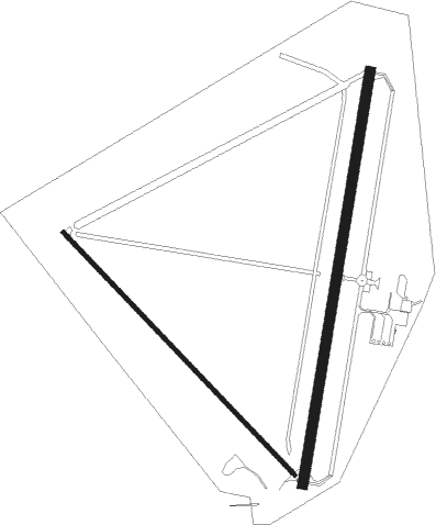
Ely - Ely Arpt Yelland Fld
Airport details
| Country | United States of America |
| State | Nevada |
| Region | K2 |
| Airspace | Salt Lake City Ctr |
| Municipality | White Pine County |
| Elevation | 6257ft (1907m) |
| Timezone | GMT -8 |
| Coordinates | 39.29969, -114.84189 |
| Magnetic var | |
| Type | land |
| Available since | X-Plane v10.40 |
| ICAO code | KELY |
| IATA code | ELY |
| FAA code | ELY |
Communication
| Ely Arpt Yelland Fld ASOS | 120.625 |
| Ely Arpt Yelland Fld CTAF/UNICOM | 122.800 |
Nearby Points of Interest:
Ely L.D.S. Stake Tabernacle
-White Pine County Courthouse
-United States Post Office
-Capital Theatre
-American Legion Hall
-McGill Historical Drug Store Museum
-Nevada Northern Railway – McGill Depot
-Osceola Ditch
Nearby beacons
| code | identifier | dist | bearing | frequency |
|---|---|---|---|---|
| ELY | ELY VOR/DME | 0.3 | 256° | 110.60 |
| CNT | DME | 51.8 | 230° | 114.95 |
Instrument approach procedures
| runway | airway (heading) | route (dist, bearing) |
|---|---|---|
| RW18 | FAPGI (188°) | FAPGI JAMOP (7mi, 183°) 9500ft |
| RW18 | INGOL (148°) | INGOL GUSME (12mi, 121°) 10600ft JAMOP (4mi, 121°) 9500ft |
| RNAV | JAMOP 9500ft FEILL (5mi, 179°) 8500ft KELY (8mi, 199°) 6275ft (6545mi, 109°) 6652ft ZOLOB (6546mi, 289°) DOTME (26mi, 152°) 12000ft DOTME (turn) |
Disclaimer
The information on this website is not for real aviation. Use this data with the X-Plane flight simulator only! Data taken with kind consent from X-Plane 12 source code and data files. Content is subject to change without notice.

