Centralia - Centralia Muni
Airport details
| Country | United States of America |
| State | Illinois |
| Region | K5 |
| Airspace | Kansas City Ctr |
| Municipality | Centralia |
| Elevation | 534ft (163m) |
| Timezone | GMT -6 |
| Coordinates | 38.51508, -89.09114 |
| Magnetic var | |
| Type | land |
| Available since | X-Plane v10.40 |
| ICAO code | KENL |
| IATA code | ENL |
| FAA code | ENL |
Communication
| Centralia Muni AWOS 3 | 121.125 |
| Centralia Muni CTAF/UNICOM | 122.800 |
Nearby Points of Interest:
Centralia Elks Lodge
-Sentinel Building
-Centralia Commercial Historic District
-William Jennings Bryan Boyhood Home
-Charles and Naomi Bachmann House
-Badollet House
-General Dean Suspension Bridge
-5th District Appellate Court
-Louisville and Nashville Depot (Nashville, Illinois)
-Calendar Rohrbough House
-Heritage House Museum
-Paine House (Xenia, Illinois)
-C. H. Judd House
-James C. Twiss House
-Sesser Opera House
-Greenville Public Library
-First Presbyterian Church
-Little Brick House
-Mayberry Mound and Village Site
-Perry County Jail
-Floyd and Glenora Dycus House
-Baltimore and Ohio Railroad Depot
-Shriver House
-Pearl and Bess Meyer House
-Rutter Store
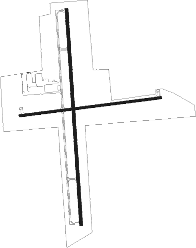
Runway info
Runway 9 / 27  | ||
| length | 1007m (3304ft) | |
| bearing | 88° / 268° | |
| width | 18m (60ft) | |
| surface | asphalt | |
| Runway 18 / 36 | ||
| length | 1526m (5007ft) | |
| bearing | 181° / 1° | |
| width | 23m (75ft) | |
| surface | asphalt | |
Nearby beacons
| code | identifier | dist | bearing | frequency |
|---|---|---|---|---|
| ENL | CENTRALIA VORTAC | 6.5 | 216° | 115 |
| VNN | VERNON DME | 16.2 | 118° | 113.80 |
| GRE | GREENVILLE NDB | 23.2 | 319° | 233 |
| JD | GOOEY (BELLEVILLE) NDB | 30.4 | 267° | 385 |
| FWC | WAYNE CO (FAIRFIELD) NDB | 33 | 101° | 257 |
| VLA | VANDALIA VOR/DME | 34.9 | 353° | 114.30 |
| SKE | SCOTT (BELLEVILLE) TACAN | 35.7 | 272° | 112.20 |
| BIB | BIBLE GROVE VORTAC | 37.5 | 56° | 109 |
| MD | CABBI (CARBONDALE-MURPHYSBORO) NDB | 39.4 | 193° | 388 |
| MW | JONNY (MARION) NDB | 40.9 | 170° | 382 |
| TOY | TROY VORTAC | 41 | 285° | 116 |
| OLY | OLNEY NDB | 44.7 | 78° | 272 |
| CP | ACORE (CAHOKIA/ST LOUIS) NDB | 45.4 | 270° | 350 |
| MWA | DME | 45.8 | 174° | 110.40 |
| CVM | CIVIC MEMORIAL (ALTON) NDB | 50.5 | 291° | 263 |
| SYZ | SHELBYVILLE NDB | 54.7 | 16° | 365 |
| MTO | DME | 68.9 | 40° | 109.40 |
Instrument approach procedures
| runway | airway (heading) | route (dist, bearing) |
|---|---|---|
| RW18 | HUTWI (181°) | HUTWI 10000ft HUTWI (turn) 2600ft |
| RNAV | HUTWI 2600ft QIMLA (7mi, 181°) 2100ft YIRBU (3mi, 181°) 1040ft KENL (2mi, 180°) 564ft (5362mi, 113°) 880ft WOKSO (5363mi, 293°) 2600ft WOKSO (turn) | |
| RW36 | WOKSO (1°) | WOKSO 2600ft |
| RNAV | WOKSO 2600ft YEJUL (7mi, 1°) 2100ft KENL (5mi, 1°) 579ft (5362mi, 113°) 784ft HUTWI (5362mi, 293°) 2600ft HUTWI (turn) |
Disclaimer
The information on this website is not for real aviation. Use this data with the X-Plane flight simulator only! Data taken with kind consent from X-Plane 12 source code and data files. Content is subject to change without notice.