Wendover
Airport details
| Country | United States of America |
| State | Utah |
| Region | K2 |
| Airspace | Salt Lake City Ctr |
| Municipality | Wendover |
| Elevation | 4234ft (1291m) |
| Timezone | GMT -7 |
| Coordinates | 40.71872, -114.02866 |
| Magnetic var | |
| Type | land |
| Available since | X-Plane v10.40 |
| ICAO code | KENV |
| IATA code | ENV |
| FAA code | ENV |
Communication
| Wendover AWOS 3 | 135.075 |
| Wendover CTAF/UNICOM | 122.800 |
Nearby Points of Interest:
Wendover Air Force Base
-Danger Cave
-Bonneville Speedway
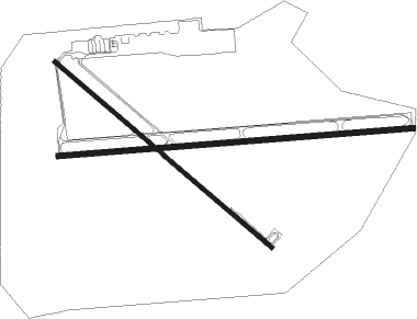
Runway info
Runway 12 / 30  | ||
| length | 2438m (7999ft) | |
| bearing | 127° / 307° | |
| width | 32m (105ft) | |
| surface | asphalt | |
| blast zone | 0m (0ft) / 31m (102ft) | |
| Runway 8 / 26 | ||
| length | 3036m (9961ft) | |
| bearing | 90° / 270° | |
| width | 46m (150ft) | |
| surface | asphalt | |
| blast zone | 30m (98ft) / 0m (0ft) | |
Nearby beacons
| code | identifier | dist | bearing | frequency |
|---|---|---|---|---|
| BVL | BONNEVILLE VORTAC | 12.3 | 88° | 112.30 |
| LCU | LUCIN VORTAC | 39.6 | 16° | 113.60 |
| LWL | WELLS VOR/DME | 50 | 294° | 114.20 |
Departure and arrival routes
| Transition altitude | 18000ft |
| Transition level | 18000ft |
| SID end points | distance | outbound heading | |
|---|---|---|---|
| RW08 | |||
| ENV1 | 12mi | 88° | |
| RW12 | |||
| ENV1 | 12mi | 88° | |
| RW26 | |||
| ENV1 | 12mi | 88° | |
Instrument approach procedures
| runway | airway (heading) | route (dist, bearing) |
|---|---|---|
| RW08 | SPATS (93°) | SPATS HUTLO (11mi, 96°) 10100ft |
| RNAV | HUTLO 10100ft DENRE (4mi, 90°) 9900ft YITUL (2mi, 90°) 9400ft KENV (9mi, 90°) 4290ft (6485mi, 110°) 4560ft BVL (6473mi, 290°) 9000ft BVL (turn) | |
| RW26 | BVL (268°) | BVL ZONSU (8mi, 86°) 9000ft ZONSU (turn) 9000ft |
| RNAV | ZONSU 9000ft UTAVY (15mi, 266°) 5900ft ZETVI (4mi, 270°) 4515ft (6483mi, 110°) 4637ft ZONSU (6465mi, 290°) 9000ft ZONSU (turn) | |
| RWNVC | SPATS (93°) | SPATS MEDBE (11mi, 97°) 10100ft |
| RNAV | MEDBE 10100ft JUTEB (6mi, 90°) 9300ft WEPLI (5mi, 90°) 7300ft KENV (4mi, 90°) 4270ft (6485mi, 110°) 4637ft MOJVL (6482mi, 290°) BVL (10mi, 88°) 9000ft BVL (turn) |
Disclaimer
The information on this website is not for real aviation. Use this data with the X-Plane flight simulator only! Data taken with kind consent from X-Plane 12 source code and data files. Content is subject to change without notice.