Ephrata - Ephrata Muni
Airport details
| Country | United States of America |
| State | Washington |
| Region | K1 |
| Airspace | Seattle Ctr |
| Municipality | Ephrata |
| Elevation | 1273ft (388m) |
| Timezone | GMT -8 |
| Coordinates | 47.30807, -119.51691 |
| Magnetic var | |
| Type | land |
| Available since | X-Plane v10.40 |
| ICAO code | KEPH |
| IATA code | EPH |
| FAA code | EPH |
Communication
| Ephrata Muni ASOS | 135.775 |
| Ephrata Muni CTAF/UNICOM | 122.800 |
| Ephrata Muni GRANT CO Approach/Departure | 126.400 |
Nearby Points of Interest:
Grant County Courthouse
-Grand Coulee
-Withrow Moraine and Jameson Lake Drumlin Field
-Drumheller Channels National Natural Landmark
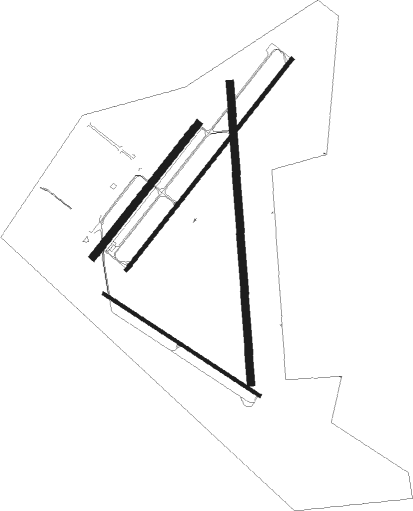
Runway info
Runway 3 / 21  | ||
| length | 1675m (5495ft) | |
| bearing | 54° / 234° | |
| width | 23m (75ft) | |
| surface | asphalt | |
| blast zone | 166m (545ft) / 138m (453ft) | |
| Runway 11 / 29 | ||
| length | 1165m (3822ft) | |
| bearing | 118° / 298° | |
| width | 18m (60ft) | |
| surface | asphalt | |
| blast zone | 0m (0ft) / 255m (837ft) | |
| Runway 4 / 22 | ||
| length | 1055m (3461ft) | |
| bearing | 54° / 234° | |
| width | 46m (150ft) | |
| surface | asphalt | |
| Runway 16 / 34 | ||
| length | 1873m (6145ft) | |
| bearing | 181° / 1° | |
| width | 46m (150ft) | |
| surface | asphalt | |
Nearby beacons
| code | identifier | dist | bearing | frequency |
|---|---|---|---|---|
| EPH | EPHRATA VORTAC | 5.6 | 53° | 112.60 |
| MWH | MOSES LAKE VOR/DME | 10 | 116° | 115 |
| MW | PELLY (MOSES LAKE) NDB | 15.2 | 128° | 408 |
| EAT | WENATCHEE VOR/DME | 28.7 | 278° | 111 |
| ELN | ELLENSBURG (ELLENSBERG) VOR/DME | 42 | 253° | 117.90 |
| YKM | YAKIMA VORTAC | 58.4 | 232° | 116 |
Instrument approach procedures
| runway | airway (heading) | route (dist, bearing) |
|---|---|---|
| RW03 | ELN (73°) | ELN DOFDO (22mi, 81°) 6700ft UDECU (8mi, 81°) 4500ft |
| RW03 | MWH (296°) | MWH UDECU (18mi, 261°) 4500ft UDECU (turn) 4500ft |
| RNAV | UDECU 4500ft WIMBU (7mi, 53°) 3200ft WIGEB (4mi, 54°) 1820ft KEPH (2mi, 55°) 1321ft (6577mi, 112°) 1519ft TICYU (6567mi, 292°) 3800ft TICYU (turn) | |
| RW21 | MWH (296°) | MWH TICYU (14mi, 358°) 4000ft TICYU (turn) 3800ft |
| RW21 | WIPES (256°) | WIPES TICYU (9mi, 280°) 3800ft |
| RNAV | TICYU 3800ft CIGUM (6mi, 234°) 2900ft KEPH (6mi, 233°) 1327ft UDECU (14mi, 234°) 4500ft UDECU (turn) |
Disclaimer
The information on this website is not for real aviation. Use this data with the X-Plane flight simulator only! Data taken with kind consent from X-Plane 12 source code and data files. Content is subject to change without notice.