Erie - Erie Intl Tom Ridge Fld
Airport details
| Country | United States of America |
| State | Pennsylvania |
| Region | K6 |
| Airspace | Cleveland Ctr |
| Municipality | Millcreek Township |
| Elevation | 729ft (222m) |
| Timezone | GMT -5 |
| Coordinates | 42.08308, -80.17394 |
| Magnetic var | |
| Type | land |
| Available since | X-Plane v10.40 |
| ICAO code | KERI |
| IATA code | ERI |
| FAA code | ERI |
Communication
| Erie Intl Tom Ridge Fld ATIS | 120.350 |
| Erie Intl Tom Ridge Fld UNICOM | 122.950 |
| Erie Intl Tom Ridge Fld CTAF | 118.100 |
| Erie Intl Tom Ridge Fld Clearance DEL | 126.800 |
| Erie Intl Tom Ridge Fld Ground Control | 121.900 |
| Erie Intl Tom Ridge Fld Tower | 118.100 |
| Erie Intl Tom Ridge Fld Approach/Departure | 121.000 |
Approach frequencies
| ILS-cat-I | RW24 | 110.3 | 18.00mi |
| ILS-cat-I | RW06 | 110.3 | 18.00mi |
| 3° GS | RW24 | 110.3 | 18.00mi |
| 3° GS | RW06 | 110.3 | 18.00mi |
Nearby Points of Interest:
Thayer-Thompson House
-West Sixth Street Historic District
-West 21st Street Historic District
-John Hill House
-Charles Manning Reed Mansion
-Boston Store
-West Park Place
-Cashier's House
-Old Customshouse
-Sturgeon House
-Renaissance Centre
-Chandlery Corner
-Modern Tool Company
-Lovell Manufacturing Company
-Pierre S. V. Hamot House
-Jackson Koehler Eagle Brewery
-Dickson Tavern
-Federal Row
-Erie Armory
-Gudgeonville Covered Bridge
-Waterford Borough Historic District
-Academy Hall
-North East Historic District
-Cambridge Springs Bridge
-Amos Kelly House
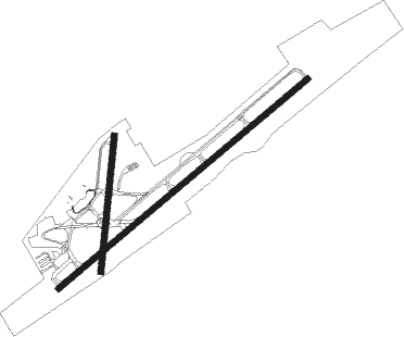
Runway info
Runway 6 / 24  | ||
| length | 2564m (8412ft) | |
| bearing | 62° / 242° | |
| width | 46m (150ft) | |
| surface | asphalt | |
| displ threshold | 280m (919ft) / 0m (0ft) | |
| Runway 2 / 20 | ||
| length | 1070m (3510ft) | |
| bearing | 13° / 193° | |
| width | 46m (150ft) | |
| surface | asphalt | |
| displ threshold | 249m (817ft) / 93m (305ft) | |
Nearby beacons
| code | identifier | dist | bearing | frequency |
|---|---|---|---|---|
| ERI | ERIE VORTAC | 6.6 | 241° | 109.40 |
| JFN | JEFFERSON VOR/DME | 32.1 | 241° | 115.20 |
| TDT | DME | 40.4 | 116° | 117.60 |
| FKL | FRANKLIN VOR | 41.2 | 154° | 109.60 |
| DKK | DME | 46.8 | 66° | 116.20 |
| YNG | YOUNGSTOWN VORTAC | 50.4 | 214° | 109 |
| CXR | CHARDON VOR/DME | 55.8 | 240° | 112.70 |
| YN | FETCH (YOUNGSTOWN/WARREN) NDB | 56.2 | 206° | 338 |
| FD | BRANTFORD NDB | 60.4 | 346° | 207 |
| CIP | DME | 64.7 | 143° | 112.90 |
| YXU | LONDON VOR/DME | 71.7 | 314° | 117.20 |
Instrument approach procedures
| runway | airway (heading) | route (dist, bearing) |
|---|---|---|
| RW06 | ERI (61°) | ERI LADVE (6mi, 242°) 3000ft LADVE (turn) 3000ft |
| RW06 | JFN (61°) | JFN LADVE (19mi, 60°) 3000ft |
| RNAV | LADVE 3000ft CABSA (6mi, 62°) 2800ft JUNOG (4mi, 62°) 1420ft KERI (2mi, 61°) 787ft (4968mi, 118°) 982ft YUYXI (4966mi, 298°) HAMIT (8mi, 69°) 3200ft HAMIT (turn) | |
| RW24 | ERI (61°) | ERI JONLI (19mi, 62°) 3400ft JONLI (turn) 3400ft |
| RW24 | FOUTN (246°) | FOUTN JONLI (19mi, 248°) 3400ft |
| RW24 | HERMA (265°) | HERMA JONLI (21mi, 278°) 3400ft |
| RNAV | JONLI 3400ft DEFJO (7mi, 242°) 2400ft YUYXI (2mi, 242°) 1600ft KERI (3mi, 243°) 779ft (4968mi, 118°) 981ft JUNOG (4970mi, 298°) ERI (4mi, 241°) 3000ft ERI (turn) |
Disclaimer
The information on this website is not for real aviation. Use this data with the X-Plane flight simulator only! Data taken with kind consent from X-Plane 12 source code and data files. Content is subject to change without notice.