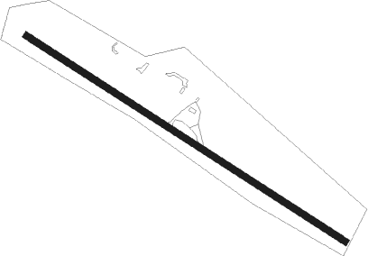
Errol
Airport details
| Country | United States of America |
| State | New Hampshire |
| Region | K6 |
| Airspace | Boston Ctr |
| Municipality | Errol |
| Elevation | 1245ft (379m) |
| Timezone | GMT -5 |
| Coordinates | 44.79227, -71.16380 |
| Magnetic var | |
| Type | land |
| Available since | X-Plane v10.40 |
| ICAO code | KERR |
| IATA code | ERR |
| FAA code | ERR |
Communication
Nearby Points of Interest:
Upton Grange No. 404
-Forest Lodge
-Benjamin Aldrich Homestead
-Wallace Farm
-Mount Jasper Lithic Source
-Martin Homestead
-Congregational Church
-Indian Stream Schoolhouse
-Andover Public Library
-Alice M. Ward Library
-Bloomfield-Nulhegan River Route 102 Bridge
-Maidstone State Park
-Garland Mill
-Lower Sunday River School
-George Washington Noyes House
-Rangeley Public Library
-Rangeley Trust Company Building
-Wilder-Holton House
-Deacon Hutchins House
-United States Post Office–Lancaster Main
-William Dennis Weeks Memorial Library
-Waumbek Cottages Historic District
-Upper Dallas School
-Weeks Estate
-Lower Meeting House and East Bethel Cemetery
Runway info
| Runway 15 / 33 | ||
| length | 1096m (3596ft) | |
| bearing | 118° / 298° | |
| width | 18m (60ft) | |
| surface | gravel | |
Nearby beacons
| code | identifier | dist | bearing | frequency |
|---|---|---|---|---|
| BML | DME | 9.5 | 188° | 116.55 |
| RQM | RANGELEY NDB | 19.5 | 71° | 221 |
| GMA | MAHN (WHITEFIELD) NDB | 34.1 | 231° | 386 |
| YSC | DME | 41.1 | 310° | 113.20 |
| LE | LEWIE (AUBURN-LEWISTON) NDB | 61.1 | 135° | 240 |
Disclaimer
The information on this website is not for real aviation. Use this data with the X-Plane flight simulator only! Data taken with kind consent from X-Plane 12 source code and data files. Content is subject to change without notice.
