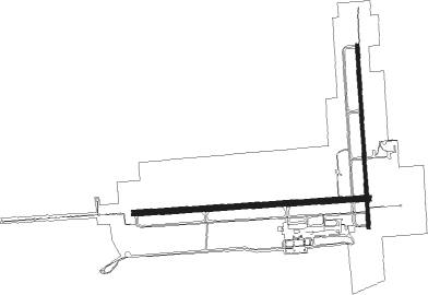
Escanaba - Delta Co
Airport details
| Country | United States of America |
| State | Michigan |
| Region | K5 |
| Airspace | Minneapolis Ctr |
| Municipality | Escanaba |
| Elevation | 606ft (185m) |
| Timezone | GMT -5 |
| Coordinates | 45.72267, -87.09372 |
| Magnetic var | |
| Type | land |
| Available since | X-Plane v10.40 |
| ICAO code | KESC |
| IATA code | ESC |
| FAA code | ESC |
Communication
| Delta Co AWOS 3 | 121.425 |
| Delta Co CTAF/UNICOM | 122.800 |
Approach frequencies
| ILS-cat-I | RW09 | 109.3 | 18.00mi |
| 3° GS | RW09 | 109.3 | 18.00mi |
Nearby Points of Interest:
Richter Brewery
-Escanaba Central Historic District
-Carnegie Public Library
-Delta Hotel
-Spider Cave
-St. Martin Island Light
-Poverty Island Light Station
-Water Tower
-Fleetwing

Nearby beacons
| code | identifier | dist | bearing | frequency |
|---|---|---|---|---|
| ESC | ESCANABA VOR/DME | 0.1 | 90° | 110.80 |
| ES | PIKLE (ESCANABA) NDB | 5.4 | 270° | 344 |
| MNM | MENOMINEE VOR/DME | 40 | 226° | 109.60 |
| SAW | SAWYER VOR/DME | 40.2 | 334° | 117.10 |
| ISQ | CO. (MANISTIQ DME | 41.4 | 75° | 114.85 |
| TN | TRIBE (MENOMINEE) NDB | 47.1 | 222° | 239 |
| II | FICHY (STURGEON BAY) NDB | 59.9 | 200° | 224 |
Instrument approach procedures
| runway | airway (heading) | route (dist, bearing) |
|---|---|---|
| RW01 | WOKOL (359°) | WOKOL 2700ft |
| RNAV | WOKOL 2700ft CUXUG (6mi, 1°) 2200ft KESC (5mi, 357°) 637ft (5283mi, 118°) 1100ft ZALKI (5287mi, 298°) 2800ft ZALKI (turn) | |
| RW09 | NAYGI (107°) | NAYGI 2500ft YEBUG (5mi, 181°) 2500ft |
| RW09 | VUYUK (73°) | VUYUK 2500ft YEBUG (5mi, 1°) 2500ft |
| RW09 | YEBUG (90°) | YEBUG 2500ft |
| RNAV | YEBUG 2500ft JAGED (6mi, 91°) 2200ft UYEPI (3mi, 91°) 1360ft KESC (3mi, 89°) 665ft ZUMAB (11mi, 91°) 2500ft ZUMAB (turn) | |
| RW19 | CESIS (183°) | CESIS 2700ft |
| RNAV | CESIS 2700ft HERRY (6mi, 181°) 2200ft KESC (5mi, 186°) 649ft (5283mi, 118°) 1100ft CESIS (5283mi, 298°) 2700ft CESIS (turn) | |
| RW27 | JAGOG (303°) | JAGOG 2500ft ZUMAB (10mi, 2°) 2500ft |
| RW27 | KESIW (239°) | KESIW 2500ft ZUMAB (10mi, 182°) 2500ft |
| RW27 | ZUMAB (271°) | ZUMAB 2500ft |
| RNAV | ZUMAB 2500ft JUVNU (6mi, 271°) 2200ft TULTE (2mi, 271°) 1440ft KESC (3mi, 272°) 646ft (5283mi, 118°) 843ft YEBUG (5295mi, 298°) 2500ft YEBUG (turn) |
Disclaimer
The information on this website is not for real aviation. Use this data with the X-Plane flight simulator only! Data taken with kind consent from X-Plane 12 source code and data files. Content is subject to change without notice.