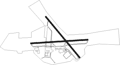
Alexandria - Esler Regl
Airport details
| Country | United States of America |
| State | Louisiana |
| Region | K4 |
| Airspace | Houston Oceanic Ctr |
| Municipality | Rapides Parish |
| Elevation | 110ft (34m) |
| Timezone | GMT -6 |
| Coordinates | 31.39490, -92.29577 |
| Magnetic var | |
| Type | land |
| Available since | X-Plane v10.40 |
| ICAO code | KESF |
| IATA code | ESF |
| FAA code | ESF |
Communication
| Esler Regl CTAF/UNICOM | 122.800 |
| Esler Regl POLK Approach/Departure | 132.050 |
Approach frequencies
| ILS-cat-I | RW27 | 111.5 | 18.00mi |
| 3° GS | RW27 | 111.5 | 18.00mi |
Nearby Points of Interest:
Tioga Commissary
-Cottingham House
-Alexandria Hall
-Central Louisiana State Hospital Dairy Barn
-Mt. Olivet Episcopal Church and Cemetery
-Bailey's Dam
-James Wade Bolton House
-Rapides Bank and Trust Company Building
-Commercial Building
-Arna Wendell Bontemps House
-Bland House
-C.A. Schnack Jewelry Company Store
-Hemenway Furniture Co. Building
-Fort Randolph
-Masonic Building
-United States Post Office and Courthouse–Alexandria
-First Methodist Church
-Alexandria Garden District
-Kent Plantation House
-Fort DeRussy
-Alexander State Forest Headquarters Building
-Lecompte High School
-Hypolite Bordelon House
-Eden
-Marksville Prehistoric Indian Site

Nearby beacons
| code | identifier | dist | bearing | frequency |
|---|---|---|---|---|
| AEX | ALEXANDRIA VORTAC | 13.4 | 236° | 116.10 |
| SWB | SAWMILL (WINNFIELD) VOR/DME | 39.8 | 327° | 113.75 |
| OOC | NATCHITOCHES NDB | 43 | 289° | 407 |
| FXU | POLK (FORT POLK) VOR | 50.3 | 253° | 108.40 |
| ECY | DURALDE (EUNICE) NDB | 50.7 | 190° | 263 |
| HEZ | NATCHEZ VOR/DME | 52.7 | 77° | 110 |
Instrument approach procedures
| runway | airway (heading) | route (dist, bearing) |
|---|---|---|
| RW09 | AEX (56°) | AEX JEVOB (9mi, 349°) 2000ft JEVOB (turn) 2000ft |
| RW09 | NUBOY (100°) | NUBOY IBVUW (18mi, 82°) 4000ft JEVOB (11mi, 148°) 2000ft |
| RNAV | JEVOB 2000ft ICIVI (6mi, 91°) 1700ft HOLAB (2mi, 91°) 940ft KESF (3mi, 90°) 149ft (5523mi, 109°) 296ft ILULE (5510mi, 289°) 3000ft ILULE (turn) | |
| RW27 | AEX (56°) | AEX ILULE (25mi, 74°) 3000ft ILULE (turn) 3000ft |
| RW27 | JOHON (284°) | JOHON ILULE (14mi, 295°) 3000ft |
| RNAV | ILULE 3000ft ESEME (6mi, 271°) 2000ft FIDRU (3mi, 271°) 1060ft KESF (3mi, 271°) 149ft (5523mi, 109°) 290ft HOVUS (5528mi, 289°) AEX (10mi, 219°) 3000ft AEX (turn) |
Disclaimer
The information on this website is not for real aviation. Use this data with the X-Plane flight simulator only! Data taken with kind consent from X-Plane 12 source code and data files. Content is subject to change without notice.