Easton - Easton Newnam Fld
Airport details
| Country | United States of America |
| State | Maryland |
| Region | K6 |
| Airspace | Washington Ctr |
| Municipality | Easton |
| Elevation | 69ft (21m) |
| Timezone | GMT -5 |
| Coordinates | 38.80416, -76.06900 |
| Magnetic var | |
| Type | land |
| Available since | X-Plane v10.40 |
| ICAO code | KESN |
| IATA code | ESN |
| FAA code | ESN |
Communication
| EASTON NEWNAM FLD AWOS 3 | 124.475 |
| EASTON NEWNAM FLD CTAF/UNICOM | 118.525 |
| EASTON NEWNAM FLD POTOMAC Clearance DEL | 126.900 |
| EASTON NEWNAM FLD GROUND | 119.075 |
| EASTON NEWNAM FLD TOWER | 118.525 |
| EASTON NEWNAM FLD POTOMAC Approach/Departure | 124.550 |
Approach frequencies
| ILS-cat-I | RW04 | 109.35 | 18.00mi |
| 3° GS | RW04 | 109.35 | 18.00mi |
Nearby Points of Interest:
Easton Historic District
-St. John's Chapel of St. Michael's Parish
-The Anchorage
-Old Bloomfield
-Miller's House
-Otwell (Oxford, Maryland)
-Edmee S.
-Edna E. Lockwood
-Cannonball House
-Jena
-Oxford Historic District (Oxford, Maryland)
-Barnaby House
-Stanley Norman
-Claude W. Somers
-Williston Mill Historic District
-West Denton Warehouse-Wharf
-Denton Armory
-Denton Historic District
-Annie Oakley House
-Glasgow
-Sigsbee
-Hilda M. Willing
-Kathryn
-E.C. Collier
-Minnie V
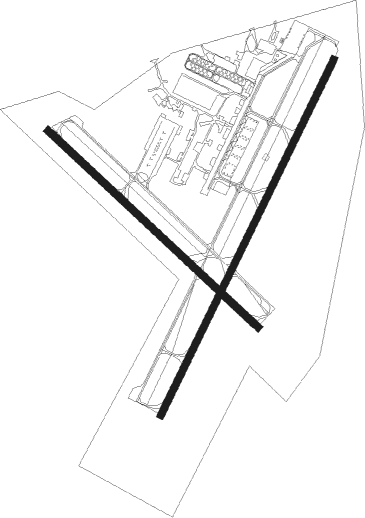
Runway info
Runway 4 / 22  | ||
| length | 1678m (5505ft) | |
| bearing | 37° / 217° | |
| width | 30m (100ft) | |
| surface | asphalt | |
| displ threshold | 0m (0ft) / 99m (325ft) | |
| blast zone | 0m (0ft) / 76m (249ft) | |
| Runway 15 / 33 | ||
| length | 1220m (4003ft) | |
| bearing | 131° / 311° | |
| width | 30m (100ft) | |
| surface | asphalt | |
Nearby beacons
| code | identifier | dist | bearing | frequency |
|---|---|---|---|---|
| OTT | NOTTINGHAM VORTAC | 32.1 | 262° | 113.70 |
| DOV | DOVER TACAN | 34.3 | 61° | 110 |
| PXT | PATUXENT (PATUXENT RIVER) VORTAC | 34.6 | 213° | 117.60 |
| NHK | PATUXENT NDB | 34.8 | 213° | 400 |
| NHK | NAS PATUXENT RIVER TACAN | 35.2 | 213° | 110.25 |
| BAL | BALTIMORE VORTAC | 35.3 | 302° | 115.10 |
| MTN | MARTIN (BALTIMORE) TACAN | 35.4 | 327° | 134.10 |
| BUH | ANNE ARUNDEL (FT MEADE) NDB | 36.3 | 292° | 260 |
| ENO | SMYRNA (KENTON) VORTAC | 36.4 | 52° | 111.40 |
| ADW | ANDREWS (CAMP SPRINGS) VORTAC | 37.3 | 270° | 113.10 |
| SBY | SALISBURY VORTAC | 38 | 129° | 111.20 |
| ATR | WATERLOO VOR/DME | 40.1 | 90° | 112.60 |
| FND | ELLICOTT (BALTIMORE) NDB | 43.9 | 304° | 371 |
| DCA | OXONN (WASHINGTON) NDB | 44.9 | 268° | 332 |
| DCA | WASHINGTON, D.C. VOR/DME | 45.3 | 273° | 111 |
| OX | LANDY (OCEAN CITY) NDB | 48.7 | 117° | 407 |
| IL | HADIN (WILMINGTON) NDB | 51.2 | 30° | 248 |
| SWL | SNOW HILL VORTAC | 53.1 | 141° | 112.40 |
| DQO | DUPONT (WILMINGTON) VORTAC | 56.7 | 28° | 114 |
| RNB | RAINBOW (MILLVILLE) NDB | 57 | 57° | 363 |
| EMI | WESTMINSTER VORTAC | 59.2 | 307° | 117.90 |
| OOD | WOODSTOWN VORTAC | 61.3 | 43° | 112.80 |
Departure and arrival routes
| Transition altitude | 18000ft |
| Transition level | 18000ft |
| SID end points | distance | outbound heading | |
|---|---|---|---|
| ALL | |||
| CONLE4 | 77mi | 205° | |
| TERPZ7 | 180mi | 238° | |
Instrument approach procedures
| runway | airway (heading) | route (dist, bearing) |
|---|---|---|
| RW04 | CLAMB (33°) | CLAMB JENOK (18mi, 29°) 2000ft RIKME (5mi, 37°) 2000ft |
| RNAV | RIKME 2000ft WEGRO (6mi, 37°) 1600ft KESN (5mi, 36°) 80ft (4756mi, 117°) 700ft ORETE (4748mi, 297°) 2000ft ORETE (turn) | |
| RW22 | AGARD (180°) | AGARD FILRO (7mi, 123°) 2000ft |
| RW22 | RIDGY (244°) | RIDGY FILRO (7mi, 278°) 2000ft |
| RNAV | FILRO 2000ft HILNU (6mi, 217°) 1600ft JOPAG (3mi, 217°) 700ft KESN (2mi, 219°) 115ft (4756mi, 117°) 320ft RIKME (4760mi, 297°) 2000ft RIKME (turn) |
Disclaimer
The information on this website is not for real aviation. Use this data with the X-Plane flight simulator only! Data taken with kind consent from X-Plane 12 source code and data files. Content is subject to change without notice.