New Smyrna Beach - New Smyrna Beach Muni
Airport details
| Country | United States of America |
| State | Florida |
| Region | K7 |
| Airspace | Jacksonville Ctr |
| Municipality | New Smyrna Beach |
| Elevation | 8ft (2m) |
| Timezone | GMT -5 |
| Coordinates | 29.05569, -80.94891 |
| Magnetic var | |
| Type | land |
| Available since | X-Plane v10.40 |
| ICAO code | KEVB |
| IATA code | n/a |
| FAA code | EVB |
Communication
| New Smyrna Beach Muni ATIS | 124.625 |
| New Smyrna Beach Muni CTAF | 119.675 |
| New Smyrna Beach Muni Ground Control | 121.325 |
| New Smyrna Beach Muni Tower | 119.675 |
| New Smyrna Beach Muni DAYTONA Approach | 125.350 |
| New Smyrna Beach Muni DAYTONA Departure | 125.350 |
Nearby Points of Interest:
El Real Retiro
-St. Rita's Colored Catholic Mission
-New Smyrna Beach Historic District
-Turnbull Colonists' House Archeological Site
-Coronado Historic District
-Old Stone Wharf Archeological Site
-Spruce Creek Mound Complex
-Gamble Place Historic District
-Halifax Drive Historic District
-Dunlawton Avenue Historic District
-Port Orange Florida East Coast Railway Freight Depot
-The Abbey
-South Beach Street Historic District
-Delos A. Blodgett House
-Olds Hall
-Seybold Baking Company Factory
-Jackie Robinson Ballpark
-Amos Kling House
-S. H. Kress and Co. Building
-United States Post Office
-S. Cornelia Young Memorial Library
-White Hall
-Rogers House
-Bartholomew J. Donnelly House
-Holly Hill Municipal Building
Runway info
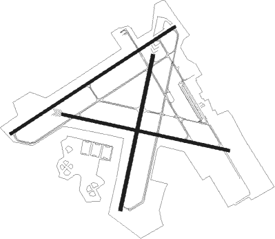
Runway 7 / 25  | ||
| length | 1524m (5000ft) | |
| bearing | 65° / 245° | |
| width | 23m (75ft) | |
| surface | asphalt | |
| displ threshold | 102m (335ft) / 91m (299ft) | |
| Runway 11 / 29 | ||
| length | 1323m (4341ft) | |
| bearing | 105° / 285° | |
| width | 23m (75ft) | |
| surface | asphalt | |
| displ threshold | 0m (0ft) / 9m (30ft) | |
| blast zone | 9m (30ft) / 0m (0ft) | |
| Runway 2 / 20 | ||
| length | 1222m (4009ft) | |
| bearing | 19° / 199° | |
| width | 30m (100ft) | |
| surface | concrete | |
| displ threshold | 240m (787ft) / 0m (0ft) | |
Nearby beacons
| code | identifier | dist | bearing | frequency |
|---|---|---|---|---|
| OMN | ORMOND BEACH VORTAC | 17.1 | 327° | 112.60 |
| ORL | ORLANDO VORTAC | 36.9 | 217° | 112.20 |
| OR | HERNY (ORLANDO) NDB | 41.6 | 221° | 221 |
| COF | PATRICK (COCOA) TACAN | 52.2 | 158° | 115 |
| SGJ | SAINT AUGUSTINE VOR/DME | 57.6 | 337° | 109.40 |
| MLB | MELBOURNE VOR/DME | 59.4 | 162° | 115.85 |
| RYD | REYNOLDS (GREEN COVE SPRINGS) NDB | 66 | 322° | 338 |
Departure and arrival routes
| Transition altitude | 18000ft |
| Transition level | 18000ft |
| STAR starting points | distance | inbound heading | |
|---|---|---|---|
| ALL | |||
| TTHOR2 | 39.4 | 155° | |
Instrument approach procedures
| runway | airway (heading) | route (dist, bearing) |
|---|---|---|
| RW02 | COCAD (98°) | COCAD LEMVE (19mi, 131°) 2000ft LEMVE (turn) 2000ft |
| RW02 | OVIDO (28°) | OVIDO LEMVE (14mi, 36°) 2000ft |
| RNAV | LEMVE 2000ft TATGE (6mi, 19°) 1600ft KEVB (5mi, 18°) 48ft (4930mi, 110°) 411ft FIPIV (4929mi, 290°) COCAD (19mi, 260°) 2000ft COCAD (turn) | |
| RW07 | KIZER (73°) | KIZER NINPE (11mi, 81°) 2800ft |
| RW07 | OAKIE (355°) | OAKIE NINPE (14mi, 295°) 2800ft NINPE (turn) 2800ft |
| RNAV | NINPE 2800ft IVISE (7mi, 65°) 1600ft KEVB (5mi, 66°) 48ft (4930mi, 110°) 411ft VAYUL (4927mi, 290°) WEGOR (7mi, 159°) OAKIE (10mi, 217°) 2800ft OAKIE (turn) | |
| RW25 | OAKIE (355°) | OAKIE PELYO (20mi, 30°) 2700ft PELYO (turn) 2700ft |
| RW25 | OMN (147°) | OMN PELYO (21mi, 113°) 2700ft PELYO (turn) 2700ft |
| RNAV | PELYO 2700ft JAXEG (7mi, 245°) 1600ft KEVB (5mi, 243°) 70ft (4930mi, 110°) 303ft NOBPI (4934mi, 290°) OAKIE (11mi, 150°) 4000ft OAKIE (turn) 4000ft | |
| RW29 | OAKIE (355°) | OAKIE RISRE (13mi, 52°) 2700ft RISRE (turn) 2700ft |
| RW29 | OMN (147°) | OMN RISRE (27mi, 129°) 2700ft RISRE (turn) 2700ft |
| RNAV | RISRE 2700ft KEYEC (6mi, 285°) 1600ft KEVB (5mi, 285°) 50ft (4930mi, 110°) 308ft ZALGO (4940mi, 290°) 2000ft ZALGO (turn) |
Holding patterns
| STAR name | hold at | type | turn | heading* | altitude | leg | speed limit |
|---|---|---|---|---|---|---|---|
| TTHOR2 | LPERD | VHF | right | 14 (194)° | DME 10.0mi | ICAO rules | |
| TTHOR2 | WEEEK | VHF | left | 2 (182)° | DME 10.0mi | ICAO rules | |
| *) magnetic outbound (inbound) holding course | |||||||
Disclaimer
The information on this website is not for real aviation. Use this data with the X-Plane flight simulator only! Data taken with kind consent from X-Plane 12 source code and data files. Content is subject to change without notice.