Maryville - Northwest Missouri Rgnl
Airport details
| Country | United States of America |
| State | Missouri |
| Region | K3 |
| Airspace | Minneapolis Ctr |
| Municipality | Nodaway County |
| Elevation | 1148ft (350m) |
| Timezone | GMT -6 |
| Coordinates | 40.35329, -94.91663 |
| Magnetic var | |
| Type | land |
| Available since | X-Plane v10.40 |
| ICAO code | KEVU |
| IATA code | n/a |
| FAA code | EVU |
Communication
| Northwest Missouri Rgnl AWOS 3 | 118.225 |
| Northwest Missouri Rgnl CTAF/UNICOM | 122.800 |
Nearby Points of Interest:
Thomas Gaunt House
-Caleb Burns House
-Nodaway County Courthouse
-Bedford Public Library
-J. F. Roberts Octagonal Barn
-Chicago, Burlington and Quincy Depot
-Bedford Oil Company Station
-Taylor County Courthouse
-Bedford House
-Lenox Round Barn
-Rankin Hall
-Goldenrod Schoolhouse
-Page County Courthouse
-Clarinda Carnegie Library
-Worth County Courthouse
-Andrew County Courthouse
-St. John's Evangelical Lutheran Church
-City Hall
-Carnegie Library of Albany
-Gentry County Courthouse
-Site No. RH00-062
-Rulo Bridge
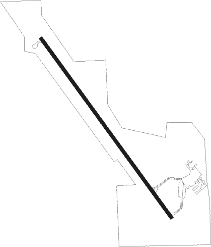
Runway info
| Runway 14 / 32 | ||
| length | 1403m (4603ft) | |
| bearing | 141° / 321° | |
| width | 23m (75ft) | |
| surface | concrete | |
Nearby beacons
| code | identifier | dist | bearing | frequency |
|---|---|---|---|---|
| STJ | SAINT JOSEPH (ST JOSEPH) VORTAC | 23.5 | 181° | 115.50 |
| AZN | AMAZON (SAINT JOSEPH) NDB | 28.1 | 179° | 233 |
| RBA | DME | 38.1 | 225° | 108.20 |
| ST | TARIO (ST JOSEPH) NDB | 40.6 | 179° | 260 |
| AFK | NEBRASKA CITY NDB | 45.7 | 285° | 347 |
| LMN | LAMONI VOR/DME | 45.7 | 76° | 116.70 |
| PMV | PLATTSMOUTH NDB | 57.5 | 301° | 329 |
| OVR | OMAHA VORTAC | 61.4 | 315° | 116.30 |
| OFF | OFFUTT (OMAHA) TACAN | 64 | 308° | 111.70 |
Instrument approach procedures
| runway | airway (heading) | route (dist, bearing) |
|---|---|---|
| RW14 | RILGE (236°) | RILGE SIAMM (28mi, 256°) 3000ft PWALK (6mi, 245°) 3000ft |
| RW14 | STJ (1°) | STJ PWALK (34mi, 347°) 3000ft PWALK (turn) 3000ft |
| RW14 | TRAIG (96°) | TRAIG PWALK (11mi, 46°) 3000ft PWALK (turn) 3000ft |
| RW14 | VIKKI (124°) | VIKKI PWALK (19mi, 115°) 3000ft |
| RNAV | PWALK 3000ft WILCX (7mi, 141°) 2700ft SUTVE (2mi, 141°) 1940ft KEVU (3mi, 141°) 1178ft (5630mi, 113°) 1388ft BARND (5624mi, 293°) 3000ft BARND (turn) | |
| RW32 | BARND (321°) | BARND 3000ft |
| RW32 | STJ (1°) | STJ BARND (15mi, 35°) 3000ft |
| RW32 | TOSAE (299°) | TOSAE BARND (8mi, 270°) 3000ft |
| RNAV | BARND 3000ft ZAREX (7mi, 321°) 2700ft KEVU (5mi, 321°) 1185ft (5630mi, 113°) 1395ft PWALK (5636mi, 293°) 3000ft PWALK (turn) |
Disclaimer
The information on this website is not for real aviation. Use this data with the X-Plane flight simulator only! Data taken with kind consent from X-Plane 12 source code and data files. Content is subject to change without notice.