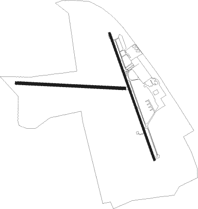
Middletown - Summit
Airport details
| Country | United States of America |
| State | Delaware |
| Region | K6 |
| Airspace | Washington Ctr |
| Municipality | New Castle County |
| Elevation | 65ft (20m) |
| Timezone | GMT -5 |
| Coordinates | 39.52103, -75.72366 |
| Magnetic var | |
| Type | land |
| Available since | X-Plane v10.40 |
| ICAO code | KEVY |
| IATA code | n/a |
| FAA code | EVY |
Communication
| Summit AWOS 3 | 132.325 |
| Summit CTAF/UNICOM | 122.725 |
| Summit PHILADELPHIA Approach | 118.350 |
| Summit PHILADELPHIA Departure | 118.350 |
Nearby Points of Interest:
Achmester
-Mason-Dixon Trail
-Mondamon Farm
-Greenlawn (Middletown, Delaware)
-J. K. Williams House
-New Castle and Frenchtown Railroad Right-of-Way
-Okolona (Middletown, Delaware)
-Noxontown
-Great House
-Duncan Beard Site
-Elk Landing
-Mitchell House
-John Carney Agricultural Complex
-Bohemia Farm
-Robert Ferguson House
-Deer Park Farm
-State Theater
-Benjamin Holmes House
-Rich Hill
-Granite Mansion
-Greenfields
-Finn's Point Rear Range Light
-Sarah and Samuel Nicholson House
-Abel and Mary Nicholson House
-The Hermitage

Nearby beacons
| code | identifier | dist | bearing | frequency |
|---|---|---|---|---|
| IL | HADIN (WILMINGTON) NDB | 6.2 | 61° | 248 |
| DQO | DUPONT (WILMINGTON) VORTAC | 10.8 | 37° | 114 |
| ENO | SMYRNA (KENTON) VORTAC | 19.8 | 144° | 111.40 |
| OOD | WOODSTOWN VORTAC | 20.6 | 75° | 112.80 |
| MXE | MODENA VORTAC | 23.9 | 8° | 113.20 |
| DOV | DOVER TACAN | 26.2 | 147° | 110 |
| RNB | RAINBOW (MILLVILLE) NDB | 27.9 | 100° | 363 |
| MTN | MARTIN (BALTIMORE) TACAN | 33.8 | 255° | 134.10 |
| VCN | CEDAR LAKE (MILLVILLE) VOR/DME | 35 | 89° | 115.20 |
| ING | AMBLER NDB | 41.5 | 36° | 275 |
| PTW | POTTSTOWN VORTAC | 42.7 | 13° | 116.50 |
| LRP | LANCASTER VOR/DME | 44.4 | 317° | 117.30 |
| BAL | BALTIMORE VORTAC | 48.3 | 250° | 115.10 |
| ATR | WATERLOO VOR/DME | 48.9 | 144° | 112.60 |
| SIE | SEA ISLE VORTAC | 49.9 | 115° | 114.80 |
| ARD | YARDLEY VOR/DME | 57.8 | 48° | 108.20 |
| BZJ | BELLGROVE (INDIANTOWN GAP) NDB | 66.8 | 318° | 328 |
Instrument approach procedures
| runway | airway (heading) | route (dist, bearing) |
|---|---|---|
| RW17 | CURVY (110°) | CURVY OGHUF (7mi, 71°) 2000ft EPKAW (5mi, 78°) 2000ft |
| RW17 | DQO (217°) | DQO ASIGY (4mi, 298°) 2000ft EPKAW (5mi, 258°) 2000ft |
| RNAV | EPKAW 2000ft BRLSN (6mi, 161°) 1700ft KEVY (5mi, 163°) 121ft (4747mi, 118°) 470ft WENDS (4742mi, 297°) 2000ft WENDS (turn) | |
| RW35-Y | ENO (324°) | ENO WYNOS (9mi, 332°) 2000ft |
| RNAV | WYNOS 2000ft REULE (6mi, 318°) 1700ft HIRSI (3mi, 318°) 760ft CEXEL (2mi, 318°) 256ft (4746mi, 118°) 440ft WENDS (4742mi, 297°) 2000ft WENDS (turn) | |
| RW35-Z | BLARE (302°) | BLARE WENDS (7mi, 234°) 2000ft WENDS (turn) 2000ft |
| RW35-Z | ENO (324°) | ENO WENDS (9mi, 307°) 2000ft |
| RW35-Z | TACKS (25°) | TACKS WENDS (9mi, 75°) 2000ft |
| RNAV | WENDS 2000ft JIPKE (6mi, 341°) 1700ft IYBAY (3mi, 341°) 800ft KEVY (3mi, 337°) 106ft (4747mi, 118°) 320ft EPKAW (4751mi, 298°) 2000ft EPKAW (turn) |
Disclaimer
The information on this website is not for real aviation. Use this data with the X-Plane flight simulator only! Data taken with kind consent from X-Plane 12 source code and data files. Content is subject to change without notice.