New Bedford - New Bedford Rgnl
Airport details
| Country | United States of America |
| State | Massachusetts |
| Region | K6 |
| Airspace | Boston Ctr |
| Municipality | New Bedford |
| Elevation | 79ft (24m) |
| Timezone | GMT -5 |
| Coordinates | 41.67657, -70.95783 |
| Magnetic var | |
| Type | land |
| Available since | X-Plane v10.40 |
| ICAO code | KEWB |
| IATA code | EWB |
| FAA code | EWB |
Communication
| New Bedford Rgnl ATIS | 126.850 |
| New Bedford Rgnl CTAF | 118.100 |
| New Bedford Rgnl UNICOM | 122.950 |
| New Bedford Rgnl Ground Control | 121.900 |
| New Bedford Rgnl Tower | 118.100 |
| New Bedford Rgnl PROVIDENCE Approach | 128.700 |
| New Bedford Rgnl PROVIDENCE Departure | 128.700 |
Approach frequencies
| ILS-cat-I | RW05 | 109.7 | 18.00mi |
| 3° GS | RW05 | 109.7 | 18.00mi |
Nearby Points of Interest:
Jewish Cemetery of New Bedford
-Shawmut Diner
-Head of the River Historic District
-Manomet Mills
-Union Street Railway Carbarn, Repair Shop
-Whitman Mills
-Bradford Smith Building
-Dawson Building
-Acushnet Heights Historic District
-North Bedford Historic District
-Buttonwood Park Historic District
-Union Baptist Church
-Times and Olympia Buildings
-First Baptist Church
-United States Customhouse
-Old Third District Courthouse
-New Bedford Historic District
-Nathan and Mary (Polly) Johnson properties
-County Street Historic District
-William J. Rotch Gothic Cottage
-Tucker Farm Historic District
-Effie M. Morrissey
-Rotch-Jones-Duff House and Garden Museum
-Moreland Terrace Historic District
-Merrill's Wharf Historic District
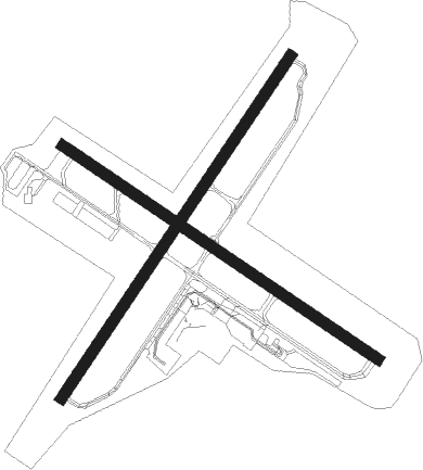
Runway info
Runway 5 / 23  | ||
| length | 1646m (5400ft) | |
| bearing | 47° / 227° | |
| width | 46m (150ft) | |
| surface | asphalt | |
| displ threshold | 0m (0ft) / 122m (400ft) | |
| Runway 14 / 32 | ||
| length | 1522m (4993ft) | |
| bearing | 121° / 301° | |
| width | 46m (150ft) | |
| surface | asphalt | |
Nearby beacons
| code | identifier | dist | bearing | frequency |
|---|---|---|---|---|
| FMH | OTIS (FALMOUTH) TACAN | 19.9 | 92° | 115.80 |
| PVD | PROVIDENCE VOR/DME | 21.3 | 276° | 115.60 |
| MVY | MARTHA'S VINEYARD VOR/DME | 22.8 | 129° | 114.50 |
| OW | STOGE (NORWOOD) NDB | 27.6 | 339° | 397 |
| HY | BOGEY (HYANNIS) NDB | 33.9 | 87° | 342 |
| PVC | PROVINCETOWN NDB | 40.4 | 62° | 389 |
| BOS | BOSTON VOR/DME | 40.9 | 357° | 112.70 |
| SEY | SANDY POINT (BLOCK ISLAND VOR/DME | 41.3 | 231° | 117.80 |
| PUT | PUTNAM VOR/DME | 43 | 287° | 117.40 |
| CQX | NAUSET (CHATHAM) NDB | 43.5 | 89° | 279 |
| LFV | MARCONI (NORTH TRURO) VOR/DME | 45.9 | 70° | 114.70 |
| ACK | NANTUCKET VOR/DME | 48.1 | 113° | 116.20 |
Departure and arrival routes
| Transition altitude | 18000ft |
| Transition level | 18000ft |
| STAR starting points | distance | inbound heading | |
|---|---|---|---|
| ALL | |||
| WIPOR3 | 54.7 | 89° | |
Instrument approach procedures
| runway | airway (heading) | route (dist, bearing) |
|---|---|---|
| RW05 | BONNI (47°) | BONNI 2100ft |
| RW05 | MVY (309°) | MVY RODME (19mi, 277°) 2100ft BONNI (6mi, 321°) 2100ft |
| RW05 | PVD (96°) | PVD CEPIG (13mi, 129°) 2100ft BONNI (6mi, 104°) 2100ft |
| RNAV | BONNI 2100ft FROLY (6mi, 47°) 1500ft WIDON (2mi, 47°) 740ft KEWB (2mi, 48°) 114ft (4558mi, 120°) 700ft BONNI (4563mi, 300°) 2100ft BONNI (turn) | |
| RW14 | BURDY (181°) | BURDY OGFIG (7mi, 234°) 4600ft CIRIR (6mi, 227°) 3200ft |
| RW14 | CIRIR (121°) | CIRIR 3200ft |
| RW14 | LAFAY (74°) | LAFAY ZISGA (26mi, 63°) 4600ft CIRIR (7mi, 47°) 3200ft |
| RNAV | CIRIR 3200ft ODOMY (6mi, 121°) 1600ft IHXOK (2mi, 121°) 780ft KEWB (2mi, 121°) 127ft (4558mi, 120°) 600ft COSSY (4556mi, 300°) 3000ft COSSY (turn) | |
| RW23 | BURDY (181°) | BURDY FURBS (10mi, 131°) 2500ft |
| RNAV | FURBS 2500ft ZEDVI (6mi, 227°) 1700ft KANJI (2mi, 227°) 980ft KEWB (3mi, 226°) 124ft (4558mi, 120°) 359ft BONNI (4563mi, 300°) 2100ft BONNI (turn) | |
| RW32 | BURDY (181°) | BURDY OMUFE (23mi, 136°) 2000ft CUGOG (7mi, 227°) 1900ft |
| RW32 | CUGOG (301°) | CUGOG 1900ft |
| RW32 | FALMA (35°) | FALMA YUWFY (15mi, 74°) 2000ft CUGOG (7mi, 47°) 1900ft |
| RW32 | MVY (309°) | MVY CUGOG (12mi, 318°) 1900ft |
| RNAV | CUGOG 1900ft ZERIR (6mi, 301°) 1700ft KEWB (5mi, 301°) 116ft (4558mi, 120°) 479ft UTBEQ (4561mi, 300°) INNDY (5mi, 306°) 2000ft INNDY (turn) |
Disclaimer
The information on this website is not for real aviation. Use this data with the X-Plane flight simulator only! Data taken with kind consent from X-Plane 12 source code and data files. Content is subject to change without notice.