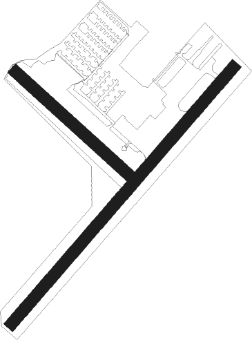
Fredericksburg - Shannon
Airport details
| Country | United States of America |
| State | Virginia |
| Region | K6 |
| Airspace | Washington Ctr |
| Municipality | Spotsylvania County |
| Elevation | 84ft (26m) |
| Timezone | GMT -5 |
| Coordinates | 38.26744, -77.44871 |
| Magnetic var | |
| Type | land |
| Available since | X-Plane v10.40 |
| ICAO code | KEZF |
| IATA code | n/a |
| FAA code | EZF |
Communication
| Shannon AWOS 3 | 128.125 |
| Shannon CTAF/UNICOM | 122.800 |
| Shannon QUANTICO ARRIVAL | 127.050 |
Nearby Points of Interest:
Braehead
-Walker–Grant School
-Ferry Farm
-Sentry Box
-Fredericksburg and Spotsylvania National Military Park
-Brompton
-Federal Hill
-Rowe House (Fredericksburg, Virginia)
-Matthew Fontaine Maury School
-Mary Washington House
-Kenmore
-Rising Sun Tavern
-La Vue
-Carl's Ice Cream
-Elmhurst (Fredericksburg, Virginia)
-St. Julien
-Conway House (Falmouth, Virginia)
-Clearview (Falmouth, Virginia)
-Union Church and Cemetery
-Fairview
-Gari Melchers Home
-Carlton (Falmouth, Virginia)
-Fall Hill
-Prospect Hill (Fredericksburg, Virginia)
-The Grove (Hanover, Virginia)
Nearby beacons
| code | identifier | dist | bearing | frequency |
|---|---|---|---|---|
| EZF | SHANNON (FREDERICKSBURG) NDB | 0.1 | 239° | 237 |
| BRV | BROOKE VORTAC | 6.1 | 54° | 114.50 |
| MSQ | NAILR (CULPEPER) NDB | 24.2 | 292° | 351 |
| DAA | DAVEE (FT BELVOIR) NDB | 28.5 | 41° | 223 |
| CSN | CASANOVA VORTAC | 29.8 | 312° | 116.30 |
| DCA | OXONN (WASHINGTON) NDB | 35.8 | 40° | 332 |
| GVE | GORDONSVILLE VORTAC | 36.5 | 250° | 115.60 |
| AML | ARMEL (WASH.,D.C.) VOR/DME | 40 | 358° | 113.50 |
| DCA | WASHINGTON, D.C. VOR/DME | 40.4 | 35° | 111 |
| OTT | NOTTINGHAM VORTAC | 42.2 | 58° | 113.70 |
| ADW | ANDREWS (CAMP SPRINGS) VORTAC | 42.4 | 47° | 113.10 |
| GTN | GEORGETOWN (WASH., D.C.) NDB | 42.6 | 26° | 323 |
| RIC | RICHMOND VORTAC | 46.3 | 170° | 114.10 |
| FAK | FLAT ROCK VORTAC | 47.8 | 207° | 113.30 |
| LDN | LINDEN VORTAC | 50 | 308° | 114.30 |
| HPW | HOPEWELL VORTAC | 58.5 | 160° | 112 |
| BUH | ANNE ARUNDEL (FT MEADE) NDB | 58.7 | 40° | 260 |
| HCM | HARCUM VORTAC | 60.3 | 138° | 108.80 |
| BAL | BALTIMORE VORTAC | 65.6 | 41° | 115.10 |
Departure and arrival routes
| Transition altitude | 18000ft |
| Transition level | 18000ft |
| STAR starting points | distance | inbound heading | |
|---|---|---|---|
| ALL | |||
| TIKEE3 | 43.1 | 114° | |
| HYPER8 | 108.9 | 206° | |
Instrument approach procedures
| runway | airway (heading) | route (dist, bearing) |
|---|---|---|
| RW24 | BRV (234°) | BRV DURWO (4mi, 50°) 2000ft DURWO (turn) 2000ft |
| RW24 | GVE (70°) | GVE DURWO (46mi, 67°) 2900ft DURWO (turn) 2000ft |
| RNAV | DURWO 2000ft ZADMN (5mi, 232°) 1700ft KEZF (5mi, 233°) 135ft (4815mi, 116°) 485ft CAMIR (4817mi, 296°) 2000ft CAMIR (turn) |
Holding patterns
| STAR name | hold at | type | turn | heading* | altitude | leg | speed limit |
|---|---|---|---|---|---|---|---|
| HYPER8 | BINNS | VHF | right | 68 (248)° | 1.0min timed | 265 | |
| HYPER8 | HYPER | VHF | left | 65 (245)° | 6001ft - 14000ft | 1.0min timed | 210 |
| *) magnetic outbound (inbound) holding course | |||||||
Disclaimer
The information on this website is not for real aviation. Use this data with the X-Plane flight simulator only! Data taken with kind consent from X-Plane 12 source code and data files. Content is subject to change without notice.

