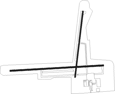
Kewanee - Kewanee Muni
Airport details
| Country | United States of America |
| State | Illinois |
| Region | K5 |
| Airspace | Chicago Ctr |
| Municipality | Henry County |
| Elevation | 856ft (261m) |
| Timezone | GMT -6 |
| Coordinates | 41.20519, -89.96386 |
| Magnetic var | |
| Type | land |
| Available since | X-Plane v10.40 |
| ICAO code | KEZI |
| IATA code | n/a |
| FAA code | EZI |
Communication
| Kewanee Muni CTAF/UNICOM | 122.800 |
| Kewanee Muni QUAD CITY Approach/Departure | 118.200 |
Nearby beacons
| code | identifier | dist | bearing | frequency |
|---|---|---|---|---|
| BDF | BRADFORD VORTAC | 17.2 | 97° | 114.70 |
| GBG | DME | 26.6 | 240° | 109.80 |
| MZV | MOLINE VOR/DME | 31.2 | 280° | 114.40 |
| PIA | PEORIA VORTAC | 32.4 | 162° | 115.20 |
| FN | HILLZ (CLINTON) NDB | 38 | 322° | 517 |
| CVA | DAVENPORT VORTAC | 38.2 | 314° | 113.80 |
| PI | TUNGG (PEORIA) NDB | 39.7 | 148° | 356 |
| JZY | MACOMB NDB | 49.3 | 221° | 251 |
| PLL | POLO VOR/DME | 49.7 | 30° | 111.20 |
| BRL | BURLINGTON VOR/DME | 52.3 | 243° | 111.40 |
Instrument approach procedures
| runway | airway (heading) | route (dist, bearing) |
|---|---|---|
| RW01 | JUBDI (14°) | JUBDI 2400ft |
| RNAV | JUBDI 2400ft CIYAC (6mi, 15°) 2400ft VACGU (3mi, 15°) 1420ft KEZI (2mi, 11°) 895ft (5404mi, 115°) 1180ft YABYU (5401mi, 295°) 2400ft YABYU (turn) | |
| RW09 | GENSO (119°) | GENSO WIKOK (9mi, 169°) 2400ft |
| RW09 | MZV (100°) | MZV WIKOK (20mi, 105°) 2400ft |
| RW09 | ONEID (70°) | ONEID WIKOK (9mi, 36°) 2400ft |
| RW09 | WIKOK (90°) | WIKOK 2400ft |
| RNAV | WIKOK 2400ft JOKBI (6mi, 91°) 2400ft HIXEG (3mi, 91°) 1400ft KEZI (2mi, 89°) 894ft (5404mi, 115°) 1181ft YAVUN (5392mi, 295°) 2500ft YAVUN (turn) | |
| RW19 | YABYU (195°) | YABYU 2400ft |
| RNAV | YABYU 2400ft JUVSU (7mi, 195°) 2400ft KEZI (5mi, 196°) 878ft (5404mi, 115°) 1163ft JUBDI (5406mi, 294°) 2400ft JUBDI (turn) | |
| RW27 | BDF (277°) | BDF YAVUN (6mi, 288°) 2500ft |
| RW27 | VICKS (42°) | VICKS YAVUN (25mi, 64°) 2500ft YAVUN (turn) 2500ft |
| RW27 | WYNET (240°) | WYNET YAVUN (15mi, 212°) 2500ft |
| RNAV | YAVUN 2500ft VACUY (6mi, 271°) 2400ft WAVEB (3mi, 271°) 1400ft KEZI (2mi, 273°) 896ft (5404mi, 115°) 1181ft WIKOK (5415mi, 295°) 2400ft WIKOK (turn) |
Disclaimer
The information on this website is not for real aviation. Use this data with the X-Plane flight simulator only! Data taken with kind consent from X-Plane 12 source code and data files. Content is subject to change without notice.

