Cameron - Cameron Mem
Airport details
| Country | United States of America |
| State | Missouri |
| Region | K3 |
| Airspace | Kansas City Ctr |
| Municipality | Clinton County |
| Elevation | 1040ft (317m) |
| Timezone | GMT -6 |
| Coordinates | 39.72755, -94.27639 |
| Magnetic var | |
| Type | land |
| Available since | X-Plane v10.40 |
| ICAO code | KEZZ |
| IATA code | n/a |
| FAA code | EZZ |
Communication
| Cameron Mem CTAF/UNICOM | 122.800 |
| Cameron Mem KANSAS CITY Approach/Departure | 118.400 |
Nearby Points of Interest:
DeKalb County Courthouse
-A. Taylor Ray House
-Daviess County Rotary Jail and Sheriff's Residence
-Daviess County Courthouse
-Watkins Woolen Mill State Park and State Historic Site
-James Brothers' House and Farm
-Claybrook House
-Aker Cemetery
-First Methodist Church
-Ligon Apartments
-Excelsior Springs Hall of Waters Commercial East Historic District
-Excelsior Springs Hall of Waters Commercial West Historic District
-Hall of Waters
-The Elms Historic District
-Nelson-Pettis Farmsteads Historic District
-Miller-Porter-Lacy House
-Buchanan County Infirmary
-Isaac Miller House
-Walnut Park Farm Historic District
-Century Apartments
-Dr. Jacob Geiger House-Maud Wyeth Painter House
-McIntyre-Burri House
-City Hose Company No. 9
-John Sublett Jr. and Caroline Ashton Logan House
-Harris Addition Historic District
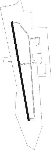
Runway info
| Runway 17 / 35 | ||
| length | 1220m (4003ft) | |
| bearing | 173° / 353° | |
| width | 23m (75ft) | |
| surface | concrete | |
Nearby beacons
| code | identifier | dist | bearing | frequency |
|---|---|---|---|---|
| BQS | BRAYMER VOR/DME | 19.4 | 104° | 115.35 |
| ST | TARIO (ST JOSEPH) NDB | 29.3 | 265° | 260 |
| AZN | AMAZON (SAINT JOSEPH) NDB | 30.6 | 284° | 233 |
| STJ | SAINT JOSEPH (ST JOSEPH) VORTAC | 33 | 290° | 115.50 |
| MCI | KANSAS CITY VORTAC | 34 | 226° | 113.25 |
| RN | HUGGY (KANSAS CITY) NDB | 36.9 | 233° | 416 |
| ANX | NAPOLEON VORTAC | 38.5 | 167° | 114 |
| LMN | LAMONI VOR/DME | 54 | 20° | 116.70 |
| PK | HERBB (OLATHE) NDB | 62.3 | 205° | 420 |
| JZ | NEWBN (LAWRENCE) NDB | 63.6 | 227° | 338 |
| SZL | WHITEMAN (KNOB NOSTER) TACAN | 68.4 | 144° | 109.80 |
Instrument approach procedures
| runway | airway (heading) | route (dist, bearing) |
|---|---|---|
| RW17 | EDUWU (173°) | EDUWU 6000ft EDUWU (turn) 3000ft |
| RW17 | FEGZI (142°) | FEGZI EDUWU (5mi, 86°) 3000ft |
| RW17 | PUVOZ (206°) | PUVOZ EDUWU (5mi, 266°) 3000ft |
| RNAV | EDUWU 3000ft APVIW (5mi, 173°) 2700ft KEZZ (5mi, 173°) 1080ft (5603mi, 113°) 1290ft VANHI (5602mi, 293°) 3000ft VANHI (turn) | |
| RW35 | AKZUB (322°) | AKZUB VANHI (5mi, 266°) 3000ft |
| RW35 | IGITE (25°) | IGITE VANHI (5mi, 86°) 3000ft |
| RW35 | VANHI (353°) | VANHI 6000ft VANHI (turn) 3000ft |
| RNAV | VANHI 3000ft OXIBE (5mi, 353°) 2700ft KEZZ (5mi, 353°) 1063ft (5603mi, 113°) 1285ft EDUWU (5603mi, 293°) 3000ft EDUWU (turn) |
Disclaimer
The information on this website is not for real aviation. Use this data with the X-Plane flight simulator only! Data taken with kind consent from X-Plane 12 source code and data files. Content is subject to change without notice.