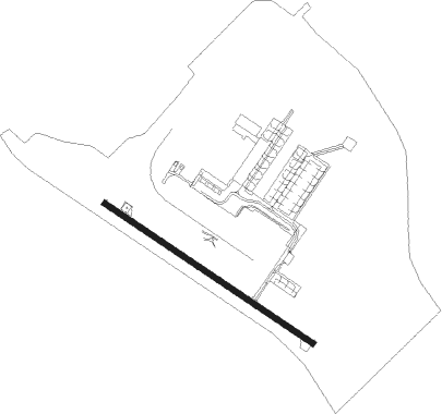
Fort Eustis - Felker Aaf
Airport details
| Country | United States of America |
| State | Virginia |
| Region | K6 |
| Airspace | Washington Ctr |
| Municipality | Newport News |
| Elevation | 11ft (3m) |
| Timezone | GMT -5 |
| Coordinates | 37.13790, -76.60484 |
| Magnetic var | |
| Type | land |
| Available since | X-Plane v10.40 |
| ICAO code | KFAF |
| IATA code | FAF |
| FAA code | FAF |
Communication
| Felker AAF CTAF | 126.300 |
| Felker AAF Ground Control | 121.350 |
| Felker AAF Tower | 126.300 |
| Felker AAF NORFOLK Approach/Departure | 125.700 |
Nearby Points of Interest:
Fort Crafford
-Lee's Mill Earthworks
-Lee Hall station
-Simon Reid Curtis House
-Carter's Grove
-Chippokes Plantation State Park
-Kingsmill
-Kiskiack
-Walnut Valley (Highgate, Virginia)
-Rich Neck Farm
-Poplar Hill (Smithfield, Virginia)
-Sessions-Pope-Sheild House
-Melville
-James Semple House
-Merchants Square
-Colonial Williamsburg Courthouse
-Little England (Gloucester, Virginia)
-Chandler Court and Pollard Park Historic District
-Wentworth-Grinnan House
-P. D. Gwaltney, Jr., House
-Smithfield Historic District
-Wolftrap Farm
-Matthew Whaley School
-Windsor Castle
-Porto Bello
Nearby beacons
| code | identifier | dist | bearing | frequency |
|---|---|---|---|---|
| LFI | LANGLEY (HAMPTON) TACAN | 12.1 | 102° | 112.30 |
| HCM | HARCUM VORTAC | 19.3 | 341° | 108.80 |
| NGU | CHAMBERS (NORFOLK) TACAN | 19.6 | 121° | 113.95 |
| AKQ | WAKEFIELD NDB | 21.1 | 249° | 274 |
| ORF | NORFOLK VORTAC | 24.3 | 121° | 116.90 |
| OR | INGLE (NORFOLK) NDB | 24.6 | 130° | 329 |
| HPW | HOPEWELL VORTAC | 26.9 | 290° | 112 |
| CCV | CAPE CHARLES VORTAC | 31.6 | 71° | 112.20 |
| FKN | FRANKLIN VORTAC | 32 | 224° | 110.60 |
| NTU | OCEANA TACAN | 33.1 | 119° | 116.60 |
| NFE | CHESAPEAKE TACAN | 34.7 | 133° | 108.25 |
| RIC | RICHMOND VORTAC | 40.5 | 297° | 114.10 |
| CVI | COFIELD VORTAC | 47.7 | 199° | 114.60 |
| LLW | WOODVILLE (ELIZABETH CITY) NDB | 54.5 | 161° | 254 |
| ECG | ELIZABETH CITY VOR/DME | 56.7 | 154° | 112.50 |
Departure and arrival routes
| Transition altitude | 18000ft |
| Transition level | 18000ft |
| STAR starting points | distance | inbound heading | |
|---|---|---|---|
| ALL | |||
| DRONE2 | 36.6 | 6° | |
Instrument approach procedures
| runway | airway (heading) | route (dist, bearing) |
|---|---|---|
| RW14 | HCM (161°) | HCM PAKSE (13mi, 201°) 2000ft |
| RW14 | HPW (110°) | HPW PAKSE (16mi, 104°) 2000ft |
| RW14 | HUMAL (100°) | HUMAL 2000ft PAKSE (5mi, 45°) 2000ft |
| RNAV | PAKSE 2000ft CATAS (6mi, 122°) 1600ft KFAF (5mi, 118°) 60ft (4766mi, 116°) 420ft HUMAL (4778mi, 296°) 2000ft HUMAL (turn) 6000ft |
Holding patterns
| STAR name | hold at | type | turn | heading* | altitude | leg | speed limit |
|---|---|---|---|---|---|---|---|
| DRONE2 | DRONE | VHF | right | 233 (53)° | 1.0min timed | ICAO rules | |
| *) magnetic outbound (inbound) holding course | |||||||
Disclaimer
The information on this website is not for real aviation. Use this data with the X-Plane flight simulator only! Data taken with kind consent from X-Plane 12 source code and data files. Content is subject to change without notice.