Frederick - Frederick Muni
Airport details
| Country | United States of America |
| State | Maryland |
| Region | K6 |
| Airspace | Washington Ctr |
| Municipality | Frederick |
| Elevation | 303ft (92m) |
| Timezone | GMT -5 |
| Coordinates | 39.41756, -77.37431 |
| Magnetic var | |
| Type | land |
| Available since | X-Plane v10.40 |
| ICAO code | KFDK |
| IATA code | FDK |
| FAA code | FDK |
Communication
| Frederick Muni FDK ATIS | 124.875 |
| Frederick Muni FDK Clearance DEL | 126.900 |
| Frederick Muni FDK Ground Control | 121.975 |
| Frederick Muni FDK Tower | 132.400 |
| Frederick Muni POTOMAC Approach | 125.525 |
| Frederick Muni POTOMAC Departure | 125.525 |
Approach frequencies
| ILS-cat-I | RW23 | 110.3 | 18.00mi |
| 3° GS | RW23 | 110.3 | 18.00mi |
Nearby Points of Interest:
Linganore Farm
-Loats Female Orphan Asylum of Frederick City
-Hessian Barracks
-Frederick Historic District
-John C. Motter House
-James K.P. Wolfe House
-Rose Hill Manor
-Frederick Armory
-Guilford
-Spring Bank Farm
-Schifferstadt
-Nallin Farm House
-Nallin Farm Springhouse and Bank Barn
-One-Million-Liter Test Sphere
-Linden Grove
-Woodsboro and Frederick Turnpike Company Tollhouse
-Edgewood
-George Markell Farmstead
-Arcadia
-George Widrick House
-Crum Road Bridge
-Highland Lodge
-Harris Farm
-Fat Oxen
-Rich Mountain
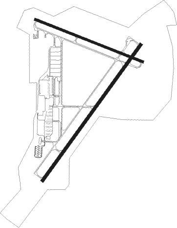
Runway info
Runway 5 / 23  | ||
| length | 1592m (5223ft) | |
| bearing | 48° / 228° | |
| width | 30m (98ft) | |
| surface | asphalt | |
| Runway 12 / 30 | ||
| length | 1098m (3602ft) | |
| bearing | 111° / 291° | |
| width | 23m (75ft) | |
| surface | asphalt | |
Nearby beacons
| code | identifier | dist | bearing | frequency |
|---|---|---|---|---|
| FDK | FREDERICK VOR | 0.3 | 189° | 109 |
| EMI | WESTMINSTER VORTAC | 18.9 | 79° | 117.90 |
| MRB | MARTINSBURG VORTAC | 22 | 266° | 112.10 |
| HGR | HAGERSTOWN VOR | 27.9 | 300° | 109.80 |
| FND | ELLICOTT (BALTIMORE) NDB | 28.8 | 102° | 371 |
| AML | ARMEL (WASH.,D.C.) VOR/DME | 29.3 | 191° | 113.50 |
| GTN | GEORGETOWN (WASH., D.C.) NDB | 31.5 | 153° | 323 |
| BUH | ANNE ARUNDEL (FT MEADE) NDB | 34.8 | 118° | 260 |
| BAL | BALTIMORE VORTAC | 36.2 | 109° | 115.10 |
| DCA | WASHINGTON, D.C. VOR/DME | 37 | 149° | 111 |
| THS | SAINT THOMAS VORTAC | 40.8 | 312° | 115 |
| DCA | OXONN (WASHINGTON) NDB | 42.3 | 152° | 332 |
| ADW | ANDREWS (CAMP SPRINGS) VORTAC | 43.6 | 140° | 113.10 |
| MTN | MARTIN (BALTIMORE) TACAN | 45 | 95° | 134.10 |
| DAA | DAVEE (FT BELVOIR) NDB | 47 | 161° | 223 |
| CX | LATLE (HARRISBURG) NDB | 48.7 | 26° | 219 |
| LDN | LINDEN VORTAC | 51.4 | 236° | 114.30 |
| OTT | NOTTINGHAM VORTAC | 51.8 | 139° | 113.70 |
| CSN | CASANOVA VORTAC | 51.9 | 212° | 116.30 |
| MD | ENOLA (HARRISBURG) NDB | 54.3 | 30° | 204 |
| HAR | HARRISBURG VORTAC | 54.9 | 19° | 112.50 |
| MSQ | NAILR (CULPEPER) NDB | 62.9 | 209° | 351 |
Departure and arrival routes
| Transition altitude | 18000ft |
| Transition level | 18000ft |
| SID end points | distance | outbound heading | |
|---|---|---|---|
| ALL | |||
| CONLE4 | 115mi | 158° | |
| TERPZ7 | 168mi | 214° | |
| STAR starting points | distance | inbound heading | |
|---|---|---|---|
| ALL | |||
| TRSTN3 | 82.0 | 17° | |
Instrument approach procedures
| runway | airway (heading) | route (dist, bearing) |
|---|---|---|
| RW23-Y | BINNS (225°) | BINNS GISGE (16mi, 222°) 2800ft |
| RW23-Y | EMI (259°) | EMI GISGE (12mi, 285°) 2800ft |
| RW23-Y | MULRR (190°) | MULRR GISGE (7mi, 121°) 2800ft |
| RNAV | GISGE 2800ft SHUEY (6mi, 228°) 1900ft ZITIM (3mi, 228°) 1020ft KFDK (2mi, 230°) 333ft (4821mi, 117°) 710ft EMI (4804mi, 297°) 3000ft EMI (turn) | |
| RW23-Z | BINNS (225°) | BINNS GISGE (16mi, 222°) 2800ft |
| RW23-Z | EMI (259°) | EMI GISGE (12mi, 285°) 2800ft |
| RW23-Z | MULRR (190°) | MULRR GISGE (7mi, 121°) 2800ft |
| RNAV | GISGE 2800ft SHUEY (6mi, 228°) 1900ft KFDK (5mi, 229°) 333ft (4821mi, 117°) 690ft BIYAS (4823mi, 297°) FEDIT (8mi, 124°) EMI (19mi, 58°) 3000ft EMI (turn) |
Holding patterns
| STAR name | hold at | type | turn | heading* | altitude | leg | speed limit |
|---|---|---|---|---|---|---|---|
| TRSTN3 | JOHOF | VHF | right | 214 (34)° | DME 10.0mi | ICAO rules | |
| *) magnetic outbound (inbound) holding course | |||||||
Disclaimer
The information on this website is not for real aviation. Use this data with the X-Plane flight simulator only! Data taken with kind consent from X-Plane 12 source code and data files. Content is subject to change without notice.