Winnsboro - Fairfield County
Airport details
| Country | United States of America |
| State | South Carolina |
| Region | K7 |
| Airspace | Jacksonville Ctr |
| Municipality | Fairfield County |
| Elevation | 577ft (176m) |
| Timezone | GMT -5 |
| Coordinates | 34.31547, -81.10880 |
| Magnetic var | |
| Type | land |
| Available since | X-Plane v10.40 |
| ICAO code | KFDW |
| IATA code | FDW |
| FAA code | FDW |
Communication
| Fairfield County AWOS 3 | 119.075 |
| Fairfield County CTAF/UNICOM | 123.050 |
| Fairfield County COLUMBIA Approach/Departure | 133.400 |
Nearby Points of Interest:
Furman Institution Faculty Residence
-Rockton and Rion Railroad Historic District
-Tocaland
-Hunstanton (Winnsboro, South Carolina)
-Rural Point
-Ketchin Building
-Winnsboro Historic District
-The Oaks
-Valencia (Ridgeway, South Carolina)
-Kincaid-Anderson House
-Monroe Wilson House
-Century House
-High Point (Jenkinsville, South Carolina)
-Dr. John Glenn House
-George P. Hoffman House
-Monticello Store and Post Office
-Balwearie
-Davis Plantation
-Fonti Flora Plantation
-Concord Presbyterian Church
-Hope Rosenwald School
-John Jacob Calhoun Koon Farmstead
-Camp Welfare
-Dr. Walter Brice House and Office
-Pomaria
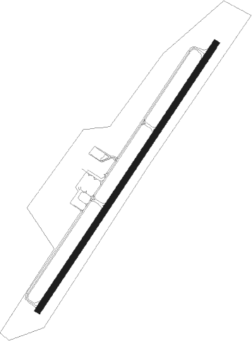
Runway info
| Runway 4 / 22 | ||
| length | 1600m (5249ft) | |
| bearing | 44° / 224° | |
| width | 30m (100ft) | |
| surface | asphalt | |
| displ threshold | 73m (240ft) / 0m (0ft) | |
Nearby beacons
| code | identifier | dist | bearing | frequency |
|---|---|---|---|---|
| CA | MURRY (COLUMBIA) NDB | 21.9 | 201° | 362 |
| EOE | ENOREE (NEWBERRY) NDB | 26.1 | 270° | 278 |
| LKR | LANCASTER NDB | 27.3 | 32° | 400 |
| CAE | COLUMBIA VORTAC | 27.6 | 173° | 114.70 |
| MMT | MC ENTIRE (COLUMBIA) VORTAC | 28 | 142° | 113.20 |
| DCM | CHESTER NDB | 28.6 | 349° | 220 |
| UOT | UNION COUNTY NDB | 34.4 | 305° | 326 |
| UZ | RALLY (ROCK HILL) NDB | 34.5 | 3° | 227 |
| SSC | SHAW (SUMTER) TACAN | 37.8 | 118° | 110.10 |
| SMS | SUMTER NDB | 42 | 113° | 252 |
| CTF | CHESTERFIELD VOR/DME | 45.9 | 68° | 108.20 |
| GIW | CORONACA (GREENWOOD) NDB | 48.6 | 266° | 239 |
| AIK | AIKEN NDB | 48.8 | 221° | 347 |
| HVS | HARTSVILLE NDB | 49.3 | 85° | 341 |
| GHJ | STONIA (GASTONIA) NDB | 52.6 | 357° | 260 |
| CLT | CHARLOTTE VOR/DME | 53.1 | 10° | 115 |
| SPA | SPARTANBURG VORTAC | 59.1 | 311° | 115.70 |
| VAN | VANCE VORTAC | 60.2 | 142° | 110.40 |
| SLP | FIRST RIVER (SHELBY) NDB | 61.2 | 332° | 417 |
| MNI | MANNING NDB | 62.7 | 129° | 381 |
| EMR | EMORY (AUGUSTA) NDB | 67.6 | 226° | 385 |
Instrument approach procedures
| runway | airway (heading) | route (dist, bearing) |
|---|---|---|
| RW04 | WIBSU (43°) | WIBSU 2300ft |
| RNAV | WIBSU 2300ft TEPID (7mi, 43°) 2100ft KFDW (5mi, 44°) 616ft (4965mi, 113°) 828ft KICKY (4958mi, 293°) 2300ft KICKY (turn) | |
| RW22 | KICKY (224°) | KICKY 2300ft |
| RNAV | KICKY 2300ft STUPE (7mi, 224°) 2000ft KFDW (5mi, 224°) 599ft (4965mi, 113°) 824ft WIBSU (4971mi, 293°) 2300ft WIBSU (turn) |
Disclaimer
The information on this website is not for real aviation. Use this data with the X-Plane flight simulator only! Data taken with kind consent from X-Plane 12 source code and data files. Content is subject to change without notice.