Freeport - Albertus
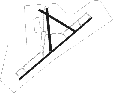
Airport details
| Country | United States of America |
| State | Illinois |
| Region | K5 |
| Airspace | Chicago Ctr |
| Municipality | Stephenson County |
| Elevation | 856ft (261m) |
| Timezone | GMT -6 |
| Coordinates | 42.24616, -89.58199 |
| Magnetic var | |
| Type | land |
| Available since | X-Plane v10.30 |
| ICAO code | KFEP |
| IATA code | FEP |
| FAA code | FEP |
Communication
| Albertus AWOS 3 | 119.025 |
| Albertus CTAF/UNICOM | 122.800 |
Approach frequencies
| ILS-cat-I | RW24 | 108.3 | 18.00mi |
| 3° GS | RW24 | 108.3 | 18.00mi |
Nearby Points of Interest:
James Bruce Round Barn
-Freeport City Hall
-John H. Addams Homestead
-Gerald Harbach Round Barn
-Dennis Otte Round Barn
-William H. Roberts House
-Charles Franks House
-William Ritzman House
-Samuel M. Hitt House
-People's State Bank
-AF and AM Lodge 687
-Union House
-Kellogg's Grove
-Charles Fehr Round Barn
-Dr. William Burns House
-Zenas Aplington House
-Buffalo Grove Lime Kiln
-Henry D. Barber House
-Bryant H. and Lucie Barber House
-John McGrath House
-Buffalo Township Public Library
-Polo Independent Order of Odd Fellows Lodge No. 197
-David and Julia Watson House
-William Moats Farm
-Pinehill Inn

Nearby beacons
| code | identifier | dist | bearing | frequency |
|---|---|---|---|---|
| PLL | POLO VOR/DME | 17 | 168° | 111.20 |
| RFD | DME | 17 | 93° | 110.80 |
| JVL | JANESVILLE VOR/DME | 28.2 | 57° | 114.30 |
| FN | HILLZ (CLINTON) NDB | 46.7 | 239° | 517 |
| CVA | DAVENPORT VORTAC | 51.5 | 239° | 113.80 |
| MSN | MADISON VORTAC | 55 | 15° | 108.60 |
| RYV | ROCK RIVER (WATERTOWN) NDB | 67.3 | 43° | 371 |
Instrument approach procedures
| runway | airway (heading) | route (dist, bearing) |
|---|---|---|
| RW06 | MIHAL (45°) | MIHAL HANKS (11mi, 24°) 2600ft |
| RW06 | PLL (348°) | PLL HANKS (16mi, 301°) 2600ft HANKS (turn) 2600ft |
| RW06 | WACKS (79°) | WACKS HANKS (11mi, 97°) 2600ft |
| RNAV | HANKS 2600ft BABJY (6mi, 62°) 2600ft KFEP (6mi, 61°) 909ft ADOSE (12mi, 62°) 2600ft ADOSE (turn) | |
| RW24 | JVL (237°) | JVL ADOSE (17mi, 233°) 2600ft |
| RW24 | MADDY (142°) | MADDY ADOSE (20mi, 108°) 2600ft ADOSE (turn) 2600ft |
| RNAV | ADOSE 2600ft LUNDN (6mi, 242°) 2600ft ZOSTA (3mi, 242°) 1580ft KFEP (3mi, 244°) 886ft (5387mi, 115°) 1097ft HANKS (5396mi, 295°) 2600ft HANKS (turn) |
Disclaimer
The information on this website is not for real aviation. Use this data with the X-Plane flight simulator only! Data taken with kind consent from X-Plane 12 source code and data files. Content is subject to change without notice.