Fremont - Fremont Muni
Airport details
| Country | United States of America |
| State | Nebraska |
| Region | K3 |
| Airspace | Minneapolis Ctr |
| Municipality | Fremont |
| Elevation | 1204ft (367m) |
| Timezone | GMT -5 |
| Coordinates | 41.44994, -96.52119 |
| Magnetic var | |
| Type | land |
| Available since | X-Plane v10.40 |
| ICAO code | KFET |
| IATA code | FET |
| FAA code | FET |
Communication
Nearby Points of Interest:
Nye House
-Samuel Bullock House
-R. B. Schneider House
-Fremont Municipal Auditorium
-Old Fremont Post Office
-Love-Larson Opera House
-Osterman and Tremaine Building
-Dodge County Courthouse
-J. D. McDonald House
-Fremont Historic Commercial District
-George and Nancy Turner House
-Christopher Knoell Farmstead
-Hooper Historic District
-Rad Plzen cis. 9 Z.C.B.J.
-North Bend Carnegie Library
-Harder Hotel
-Saunders County Courthouse
-C.C. Crowell Jr. House
-Ackerhurst Dairy Barn
-Blair High School
-Washington County Courthouse
-Schneider's Opera House
-Boys Town
-Military Road
-H.S.M. Spielman House
Runway info
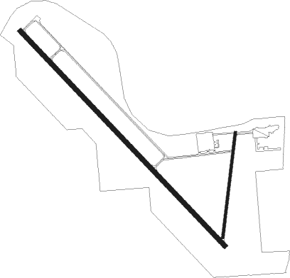
Runway 14 / 32  | ||
| length | 1938m (6358ft) | |
| bearing | 133° / 313° | |
| width | 30m (100ft) | |
| surface | concrete | |
| displ threshold | 259m (850ft) / 259m (850ft) | |
| Runway 1 / 19 | ||
| length | 691m (2267ft) | |
| bearing | 15° / 195° | |
| width | 15m (50ft) | |
| surface | asphalt | |
| displ threshold | 91m (299ft) / 183m (600ft) | |
Nearby beacons
| code | identifier | dist | bearing | frequency |
|---|---|---|---|---|
| SCB | SCRIBNER VOR/DME | 10.4 | 325° | 111 |
| AHQ | WAHOO NDB | 13.1 | 200° | 400 |
| LNK | LINCOLN VORTAC | 33.1 | 203° | 116.10 |
| OFF | OFFUTT (OMAHA) TACAN | 34.4 | 118° | 111.70 |
| OLU | COLUMBUS VOR/DME | 36.8 | 270° | 111.80 |
| PLT | PLATTE CENTER (COLUMBUS) NDB | 38.8 | 273° | 407 |
| OVR | OMAHA VORTAC | 39.2 | 110° | 116.30 |
| PMV | PLATTSMOUTH NDB | 40.9 | 130° | 329 |
| LN | POTTS (LINCOLN) NDB | 43.5 | 199° | 385 |
| OFK | NORFOLK VOR/DME | 52.1 | 300° | 109.60 |
| SU | SALIX (SOUIX CITY) NDB | 53.7 | 15° | 414 |
| SUX | SIOUX CITY TACAN | 54.4 | 12° | 116.50 |
| AFK | NEBRASKA CITY NDB | 58.8 | 142° | 347 |
Instrument approach procedures
| runway | airway (heading) | route (dist, bearing) |
|---|---|---|
| RW14 | AYUVI (132°) | AYUVI 3300ft |
| RNAV | AYUVI 3300ft GRAIN (7mi, 133°) 3000ft BOCAK (3mi, 133°) 1940ft KFET (3mi, 132°) 1243ft (5698mi, 113°) 1453ft HUSIV (5691mi, 293°) 3800ft HUSIV (turn) | |
| RW32 | HUSIV (313°) | HUSIV 3800ft |
| RNAV | HUSIV 3800ft ZEMES (7mi, 313°) 3000ft KFET (6mi, 313°) 1243ft (5698mi, 113°) 1455ft AYUVI (5706mi, 293°) 3300ft AYUVI (turn) |
Disclaimer
The information on this website is not for real aviation. Use this data with the X-Plane flight simulator only! Data taken with kind consent from X-Plane 12 source code and data files. Content is subject to change without notice.