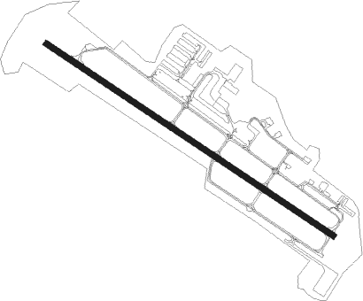
Atlanta - Atlanta Regl Falcon Fld
Airport details
| Country | United States of America |
| State | Georgia |
| Region | K7 |
| Airspace | Atlanta Ctr |
| Municipality | Peachtree City |
| Elevation | 808ft (246m) |
| Timezone | GMT -5 |
| Coordinates | 33.35772, -84.57253 |
| Magnetic var | |
| Type | land |
| Available since | X-Plane v10.32 |
| ICAO code | KFFC |
| IATA code | FFC |
| FAA code | FFC |
Communication
| Atlanta Regl Falcon Fld AWOS 3 | 118.525 |
| Atlanta Regl Falcon Fld CTAF/UNICOM | 123.050 |
| Atlanta Regl Falcon Fld ATLANTA Approach/Departure | 119.800 |
Approach frequencies
| ILS-cat-I | RW31 | 111.95 | 18.00mi |
| 3° GS | RW31 | 111.95 | 18.00mi |
Nearby Points of Interest:
McFarland-Render House
-Mary Ray Memorial School
-Holliday-Dorsey-Fife House
-Thomas P. Arnold House
-Powell Chapel School
-Coweta County Courthouse
-White Oak Creek Covered Bridge
-Campbell County Courthouse
-Crawford-Dorsey House and Cemetery
-Stately Oaks
-Old Gaissert Homeplace
-Bailey-Tebault House
-Mills House
-Old Spalding County Courthouse
-Sam Bailey Building
-Hill-Kurtz House
-Greenville Presbyterian Church and Cemetery
-Pike County Courthouse
-Double Cabins
-Rex Mill
-Meriwether County Courthouse
-Greenville Historic District
-William Barker Whiskey Bonding Barn
-Beulah Grove Lodge No. 372, Free and Accepted York Masons
-Jeremiah S. Gilbert House
Nearby beacons
| code | identifier | dist | bearing | frequency |
|---|---|---|---|---|
| FFC | PECAT (ATLANTA) NDB | 5.5 | 123° | 316 |
| EQQ | COWETA COUNTY (NEWNAN) NDB | 9.3 | 234° | 234 |
| AT | CATTA (ATLANTA) NDB | 17.4 | 6° | 375 |
| ATL | ATLANTA VORTAC | 17.6 | 27° | 116.90 |
| GPQ | CARROLLTON NDB | 30.6 | 290° | 278 |
| OP | YATES (THOMASTON) NDB | 32.6 | 139° | 339 |
| DOB | DOBBINS (MARIETTA) TACAN | 33.6 | 7° | 113 |
| PDK | PEACHTREE (ATLANTA) VOR/DME | 33.9 | 28° | 116.60 |
| LGC | LA GRANGE VORTAC | 36.8 | 244° | 115.60 |
| VOF | ALCOVY (COVINGTON) NDB | 42.8 | 71° | 370 |
| CSG | COLUMBUS VORTAC | 49.9 | 211° | 117.10 |
| TX | GWNET (LAWRENCEVILLE) NDB | 53.2 | 47° | 419 |
| DJD | CHERO NDB | 53.8 | 5° | 415 |
| RMG | ROME VORTAC | 55.5 | 326° | 115.40 |
| CS | FENIX (COLUMBUS) NDB | 59.3 | 207° | 355 |
| BMW | BARROW COUNTY (WINDER) NDB | 60.1 | 60° | 404 |
| FKV | FLOWERY BRANCH (GAINESVILLE) NDB | 60.7 | 38° | 365 |
| MCN | MACON VORTAC | 61.4 | 126° | 114.20 |
| WRB | ROBINS (WARNER ROBINS) TACAN | 65.5 | 126° | 135.30 |
| IZS | MONTEZUMA NDB | 65.9 | 150° | 426 |
Departure and arrival routes
| Transition altitude | 18000ft |
| Transition level | 18000ft |
| STAR starting points | distance | inbound heading | |
|---|---|---|---|
| ALL | |||
| BUKHD3 | 73.3 | 154° | |
| DEHAN3 | 73.5 | 208° | |
Instrument approach procedures
| runway | airway (heading) | route (dist, bearing) |
|---|---|---|
| RW13 | PILRE (123°) | PILRE 3100ft |
| RNAV | PILRE 3100ft CAVOV (7mi, 123°) 2600ft ZEDUS (3mi, 123°) 1580ft KFFC (2mi, 123°) 857ft (5133mi, 112°) 1184ft INOGE (5123mi, 291°) 3000ft INOGE (turn) | |
| RW31 | INOGE (303°) | INOGE 2800ft |
| RNAV | INOGE 2800ft BAGAY (6mi, 303°) 2500ft AGEHO (3mi, 303°) 1400ft KFFC (2mi, 303°) 845ft (5133mi, 112°) 1500ft TIROE (5148mi, 291°) 3500ft TIROE (turn) |
Holding patterns
| STAR name | hold at | type | turn | heading* | altitude | leg | speed limit |
|---|---|---|---|---|---|---|---|
| BUKHD3 | HLNDS | VHF | right | 327 (147)° | DME 10.0mi | ICAO rules | |
| DEHAN3 | AWSON | VHF | left | 29 (209)° | DME 10.0mi | ICAO rules | |
| DEHAN3 | TRALZ | VHF | right | 32 (212)° | DME 10.0mi | ICAO rules | |
| *) magnetic outbound (inbound) holding course | |||||||
Disclaimer
The information on this website is not for real aviation. Use this data with the X-Plane flight simulator only! Data taken with kind consent from X-Plane 12 source code and data files. Content is subject to change without notice.