Frankfort - Capital City
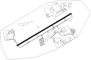
Airport details
| Country | United States of America |
| State | Kentucky |
| Region | K5 |
| Airspace | Indianapolis Ctr |
| Municipality | Frankfort |
| Elevation | 889ft (271m) |
| Timezone | GMT -5 |
| Coordinates | 38.18173, -84.90675 |
| Magnetic var | |
| Type | land |
| Available since | X-Plane v10.40 |
| ICAO code | KFFT |
| IATA code | FFT |
| FAA code | FFT |
Communication
| Capital City CTAF | 122.800 |
| Capital City Tower Frequency | 128.800 |
| Capital City Lexington Approach | 120.750 |
| Capital City Lexington Departure | 120.750 |
Approach frequencies
| LOC | RW25 | 109.95 | 18.00mi |
Nearby Points of Interest:
Berry Mansion
-Kentucky State Capitol
-Jesse R. Zeigler House
-Corner in Celebrities Historic District
-Kentucky Governor's Mansion
-Liberty Hall
-Old United States Courthouse and Post Office
-Gooch House
-Old Governor's Mansion
-Glen Willis
-Buffalo Trace Distillery
-T. B. Ripy House
-Robertson House
-Dr. Nash House
-Martyrs Monument in Midway
-Midway Historic District
-Cleveland House
-Confederate Monument in Versailles
-Carriss's Feed Store
-Bayne House
-East Shelbyville District
-Bethel AME Church
-Science Hill School
-St. John United Methodist Church
-Keeneland
Nearby beacons
| code | identifier | dist | bearing | frequency |
|---|---|---|---|---|
| FFT | FRANKFORT VOR | 0 | 290° | 109.40 |
| LE | BLAYD (LEXINGTON) NDB | 16.5 | 128° | 242 |
| GN | BRIDL (LEXINGTON) NDB | 19.1 | 98° | 340 |
| HYK | LEXINGTON VOR/DME | 24.2 | 116° | 112.60 |
| IIU | LOUISVILLE VORTAC | 32 | 263° | 114.80 |
| LK | LAANG (LOUISVILLE) NDB | 34.3 | 267° | 414 |
| BQM | (LOUISVILLE) DME | 35.8 | 274° | 112.20 |
| DVK | GOODALL (DANVILLE) NDB | 36.9 | 167° | 311 |
| FLM | FALMOUTH VOR/DME | 39.6 | 52° | 117 |
| JV | CATCH (JEFFERSONVILLE) NDB | 42.8 | 289° | 331 |
| GVR | (MADISON) DME | 43.6 | 316° | 114.65 |
| IOB | MOUNT STERLING NDB | 44.3 | 97° | 210 |
| EWO | NEW HOPE VOR/DME | 49.1 | 234° | 110.80 |
| CVG | CINCINNATI VORTAC | 51 | 14° | 117.30 |
| PWF | SPORTYS (BATAVIA) NDB | 62.7 | 38° | 245 |
Instrument approach procedures
| runway | airway (heading) | route (dist, bearing) |
|---|---|---|
| RW07 | DEXLO (69°) | DEXLO 3000ft |
| RNAV | DEXLO 3000ft ACETO (7mi, 69°) 2400ft JAPOL (2mi, 69°) 1620ft KFFT (3mi, 69°) 857ft (5165mi, 114°) 1087ft CUKRI (5154mi, 294°) 3000ft CUKRI (turn) | |
| RW25 | CUKRI (249°) | CUKRI 3000ft |
| RNAV | CUKRI 3000ft LAYIV (7mi, 249°) 2400ft KICSE (2mi, 249°) 1620ft KFFT (3mi, 249°) 828ft (5165mi, 114°) 1098ft DEXLO (5176mi, 294°) 3000ft DEXLO (turn) |
Disclaimer
The information on this website is not for real aviation. Use this data with the X-Plane flight simulator only! Data taken with kind consent from X-Plane 12 source code and data files. Content is subject to change without notice.