Fort Huachuca Sierra Vista - Sierra Vista Muni Libby Aaf
Airport details
| Country | United States of America |
| State | Arizona |
| Region | K2 |
| Airspace | Albuquerque Ctr |
| Municipality | Sierra Vista |
| Elevation | 4719ft (1438m) |
| Timezone | GMT -7 |
| Coordinates | 31.58847, -110.34439 |
| Magnetic var | |
| Type | land |
| Available since | X-Plane v10.40 |
| ICAO code | KFHU |
| IATA code | FHU |
| FAA code | FHU |
Communication
| SIERRA VISTA MUNI LIBBY AAF ATIS | 134.750 |
| SIERRA VISTA MUNI LIBBY AAF ASOS | 119.675 |
| SIERRA VISTA MUNI LIBBY AAF CTAF | 124.950 |
| SIERRA VISTA MUNI LIBBY AAF UNICOM | 122.950 |
| SIERRA VISTA MUNI LIBBY AAF Ground Control | 121.700 |
| SIERRA VISTA MUNI LIBBY AAF LIBBY Tower | 124.950 |
| SIERRA VISTA MUNI LIBBY AAF LIBBY GCA | 127.050 |
Approach frequencies
| ILS-cat-I | RW26 | 109.9 | 18.00mi |
| 3° GS | RW26 | 109.9 | 18.00mi |
Nearby Points of Interest:
Fort Huachuca
-Canelo School
-Canelo Ranger Station
-Canelo Hills Cienega Reserve
-The Little Outfit Schoolhouse
-Kinjockity Ranch
-Coronado National Memorial
-Tombstone Courthouse State Historic Park
-Tombstone Historic District
-Sacred Heart Church
-San Rafael Ranch
-James Finley House
-Cady Hall
-St. Patrick's Roman Catholic Church
-Bisbee Woman's Club Clubhouse
-Phelps Dodge General Office Building
-Naco Border Station
-J.H. Smith Grocery Store and Filling Station
-George Dunbar House
-W.G. Bowman House
-Sen. James A. Harrison House
-United States Post Office and Immigration Station–Nogales Main
-Santa Cruz County Courthouse
-A.S. Noon Building
-Old Nogales City Hall and Fire Station
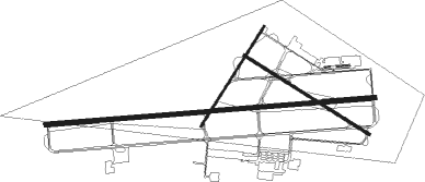
Runway info
Runway 8 / 26  | ||
| length | 3650m (11975ft) | |
| bearing | 90° / 270° | |
| width | 46m (151ft) | |
| surface | concrete | |
| blast zone | 255m (837ft) / 255m (837ft) | |
| Runway 12 / 30 | ||
| length | 1635m (5364ft) | |
| bearing | 123° / 303° | |
| width | 30m (100ft) | |
| surface | asphalt | |
| blast zone | 159m (522ft) / 61m (200ft) | |
| Runway 3 / 21 | ||
| length | 1307m (4288ft) | |
| bearing | 41° / 221° | |
| width | 23m (75ft) | |
| surface | asphalt | |
| displ threshold | 382m (1253ft) / 0m (0ft) | |
| blast zone | 61m (200ft) / 146m (479ft) | |
Nearby beacons
| code | identifier | dist | bearing | frequency |
|---|---|---|---|---|
| ARH | FORT HUACHUCA TACAN | 0.3 | 118° | 111.60 |
| FHU | LIBBY (FT HUACHUCA) VOR/DME | 0.5 | 276° | 113.60 |
| OLS | NOGALES VOR/DME | 27.8 | 251° | 108.20 |
| DUG | DOUGLAS VORTAC | 38.6 | 99° | 108.80 |
| TUS | TUCSON VORTAC | 42.1 | 312° | 116 |
| DMA | DAVIS-MONTHAN (TUCSON) TACAN | 43.8 | 317° | 117.60 |
| RYN | RYAN (TUCSON) NDB | 53.1 | 304° | 338 |
| AVQ | MARANA NDB | 66.4 | 313° | 245 |
Instrument approach procedures
| runway | airway (heading) | route (dist, bearing) |
|---|---|---|
| RW08 | TOMBS (216°) | TOMBS PUGDE (16mi, 287°) 10000ft ZEMBI (10mi, 238°) 8500ft BABOO (10mi, 180°) 8500ft HESTU (7mi, 90°) 7300ft |
| RW08 | TUS (132°) | TUS ZEMBI (24mi, 143°) 8500ft BABOO (10mi, 180°) 8500ft HESTU (7mi, 90°) 7300ft |
| RNAV | HESTU 7300ft RUGEE (3mi, 90°) 6400ft TABHU (3mi, 90°) 5500ft KFHU (3mi, 89°) 4778ft (6440mi, 106°) 4919ft WODRI (6434mi, 286°) JORTO (9mi, 32°) 9500ft JORTO (turn) 9500ft | |
| RW26 | CAYLA (254°) | CAYLA MICCO (6mi, 217°) 7400ft |
| RNAV | MICCO 7400ft SERRA (7mi, 270°) 6300ft KFHU (6mi, 270°) 4648ft (6440mi, 106°) 5040ft TOMBS (6431mi, 286°) 9500ft TOMBS (turn) 9500ft |
Disclaimer
The information on this website is not for real aviation. Use this data with the X-Plane flight simulator only! Data taken with kind consent from X-Plane 12 source code and data files. Content is subject to change without notice.