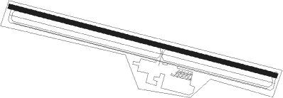
Clearfield - Clearfield Lawrence
Airport details
| Country | United States of America |
| State | Pennsylvania |
| Region | K6 |
| Airspace | Cleveland Ctr |
| Municipality | Lawrence Township |
| Elevation | 1516ft (462m) |
| Timezone | GMT -5 |
| Coordinates | 41.04913, -78.41516 |
| Magnetic var | |
| Type | land |
| Available since | X-Plane v10.40 |
| ICAO code | KFIG |
| IATA code | n/a |
| FAA code | FIG |
Communication
| CLEARFIELD LAWRENCE ASOS | 119.275 |
| CLEARFIELD LAWRENCE CTAF/UNICOM | 122.725 |
Nearby Points of Interest:
Clearfield County Courthouse
-Old Town Historic District
-Thomas Murray House
-Clearfield Armory
-Joseph F. and Anna B. Schrot Farm
-Hogback Bridge
-S. B. Elliott State Park Family Cabin District
-S. B. Elliott State Park Day Use District
-Parker Dam State Park Family Cabin District
-Philipsburg Historic District
-Hardman Philips House
-Bridge in Greenwood Township
-St. Severin's Old Log Church
-DuBois Historic District
-Black Moshannon State Park Family Cabin District
-Black Moshannon State Park Day Use District
-Coalport Historic District
-Redferd Segers House
-Brockway station
-Bridge in Westover Borough
-Herpel Brothers Foundry and Machine Shop
-Irvin-Patchin House
-Sen. Joseph O. Clark House
-George Wilson Homestead
-St. Marys Historic District
Nearby beacons
| code | identifier | dist | bearing | frequency |
|---|---|---|---|---|
| ETG | KEATING VORTAC | 15.8 | 59° | 116 |
| PSB | PHILIPSBURG VORTAC | 20.7 | 107° | 115.50 |
| UN | PENUE (STATE COLLEGE) NDB | 31.6 | 102° | 388 |
| REC | REVLOC VOR/DME | 33.7 | 213° | 110.60 |
| SLT | SLATE RUN VORTAC | 34.3 | 44° | 113.90 |
| BFD | DME | 45.2 | 345° | 116.60 |
| JST | JOHNSTOWN VOR/DME | 47.9 | 210° | 113 |
| SFK | STONYFORK VOR/DME | 59.3 | 57° | 108.60 |
| SYS | STOYSTOWN (SOMERSET) NDB | 62.2 | 207° | 209 |
Instrument approach procedures
| runway | airway (heading) | route (dist, bearing) |
|---|---|---|
| RW12 | ASICO (104°) | ASICO 4000ft |
| RW12 | JELEP (91°) | JELEP ASICO (8mi, 69°) 4000ft |
| RW12 | KUNHA (119°) | KUNHA ASICO (9mi, 147°) 4000ft |
| RNAV | ASICO 4000ft JODOV (7mi, 104°) 3600ft EFELE (turn) 3200ft FIGIV (turn) 2800ft KFIG (3mi, 105°) 1560ft (4882mi, 118°) 1916ft EBUME (4869mi, 298°) 4000ft EBUME (turn) | |
| RW30 | EBUME (285°) | EBUME 6000ft EBUME (turn) 4000ft |
| RW30 | NUXUW (298°) | NUXUW EBUME (8mi, 327°) 4000ft |
| RW30 | ODLOE (272°) | ODLOE EBUME (7mi, 250°) 4000ft |
| RW30 | PSB (287°) | PSB EBUME (8mi, 292°) 4000ft |
| RNAV | EBUME 4000ft EZMEC (7mi, 285°) 3300ft ZURTO (3mi, 285°) 2480ft UYUHO (2mi, 285°) 1882ft (4881mi, 118°) 2200ft EBUME (4869mi, 298°) 4000ft EBUME (turn) |
Disclaimer
The information on this website is not for real aviation. Use this data with the X-Plane flight simulator only! Data taken with kind consent from X-Plane 12 source code and data files. Content is subject to change without notice.
