Palm Coast - Flagler Executive
Airport details
| Country | United States of America |
| State | Florida |
| Region | K7 |
| Airspace | Jacksonville Ctr |
| Municipality | Flagler County |
| Elevation | 33ft (10m) |
| Timezone | GMT -5 |
| Coordinates | 29.45759, -81.20834 |
| Magnetic var | |
| Type | land |
| Available since | X-Plane v10.40 |
| ICAO code | KFIN |
| IATA code | n/a |
| FAA code | FIN |
Communication
| Flagler Executive ATIS | 128.325 |
| Flagler Executive CTAF | 118.950 |
| Flagler Executive Flagler Ground/Clearance Delivery | 121.750 |
| Flagler Executive Flagler Tower | 118.950 |
| Flagler Executive Daytona Approach | 125.800 |
| Flagler Executive Daytona Departure | 125.800 |
Nearby Points of Interest:
Bunnell Water Tower
-Vocational Agriculture Building
-Old Bunnell State Bank Building
-Nocoroco
-Mala Compra Plantation Archeological Site
-Dixie Highway
-Marineland of Florida
-The Hammocks
-Dix House
-Rowallan
-Ormond Yacht Club
-Talahloka
-Anderson-Price Memorial Library Building
-John Anderson Lodge
-The Casements
-Ormond Fire House
-The Porches
-Lippincott Mansion
-Holly Hill Municipal Building
-El Pino Parque Historic District
-Hubbard House
-Crescent City Historic District
-Bartholomew J. Donnelly House
-White Hall
-Rogers House
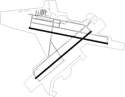
Runway info
Runway 6 / 24  | ||
| length | 1526m (5007ft) | |
| bearing | 58° / 238° | |
| width | 30m (100ft) | |
| surface | asphalt | |
| Runway 11 / 29 | ||
| length | 1672m (5486ft) | |
| bearing | 104° / 284° | |
| width | 30m (100ft) | |
| surface | asphalt | |
| blast zone | 46m (151ft) / 46m (151ft) | |
| Runway 18 / 36 | ||
| length | 735m (2411ft) | |
| bearing | 180° / 0° | |
| width | 91m (300ft) | |
Nearby beacons
| code | identifier | dist | bearing | frequency |
|---|---|---|---|---|
| OMN | ORMOND BEACH VORTAC | 10.5 | 148° | 112.60 |
| SGJ | SAINT AUGUSTINE VOR/DME | 30.6 | 346° | 109.40 |
| RYD | REYNOLDS (GREEN COVE SPRINGS) NDB | 38.5 | 319° | 338 |
| GN | WYNDS (GAINESVILLE) NDB | 51.9 | 282° | 269 |
| NIP | JACKSONVILLE TACAN | 52.6 | 329° | 108.20 |
| CRG | CRAIG (JACKSONVILLE) VORTAC | 55.2 | 341° | 114.50 |
| ORL | ORLANDO VORTAC | 55.3 | 188° | 112.20 |
| NRB | MAYPORT TACAN | 57 | 347° | 111.40 |
| NZC | CECIL TACAN | 57.3 | 319° | 114.10 |
| OR | HERNY (ORLANDO) NDB | 58.3 | 193° | 221 |
Instrument approach procedures
| runway | airway (heading) | route (dist, bearing) |
|---|---|---|
| RW06 | ASTOR (165°) | ASTOR KABEC (27mi, 190°) 2300ft KABEC (turn) 2300ft |
| RW06 | BARBS (53°) | BARBS KABEC (3mi, 31°) 2300ft |
| RW06 | OMN (328°) | OMN KABEC (14mi, 281°) 2300ft KABEC (turn) 2300ft |
| RW06 | ROYES (110°) | ROYES KABEC (11mi, 164°) 2300ft KABEC (turn) 2300ft |
| RNAV | KABEC 2300ft JABKU (6mi, 58°) 1600ft KRUZE (3mi, 58°) 700ft KFIN (2mi, 65°) 69ft (4946mi, 110°) 282ft GACDE (4937mi, 290°) 2300ft GACDE (turn) | |
| RW11 | ASTOR (165°) | ASTOR MEGPE (18mi, 204°) 2300ft MEGPE (turn) 2300ft |
| RW11 | BARBS (53°) | BARBS MEGPE (13mi, 356°) 2300ft MEGPE (turn) 2300ft |
| RW11 | OMN (328°) | OMN MEGPE (21mi, 305°) 2300ft MEGPE (turn) 2300ft |
| RNAV | MEGPE 2300ft LABIY (6mi, 104°) 1800ft PHINX (3mi, 104°) 700ft KFIN (3mi, 118°) 71ft (4946mi, 110°) 420ft IBAYI (4935mi, 290°) 2300ft IBAYI (turn) | |
| RW24 | ASTOR (165°) | ASTOR GACDE (20mi, 130°) 2300ft GACDE (turn) 2300ft |
| RW24 | BARBS (53°) | BARBS GACDE (25mi, 55°) 2300ft GACDE (turn) 2300ft |
| RW24 | OMN (328°) | OMN GACDE (17mi, 17°) 2300ft GACDE (turn) 2300ft |
| RW24 | ROYES (110°) | ROYES GACDE (21mi, 85°) 2300ft GACDE (turn) 2300ft |
| RNAV | GACDE 2300ft FABIV (6mi, 238°) 1600ft JEPKO (3mi, 238°) 700ft KFIN (3mi, 233°) 71ft (4946mi, 110°) 380ft KABEC (4954mi, 290°) 2300ft KABEC (turn) | |
| RW29 | ASTOR (165°) | ASTOR IBAYI (28mi, 142°) 2300ft IBAYI (turn) 2300ft |
| RW29 | BARBS (53°) | BARBS IBAYI (22mi, 75°) 2300ft IBAYI (turn) 2300ft |
| RW29 | OMN (328°) | OMN IBAYI (9mi, 44°) 2300ft IBAYI (turn) 2300ft |
| RW29 | ROYES (110°) | ROYES IBAYI (24mi, 106°) 2300ft IBAYI (turn) 2300ft |
| RNAV | IBAYI 2300ft HAGAV (6mi, 284°) 1600ft LOOZE (3mi, 284°) 700ft KFIN (3mi, 270°) 71ft (4946mi, 110°) 400ft MEGPE (4957mi, 290°) 2300ft MEGPE (turn) |
Disclaimer
The information on this website is not for real aviation. Use this data with the X-Plane flight simulator only! Data taken with kind consent from X-Plane 12 source code and data files. Content is subject to change without notice.