Franklin - Venango Rgnl
Airport details
| Country | United States of America |
| State | Pennsylvania |
| Region | K6 |
| Airspace | Cleveland Ctr |
| Municipality | Franklin |
| Elevation | 1540ft (469m) |
| Timezone | GMT -5 |
| Coordinates | 41.37742, -79.86064 |
| Magnetic var | |
| Type | land |
| Available since | X-Plane v10.40 |
| ICAO code | KFKL |
| IATA code | FKL |
| FAA code | FKL |
Communication
| Venango Rgnl AWOS 3 | 118.175 |
| Venango Rgnl CTAF/UNICOM | 122.700 |
| Venango Rgnl YOUNGSTOWN Approach/Departure | 126.250 |
Approach frequencies
| ILS-cat-I | RW21 | 110.5 | 18.00mi |
| 3° GS | RW21 | 110.5 | 18.00mi |
Nearby Points of Interest:
Franklin Historic District
-Samuel F. Dale House
-Oil City South Side Historic District
-Witherup Bridge
-Oil City Armory
-Oil City North Side Historic District
-National Transit Building
-Oil City Downtown Commercial Historic District
-Bridge in Clinton Township
-Bridge in French Creek Township
-Foxburg Country Club
-Bridge in Oil Creek Township
-Titusville City Hall
-Titusville Historic District
-Connely-Holeman House
-Allegheny Baptist Church
-Mercer County Courthouse
-Christiana Lindsey House
-Judge Henry Shippen House
-Independent Congregational Church
-Meadville Downtown Historic District
-Roueche House
-Ruter Hall
-Bentley Hall
-John Brown Tannery Site
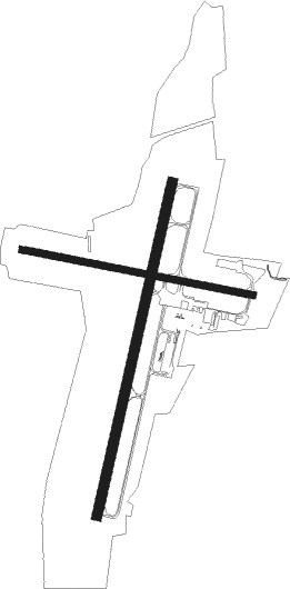
Runway info
Runway 3 / 21  | ||
| length | 1587m (5207ft) | |
| bearing | 22° / 202° | |
| width | 46m (151ft) | |
| surface | asphalt | |
| blast zone | 0m (0ft) / 93m (305ft) | |
| Runway 12 / 30 | ||
| length | 1094m (3589ft) | |
| bearing | 102° / 282° | |
| width | 30m (98ft) | |
| surface | asphalt | |
Nearby beacons
| code | identifier | dist | bearing | frequency |
|---|---|---|---|---|
| FKL | FRANKLIN VOR | 3.6 | 4° | 109.60 |
| CIP | DME | 22.8 | 120° | 112.90 |
| TDT | DME | 28.3 | 53° | 117.60 |
| UCP | CASTLE (NEW CASTLE) NDB | 32.9 | 237° | 272 |
| YN | FETCH (YOUNGSTOWN/WARREN) NDB | 34.8 | 256° | 338 |
| EWC | ELLWOOD CITY VOR/DME | 36.7 | 212° | 115.80 |
| YNG | YOUNGSTOWN VORTAC | 36.8 | 267° | 109 |
| ERI | ERIE VORTAC | 43 | 326° | 109.40 |
| JFN | JEFFERSON VOR/DME | 46 | 293° | 115.20 |
| MMJ | (PITTSBURGH) DME | 55.5 | 201° | 112 |
| JHW | JAMESTOWN VOR/DME | 58.9 | 42° | 114.70 |
Instrument approach procedures
| runway | airway (heading) | route (dist, bearing) |
|---|---|---|
| RW03 | BUVCA (22°) | BUVCA 3200ft |
| RW03 | PEREA (6°) | PEREA BUVCA (4mi, 317°) 3200ft |
| RW03 | VOLAN (49°) | VOLAN BUVCA (10mi, 74°) 3200ft |
| RNAV | BUVCA 3200ft AYIGE (6mi, 22°) 3200ft KFKL (6mi, 22°) 1575ft (4949mi, 117°) 1940ft BUVCA (4951mi, 297°) 3200ft BUVCA (turn) | |
| RW21 | FKL (184°) | FKL DACCA (9mi, 30°) 3400ft DACCA (turn) 3400ft |
| RNAV | DACCA 3400ft AYUSU (7mi, 203°) 3200ft KFKL (5mi, 203°) 1589ft (4949mi, 117°) 1803ft BUVCA (4951mi, 297°) 3400ft BUVCA (turn) |
Disclaimer
The information on this website is not for real aviation. Use this data with the X-Plane flight simulator only! Data taken with kind consent from X-Plane 12 source code and data files. Content is subject to change without notice.