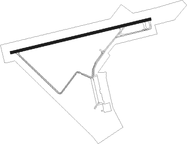
Franklin - Franklin Regl
Airport details
| Country | United States of America |
| State | Virginia |
| Region | K6 |
| Airspace | Washington Ctr |
| Municipality | Isle of Wight County |
| Elevation | 40ft (12m) |
| Timezone | GMT -5 |
| Coordinates | 36.70031, -76.90214 |
| Magnetic var | |
| Type | land |
| Available since | X-Plane v10.40 |
| ICAO code | KFKN |
| IATA code | FKN |
| FAA code | FKN |
Communication
| Franklin Regl AWOS 3 | 124.675 |
| Franklin Regl CTAF/UNICOM | 122.800 |
| Franklin Regl NORFOLK Approach/Departure | 127.900 |
| Franklin Regl NORFOLK Departure | 127.900 |
Nearby beacons
| code | identifier | dist | bearing | frequency |
|---|---|---|---|---|
| FKN | FRANKLIN VORTAC | 5.3 | 277° | 110.60 |
| AKQ | WAKEFIELD NDB | 17.6 | 341° | 274 |
| CVI | COFIELD VORTAC | 19.7 | 175° | 114.60 |
| OR | INGLE (NORFOLK) NDB | 32.4 | 78° | 329 |
| NGU | CHAMBERS (NORFOLK) TACAN | 33.3 | 69° | 113.95 |
| LFI | LANGLEY (HAMPTON) TACAN | 34.8 | 55° | 112.30 |
| ORF | NORFOLK VORTAC | 35.6 | 75° | 116.90 |
| NFE | CHESAPEAKE TACAN | 36.8 | 90° | 108.25 |
| HPW | HOPEWELL VORTAC | 39.1 | 341° | 112 |
| LLW | WOODVILLE (ELIZABETH CITY) NDB | 39.2 | 126° | 254 |
| NTU | OCEANA TACAN | 42.2 | 82° | 116.60 |
| ECG | ELIZABETH CITY VOR/DME | 44 | 121° | 112.50 |
| HCM | HARCUM VORTAC | 45.8 | 14° | 108.80 |
| RIC | RICHMOND VORTAC | 52.1 | 332° | 114.10 |
| CCV | CAPE CHARLES VORTAC | 58.2 | 54° | 112.20 |
| TYI | TAR RIVER (ROCKY MOUNT) VORTAC | 58.2 | 228° | 117.80 |
| AQE | ALWOOD (GREENVILLE) NDB | 63.8 | 205° | 230 |
| FAK | FLAT ROCK VORTAC | 66.6 | 312° | 113.30 |
Instrument approach procedures
| runway | airway (heading) | route (dist, bearing) |
|---|---|---|
| RW09 | ETUME (83°) | ETUME 2600ft |
| RW09 | GUMBE (71°) | GUMBE ETUME (19mi, 63°) 2600ft |
| RW09 | MAZON (97°) | MAZON ETUME (12mi, 112°) 2600ft |
| RNAV | ETUME 2600ft SURUE (6mi, 83°) 1700ft ZIGTU (3mi, 83°) 860ft KFKN (3mi, 83°) 73ft (4776mi, 116°) 319ft JADIM (4765mi, 296°) 2600ft JADIM (turn) | |
| RW27 | EDTAJ (286°) | EDTAJ JADIM (9mi, 327°) 2600ft |
| RW27 | HPW (161°) | HPW DRIVE (37mi, 128°) 2600ft JADIM (11mi, 207°) 2600ft |
| RW27 | JADIM (263°) | JADIM 2600ft |
| RNAV | JADIM 2600ft OBERE (6mi, 263°) 1700ft FOVPO (3mi, 263°) 800ft KFKN (3mi, 263°) 80ft (4776mi, 116°) 354ft ETUME (4788mi, 295°) 2600ft ETUME (turn) |
Disclaimer
The information on this website is not for real aviation. Use this data with the X-Plane flight simulator only! Data taken with kind consent from X-Plane 12 source code and data files. Content is subject to change without notice.
