Frankfort - Frankfort Dow Mem Fld
Airport details
| Country | United States of America |
| State | Michigan |
| Region | K5 |
| Airspace | Minneapolis Ctr |
| Municipality | Crystal Lake Township |
| Elevation | 631ft (192m) |
| Timezone | GMT -5 |
| Coordinates | 44.62522, -86.20081 |
| Magnetic var | |
| Type | land |
| Available since | X-Plane v10.40 |
| ICAO code | KFKS |
| IATA code | n/a |
| FAA code | FKS |
Communication
| FRANKFORT DOW MEM FLD AWOS 3 | 118.325 |
| FRANKFORT DOW MEM FLD CTAF/UNICOM | 123.050 |
Nearby Points of Interest:
Frankfort Land Company House
-Navigation Structures at Frankfort Harbor
-Gwen Frostic Studio
-Mills Community House
-Point Betsie Light
-Watervale
-Benzie County Courthouse
-Platte River Campground Site
-Camp Arcadia
-Empire School
-Sandenburgh-Rogers Summer Resort Complex
-Camp Tosebo
-John J. Makinen Bottle House
-Port Oneida Rural Historic District
-Manistee Central Business District
-Manistee Harbor, South Breakwater
-First Congregational Church
-Simeon Babcock House
-Our Saviour's Evangelical Lutheran Church
-George Conrad Hutzler Farm
-Hutzler's Barn
-Traverse City State Hospital
-Central Neighborhood Historic District
-Campbell-DeYoung Farm
-Bingham District No. 5 Schoolhouse
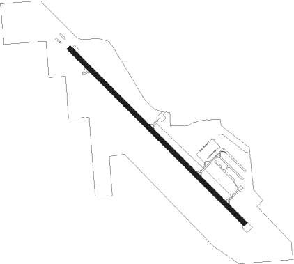
Runway info
| Runway 15 / 33 | ||
| length | 1234m (4049ft) | |
| bearing | 130° / 310° | |
| width | 23m (75ft) | |
| surface | asphalt | |
| displ threshold | 334m (1096ft) / 34m (112ft) | |
| blast zone | 90m (295ft) / 0m (0ft) | |
Nearby beacons
| code | identifier | dist | bearing | frequency |
|---|---|---|---|---|
| MB | JEPOT (MANISTEE) NDB | 21.4 | 171° | 254 |
| MBL | DME | 21.4 | 189° | 111.40 |
| TVC | TRAVERSE CITY VOR/DME | 27.9 | 86° | 114.60 |
| TV | GWENN (TRAVERSE CITY) NDB | 33.6 | 82° | 365 |
| MA | WEXOR (CADILLAC) NDB | 36.4 | 121° | 336 |
Instrument approach procedures
| runway | airway (heading) | route (dist, bearing) |
|---|---|---|
| RW15 | VULHU (98°) | VULHU WIMQE (5mi, 44°) 2700ft |
| RW15 | WIMQE (117°) | WIMQE 2700ft |
| RW15 | YUQZU (139°) | YUQZU WIMQE (5mi, 224°) 2700ft |
| RNAV | WIMQE 2700ft ZIVKU (6mi, 116°) 2400ft HUSDI (5mi, 116°) 794ft (5243mi, 117°) 1033ft WIMQE (5253mi, 297°) 2700ft WIMQE (turn) | |
| RW33 | OYVUK (325°) | OYVUK 3500ft |
| RW33 | UYIPO (352°) | UYIPO 3500ft OYVUK (5mi, 71°) 3500ft |
| RW33 | YULYU (303°) | YULYU 3500ft OYVUK (5mi, 251°) 3500ft |
| RNAV | OYVUK 3500ft WECQO (7mi, 326°) 2600ft JEQMU (6mi, 326°) 802ft (5242mi, 117°) 1033ft OYVUK (5237mi, 297°) 3500ft OYVUK (turn) |
Disclaimer
The information on this website is not for real aviation. Use this data with the X-Plane flight simulator only! Data taken with kind consent from X-Plane 12 source code and data files. Content is subject to change without notice.