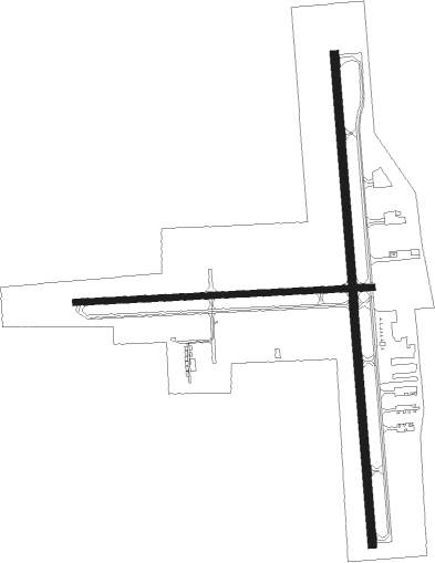
Fond Du Lac - Fond Du Lac Co
Airport details
| Country | United States of America |
| State | Wisconsin |
| Region | K5 |
| Airspace | Chicago Ctr |
| Municipality | Town of Fond du Lac |
| Elevation | 808ft (246m) |
| Timezone | GMT -6 |
| Coordinates | 43.77117, -88.48842 |
| Magnetic var | |
| Type | land |
| Available since | X-Plane v10.40 |
| ICAO code | KFLD |
| IATA code | FLD |
| FAA code | FLD |
Communication
| Fond Du Lac Co ASOS | 134.000 |
| Fond Du Lac Co CTAF/UNICOM | 122.800 |
Approach frequencies
| LOC | RW36 | 108.3 | 18.00mi |
Nearby Points of Interest:
Chicago and Northwestern Railroad Depot (Fond du Lac, Wisconsin)
-Wallace-Jagdfeld Octagon House
-El Dorado Apartments
-Octagon House
-First Baptist Church of Fond du Lac
-South Main Street Historic District
-Aetna Station No. 5
-George and Mary Agnes Dana House
-Sisson's Peony Gardens
-St. John the Baptist Catholic Church
-W. H. Boller Meat Market and Residence
-St. Andrew's Church
-Brandon Village Hall and Library
-Waupun Public Library
-Waupun Correctional Institution
-Martin K. Dahl House
-Zion Congregational Church
-Robert Lutz House
-Brooklyn No. 4 Fire House
-Richard Guenther House
-Trinity Episcopal Church
-First Methodist Church
-Oviatt House
-St. Peter's Episcopal Church
-Baptist Church

Nearby beacons
| code | identifier | dist | bearing | frequency |
|---|---|---|---|---|
| OS | POBER (OSHKOSH) NDB | 6.8 | 326° | 395 |
| OSH | OSHKOSH VORTAC | 13.4 | 343° | 116.75 |
| UNU | JUNEAU NDB | 22.5 | 212° | 344 |
| BJB | WEST BEND VOR | 26.2 | 134° | 109.80 |
| AQ | KOOKY (APPLETON) NDB | 26.9 | 11° | 407 |
| FAH | (SHEBOYGAN) DME | 27.7 | 90° | 110 |
| RYV | ROCK RIVER (WATERTOWN) NDB | 37.3 | 202° | 371 |
| BAE | BADGER (MILWAUKEE) VOR/DME | 40.2 | 163° | 116.40 |
| SG | DEPRE (GREEN BAY) NDB | 40.6 | 30° | 332 |
| MTW | DME | 41 | 66° | 111 |
| GR | FAMIS (GREEN BAY) NDB | 41.6 | 20° | 356 |
| MT | MAWOC (MANITOWOC) NDB | 42.6 | 61° | 362 |
| LJT | (MILWAUKEE) DME | 44.3 | 146° | 115.65 |
| GRB | GREEN BAY VORTAC | 48.7 | 21° | 115.50 |
| MSN | MADISON VORTAC | 52.8 | 234° | 108.60 |
Instrument approach procedures
| runway | airway (heading) | route (dist, bearing) |
|---|---|---|
| RW18 | NUNAE (219°) | NUNAE WESAK (8mi, 270°) 3100ft |
| RW18 | WOTRI (141°) | WOTRI WESAK (8mi, 90°) 3100ft |
| RNAV | WESAK 3100ft ZIGOM (8mi, 180°) 2500ft KFLD (6mi, 181°) 828ft (5340mi, 116°) 1300ft BADAN (5353mi, 296°) 3000ft BADAN (turn) | |
| RW36 | BADAN (84°) | BADAN SABLL (11mi, 145°) 3000ft FONDY (8mi, 90°) 2700ft |
| RW36 | CYNDI (281°) | CYNDI TRIAD (21mi, 263°) 3000ft FONDY (8mi, 270°) 2700ft |
| RNAV | FONDY 2700ft TEJEY (6mi, 0°) 2500ft ZESDA (3mi, 0°) 1500ft KFLD (3mi, 357°) 839ft (5340mi, 116°) 1400ft BADAN (5353mi, 296°) 3000ft BADAN (turn) |
Disclaimer
The information on this website is not for real aviation. Use this data with the X-Plane flight simulator only! Data taken with kind consent from X-Plane 12 source code and data files. Content is subject to change without notice.