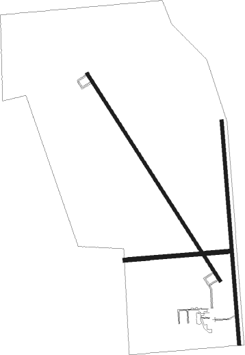
Fort Morgan
Airport details
| Country | United States of America |
| State | Colorado |
| Region | K2 |
| Airspace | Denver Ctr |
| Municipality | Morgan County |
| Elevation | 4567ft (1392m) |
| Timezone | GMT -7 |
| Coordinates | 40.33545, -103.80417 |
| Magnetic var | |
| Type | land |
| Available since | X-Plane v10.40 |
| ICAO code | KFMM |
| IATA code | n/a |
| FAA code | FMM |
Communication
| Fort Morgan AWOS | 132.950 |
| Fort Morgan CTAF/UNICOM | 123.050 |
Nearby Points of Interest:
Fort Morgan State Armory
-All Saints Church of Eben Ezer
-Akron Gymnasium
Nearby beacons
| code | identifier | dist | bearing | frequency |
|---|---|---|---|---|
| AKO | AKRON VOR/DME | 30.5 | 106° | 114.40 |
| GLL | GILL VOR/DME | 35.7 | 283° | 114.20 |
| DVV | MILE HIGH (DENVER) VORTAC | 46 | 242° | 114.70 |
| TXC | THURMAN VORTAC | 46.8 | 137° | 112.90 |
| DEN | DENVER VOR/DME | 50.3 | 239° | 117.90 |
| FQF | FALCON (DENVER) VORTAC | 53.9 | 232° | 116.30 |
| BKF | BUCKLEY (AURORA) TACAN | 57.6 | 236° | 109.60 |
| SNY | SIDNEY VOR/DME | 59 | 47° | 115.90 |
| CYS | CHEYENNE VORTAC | 68.5 | 312° | 113.10 |
Instrument approach procedures
| runway | airway (heading) | route (dist, bearing) |
|---|---|---|
| RW14 | CAPVA (192°) | CAPVA ECUDI (10mi, 248°) 7400ft |
| RW14 | DEKTE (109°) | DEKTE ECUDI (10mi, 67°) 7400ft |
| RW14 | ECUDI (145°) | ECUDI 14000ft ECUDI (turn) 7400ft |
| RNAV | ECUDI 7400ft FEPAS (7mi, 145°) 6200ft GISEY (3mi, 145°) 5340ft KFMM (3mi, 144°) 4625ft (6035mi, 111°) 4845ft HARPU (6030mi, 291°) 7400ft HARPU (turn) | |
| RW32 | HARPU (325°) | HARPU 7400ft |
| RW32 | KASEC (289°) | KASEC HARPU (10mi, 248°) 7400ft |
| RW32 | LAYCE (11°) | LAYCE HARPU (10mi, 67°) 7400ft |
| RNAV | HARPU 7400ft JADEK (8mi, 325°) 6200ft KFMM (5mi, 325°) 4561ft (6035mi, 111°) 4796ft ECUDI (6039mi, 291°) 7400ft ECUDI (turn) |
Disclaimer
The information on this website is not for real aviation. Use this data with the X-Plane flight simulator only! Data taken with kind consent from X-Plane 12 source code and data files. Content is subject to change without notice.

