Farmington - Four Corners Regl
Airport details
| Country | United States of America |
| State | New Mexico |
| Region | K2 |
| Airspace | Denver Ctr |
| Municipality | Farmington |
| Elevation | 5502ft (1677m) |
| Timezone | GMT -7 |
| Coordinates | 36.74125, -108.22994 |
| Magnetic var | |
| Type | land |
| Available since | X-Plane v10.40 |
| ICAO code | KFMN |
| IATA code | FMN |
| FAA code | FMN |
Communication
| Four Corners Regl ATIS | 127.150 |
| Four Corners Regl CTAF | 118.900 |
| Four Corners Regl UNICOM | 122.950 |
| Four Corners Regl GROUND | 121.700 |
| Four Corners Regl FARMINGTON TOWER | 118.900 |
| Four Corners Regl DENVER ApproachROACH | 118.575 |
| Four Corners Regl DENVER DepartureARTURE | 118.575 |
Approach frequencies
| ILS-cat-I | RW25 | 111.9 | 18.00mi |
| 3° GS | RW25 | 111.9 | 18.00mi |
Nearby Points of Interest:
Farmington Historic Downtown Commercial District
-Engleman-Thomas Building
-American Hotel
-Aztec Main Street Historic District
-Aztec Ruins Administration Building-Museum
-Denver and Rio Grande Western Railway Depot
-Crow Canyon Archaeological District
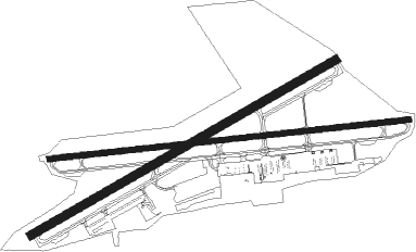
Runway info
Runway 7 / 25  | ||
| length | 2039m (6690ft) | |
| bearing | 89° / 269° | |
| width | 30m (100ft) | |
| surface | asphalt | |
| displ threshold | 73m (240ft) / 57m (187ft) | |
| blast zone | 18m (59ft) / 18m (59ft) | |
| Runway 5 / 23 | ||
| length | 1978m (6490ft) | |
| bearing | 69° / 249° | |
| width | 46m (150ft) | |
| surface | asphalt | |
| displ threshold | 0m (0ft) / 38m (125ft) | |
Nearby beacons
| code | identifier | dist | bearing | frequency |
|---|---|---|---|---|
| RSK | RATTLESNAKE (FARMINGTON) VORTAC | 6.3 | 87° | 115.30 |
| DRO | DURANGO VOR/DME | 33.8 | 49° | 116.55 |
| CEZ | CORTEZ VOR/DME | 42 | 333° | 108.40 |
Departure and arrival routes
| Transition altitude | 18000ft |
| Transition level | 18000ft |
| SID end points | distance | outbound heading | |
|---|---|---|---|
| RW23 | |||
| PLATA1 | 17mi | 10° | |
| RW25 | |||
| PLATA1 | 17mi | 10° | |
Instrument approach procedures
| runway | airway (heading) | route (dist, bearing) |
|---|---|---|
| RW05 | GUVBE (50°) | GUVBE OVPUE (11mi, 27°) 8000ft |
| RW05 | PLATA (170°) | PLATA RIVGE (19mi, 228°) 9500ft OVPUE (7mi, 138°) 8000ft |
| RW05 | ZENFO (78°) | ZENFO OVPUE (20mi, 83°) 8000ft |
| RNAV | OVPUE 8000ft LASGE (6mi, 69°) 7300ft KFMN (6mi, 69°) 5527ft (6277mi, 109°) 5750ft DIYEP (6267mi, 289°) 8400ft DIYEP (turn) | |
| RW07 | DERMA (48°) | DERMA HASIT (13mi, 3°) 8000ft |
| RW07 | HASIT (89°) | HASIT 8000ft |
| RW07 | PLATA (170°) | PLATA PAKIE (12mi, 239°) 10000ft HASIT (8mi, 178°) 8000ft |
| RNAV | HASIT 8000ft TEBIE (6mi, 89°) 7000ft KFMN (5mi, 89°) 5532ft (6277mi, 109°) 5760ft CODEN (6265mi, 289°) 8300ft CODEN (turn) | |
| RW23 | ADUMY (277°) | ADUMY HEBLO (9mi, 330°) 9500ft |
| RW23 | CUMOR (216°) | CUMOR HEBLO (9mi, 150°) 9500ft |
| RW23 | HEBLO (249°) | HEBLO 9500ft |
| RNAV | HEBLO 9500ft ODLAE (5mi, 249°) 7800ft IDGIY (4mi, 249°) 6500ft KFMN (3mi, 249°) 5546ft (6277mi, 109°) 5755ft EXZAR (6280mi, 289°) HASIT (8mi, 276°) 8000ft HASIT (turn) | |
| RW25 | DRO (229°) | DRO TURLY (23mi, 183°) 9900ft POMEE (9mi, 264°) 8400ft |
| RW25 | MISSY (307°) | MISSY POMEE (15mi, 349°) 8400ft |
| RNAV | POMEE 8400ft EPOTE (6mi, 269°) 7800ft KODYS (4mi, 269°) 6640ft KFMN (4mi, 269°) 5560ft (6277mi, 109°) 5707ft HASIT (6288mi, 289°) 8000ft HASIT (turn) |
Disclaimer
The information on this website is not for real aviation. Use this data with the X-Plane flight simulator only! Data taken with kind consent from X-Plane 12 source code and data files. Content is subject to change without notice.