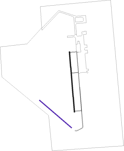
Fairmont - Fairmont State Afld
Airport details
| Country | United States of America |
| State | Nebraska |
| Region | K3 |
| Airspace | Minneapolis Ctr |
| Municipality | Fillmore County |
| Elevation | 1636ft (499m) |
| Timezone | GMT -6 |
| Coordinates | 40.58610, -97.57314 |
| Magnetic var | |
| Type | land |
| Available since | X-Plane v10.40 |
| ICAO code | KFMZ |
| IATA code | n/a |
| FAA code | FMZ |
Communication
| Fairmont State Afld CTAF | 122.900 |
Nearby Points of Interest:
Fairmont State Airfield
-George W. Smith House
-The Auditorium
-Cesko-narodni sin-Milligan Auditorium
-Strang School District No. 36
-Deering Bridge
-Isaac Newton Clark House
-Rad Saline Center cis. 389 Z.C.B.J.
-Bradshaw Town Hall
-Z.C.B.J. Rad Tabor No. 74
-Richard E. Dill House
-Clay County Courthouse
-IOOF Opera House
-Hebron United States Post Office
-Telocvicna Jednota Sokol
-W.S. Jeffery Farmstead
-Streeter-Peterson House
-Fairfield Carnegie Library
-Clem's Opera House
-Deutsche Evangelisch Lutherische Zion Kirche
-Frank J. Rademacher House
-Saline County Courthouse
-Doane College Historic Buildings
-Sokol Pavilion
-Seward County Courthouse
Nearby beacons
| code | identifier | dist | bearing | frequency |
|---|---|---|---|---|
| FMZ | BEKLOF (FAIRMONT) NDB | 0.3 | 53° | 392 |
| JYR | YORK NDB | 18.8 | 352° | 257 |
| FBY | FAIRBURY NDB | 30.8 | 135° | 293 |
| GR | SANCY NDB | 37.8 | 291° | 380 |
| LN | POTTS (LINCOLN) NDB | 38.1 | 79° | 385 |
| HSI | HASTINGS VOR/DME | 39 | 271° | 108.80 |
| BIE | BEATRICE VOR | 41.1 | 109° | 110.60 |
| GRI | GRAND ISLAND VOR/DME | 41.3 | 298° | 112 |
| LNK | LINCOLN VORTAC | 42.9 | 68° | 116.10 |
| OLU | COLUMBUS VOR/DME | 52.9 | 15° | 111.80 |
| PLT | PLATTE CENTER (COLUMBUS) NDB | 55.3 | 12° | 407 |
| TKO | MANKATO VORTAC | 56.4 | 221° | 109.80 |
| AHQ | WAHOO NDB | 59.1 | 56° | 400 |
| OBH | WOLBACH VORTAC | 59.1 | 315° | 114.80 |
Instrument approach procedures
| runway | airway (heading) | route (dist, bearing) |
|---|---|---|
| RW17 | CELTA (180°) | CELTA 10000ft CELTA (turn) 4000ft |
| RW17 | CEVER (210°) | CEVER CELTA (5mi, 270°) 4000ft |
| RW17 | FATSA (150°) | FATSA CELTA (5mi, 90°) 4000ft |
| RNAV | CELTA 4000ft BOLPE (6mi, 180°) 3200ft KFMZ (5mi, 181°) 1675ft (5750mi, 113°) 1934ft UNITE (5751mi, 292°) 4000ft UNITE (turn) | |
| RW35 | IPIVY (30°) | IPIVY UNITE (5mi, 90°) 4000ft |
| RW35 | UNITE (359°) | UNITE 10000ft UNITE (turn) 4000ft |
| RW35 | VALUU (329°) | VALUU UNITE (5mi, 270°) 4000ft |
| RNAV | UNITE 4000ft LYYON (6mi, 360°) 3200ft ATOYO (3mi, 360°) 2180ft KFMZ (2mi, 356°) 1674ft (5750mi, 113°) 1934ft CELTA (5749mi, 293°) 4000ft CELTA (turn) |
Disclaimer
The information on this website is not for real aviation. Use this data with the X-Plane flight simulator only! Data taken with kind consent from X-Plane 12 source code and data files. Content is subject to change without notice.

