Falls City - Brenner Fld
Airport details
| Country | United States of America |
| State | Nebraska |
| Region | K3 |
| Airspace | Kansas City Ctr |
| Municipality | Falls City |
| Elevation | 981ft (299m) |
| Timezone | GMT -6 |
| Coordinates | 40.07878, -95.59200 |
| Magnetic var | |
| Type | land |
| Available since | X-Plane v10.40 |
| ICAO code | KFNB |
| IATA code | n/a |
| FAA code | FNB |
Communication
| Brenner Fld CTAF/UNICOM | 122.800 |
Nearby Points of Interest:
Richardson County Courthouse
-Gehling's Theatre
-Rulo Bridge
-St. John's Evangelical Lutheran Church
-Old Albany Schoolhouse
-Site No. RH00-062
-Alfred and Magdalena Schmid Farmstead
-Chicago, Burlington and Quincy Depot
-John Holman House
-John W. Bennett House
-City Hall
-Brownville Bridge
-Irvin Hall
-Rad Jan Kollar cis 101 Z.C.B.J.
-Nemaha County Courthouse
-Auburn United States Post Office
-Rankin Hall
-United States Post Office
-Pawnee County Courthouse
-Doniphan County Courthouse
-Camp Creek School, Otoe County District No. 54
Runway info
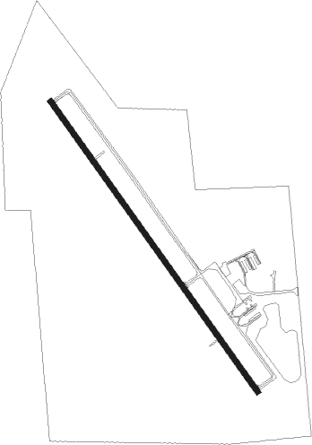
| Runway 15 / 33 | ||
| length | 1220m (4003ft) | |
| bearing | 142° / 322° | |
| width | 18m (59ft) | |
| surface | concrete | |
Nearby beacons
| code | identifier | dist | bearing | frequency |
|---|---|---|---|---|
| RBA | DME | 15.7 | 144° | 108.20 |
| PWE | PAWNEE CITY VORTAC | 29.1 | 281° | 112.40 |
| STJ | SAINT JOSEPH (ST JOSEPH) VORTAC | 31.4 | 100° | 115.50 |
| AZN | AMAZON (SAINT JOSEPH) NDB | 33.5 | 106° | 233 |
| AFK | NEBRASKA CITY NDB | 33.9 | 333° | 347 |
| ST | TARIO (ST JOSEPH) NDB | 39.7 | 120° | 260 |
| PMV | PLATTSMOUTH NDB | 53.9 | 340° | 329 |
| TOP | TOPEKA VORTAC | 56.5 | 177° | 117.80 |
| TO | BILOY (TOPEKA) NDB | 57.7 | 186° | 521 |
| RN | HUGGY (KANSAS CITY) NDB | 57.8 | 136° | 416 |
| MCI | KANSAS CITY VORTAC | 61.9 | 133° | 113.25 |
Instrument approach procedures
| runway | airway (heading) | route (dist, bearing) |
|---|---|---|
| RW15 | COVUT (142°) | COVUT 3000ft |
| RNAV | COVUT 3000ft KOSHO (9mi, 142°) 2700ft ODIVE (3mi, 142°) 1840ft KFNB (3mi, 142°) 1024ft (5662mi, 113°) 1234ft USACE (5656mi, 293°) 3000ft USACE (turn) | |
| RW33 | USACE (322°) | USACE 3000ft |
| RNAV | USACE 3000ft TAYUG (7mi, 322°) 2700ft ZIGNI (4mi, 322°) 1520ft KFNB (2mi, 322°) 1020ft (5662mi, 113°) 1234ft COVUT (5669mi, 293°) 3000ft COVUT (turn) |
Disclaimer
The information on this website is not for real aviation. Use this data with the X-Plane flight simulator only! Data taken with kind consent from X-Plane 12 source code and data files. Content is subject to change without notice.