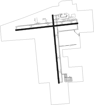
Flint - Bishop Intl
Airport details
| Country | United States of America |
| State | Michigan |
| Region | K5 |
| Airspace | Cleveland Ctr |
| Municipality | Flint |
| Elevation | 782ft (238m) |
| Timezone | GMT -5 |
| Coordinates | 42.96547, -83.74475 |
| Magnetic var | |
| Type | land |
| Available since | X-Plane v10.40 |
| ICAO code | KFNT |
| IATA code | FNT |
| FAA code | FNT |
Communication
| Bishop Intl ATIS | 133.150 |
| Bishop Intl CTAF | 126.300 |
| Bishop Intl UNICOM | 122.950 |
| Bishop Intl Clearance DEL | 121.750 |
| Bishop Intl FLINT Ground Control | 121.900 |
| Bishop Intl FLINT Tower | 126.300 |
| Bishop Intl FLINT Approach/Departure | 118.800 |
| Bishop Intl FLINT Approach/Departure | 128.550 |
| Bishop Intl FLINT Approach/Departure | 133.800 |
Approach frequencies
| ILS-cat-I | RW09 | 109.9 | 18.00mi |
| ILS-cat-I | RW27 | 109.9 | 18.00mi |
| 3° GS | RW27 | 109.9 | 18.00mi |
| 2.8° GS | RW09 | 109.9 | 18.00mi |
Nearby Points of Interest:
Robert P. Aitken Farm House
-Morris A. Knight House
-Genesee County Courthouse
-Elks Lodge Building
-Flint Brewing Company Building
-Durant-Dort Carriage Company Office
-First Street Lofts
-Genesee County Savings Bank
-Horace Gilbert House
-Tinlinn Apartments
-Berridge Hotel
-Flint Journal Building
-Civic Park Historic District
-Daniel O'Sullivan House
-Jesse H. Buck Farm House
-Main Street Historic District
-Barn at 4277 Irish Road
-Atlas Grange Hall
-Bridge Street-Broad Street Historic District
-Genesee Avenue–Walker Street Historic District
-James H. Murray House
-House at 4344 Frances Road
-Fenton Railroad Depot
-Dibbleville-Fentonville Historic District
-William Henry and Lucinda McCaslin Farm House
Nearby beacons
| code | identifier | dist | bearing | frequency |
|---|---|---|---|---|
| FNT | FLINT VORTAC | 0.1 | 300° | 116.90 |
| PSI | DME | 18.4 | 141° | 111 |
| SVM | SALEM VORTAC | 34 | 165° | 114.30 |
| MB | OLSTE (SAGINAW) NDB | 35.3 | 319° | 257 |
| MBS | SAGINAW VOR/DME | 36.9 | 330° | 112.90 |
| MTC | SELFRIDGE (MOUNT CLEMENS) TACAN | 45.4 | 111° | 133.70 |
| DXO | DETROIT VOR/DME | 48.1 | 153° | 113.40 |
| DM | SPENC (DETROIT) NDB | 50.7 | 144° | 223 |
| DT | REVUP (DETROIT) NDB | 52.6 | 160° | 388 |
| JXN | DME | 52.8 | 225° | 115.45 |
| QG | WINDSOR NDB | 55 | 127° | 353 |
| TCU | TECUMSEH NDB | 56.2 | 189° | 239 |
| CRL | CARLETON VOR/DME | 56.5 | 163° | 115.70 |
| RYS | GROSSE ILE (DETROIT) NDB | 58.1 | 146° | 419 |
| MOP | MOUNT PLEASANT VOR/DME | 58.6 | 304° | 110.60 |
Departure and arrival routes
| Transition altitude | 18000ft |
| Transition level | 18000ft |
| STAR starting points | distance | inbound heading | |
|---|---|---|---|
| ALL | |||
| FOREY2 | 82.7 | 316° | |
Instrument approach procedures
| runway | airway (heading) | route (dist, bearing) |
|---|---|---|
| RW09 | CLIOO (139°) | CLIOO FONKO (7mi, 247°) 2400ft AJDIF (5mi, 177°) 2400ft |
| RW09 | FNT (120°) | FNT AJDIF (12mi, 269°) 2400ft AJDIF (turn) 2400ft |
| RW09 | POLAR (356°) | POLAR CIHUB (12mi, 279°) 2500ft AJDIF (5mi, 357°) 2400ft |
| RNAV | AJDIF 2400ft EHEMI (6mi, 89°) 2400ft KFNT (6mi, 90°) 814ft (5131mi, 117°) 971ft JUBUG (5128mi, 297°) KATTY (8mi, 92°) 3000ft KATTY (turn) | |
| RW18 | BIRRS (175°) | BIRRS JUBER (11mi, 171°) 3100ft |
| RW18 | FIBIN (210°) | FIBIN JUBER (5mi, 269°) 3100ft |
| RW18 | JUBER (179°) | JUBER 3100ft |
| RW18 | OWOSO (97°) | OWOSO NUPUE (13mi, 59°) 3100ft JUBER (5mi, 89°) 3100ft |
| RNAV | JUBER 3100ft CODAG (6mi, 179°) 2400ft EVNEW (2mi, 179°) 1640ft KFNT (3mi, 180°) 807ft (5131mi, 117°) 1109ft HAGEM (5130mi, 297°) POLAR (5mi, 175°) 3000ft POLAR (turn) | |
| RW27 | ADRIE (271°) | ADRIE JAGMI (16mi, 273°) 2900ft |
| RW27 | JAGMI (268°) | JAGMI 2900ft |
| RW27 | SUANN (200°) | SUANN ZORGA (13mi, 142°) 2900ft JAGMI (5mi, 178°) 2900ft |
| RW27 | WIPEM (286°) | WIPEM JAGMI (5mi, 358°) 2900ft |
| RNAV | JAGMI 2900ft HIKOP (6mi, 269°) 2400ft IYUPI (2mi, 269°) 1640ft KFNT (3mi, 266°) 819ft (5131mi, 117°) 1098ft CURGO (5134mi, 297°) CLIOO (9mi, 342°) 3000ft CLIOO (turn) | |
| RW36 | ERRYS (76°) | ERRYS COKIN (14mi, 108°) 2700ft HITMO (5mi, 89°) 2700ft |
| RW36 | HITMO (358°) | HITMO 2700ft |
| RW36 | KATTY (270°) | KATTY FISKU (13mi, 210°) 2900ft HITMO (5mi, 269°) 2700ft |
| RNAV | HITMO 2700ft JORDI (6mi, 359°) 2400ft DUVIH (2mi, 359°) 1660ft KFNT (3mi, 357°) 833ft (5131mi, 117°) 1123ft CEGNA (5131mi, 297°) CLIOO (8mi, 310°) 3000ft CLIOO (turn) |
Holding patterns
| STAR name | hold at | type | turn | heading* | altitude | leg | speed limit |
|---|---|---|---|---|---|---|---|
| FOREY2 | FOREY | VHF | right | 144 (324)° | DME 10.0mi | ICAO rules | |
| *) magnetic outbound (inbound) holding course | |||||||
Disclaimer
The information on this website is not for real aviation. Use this data with the X-Plane flight simulator only! Data taken with kind consent from X-Plane 12 source code and data files. Content is subject to change without notice.

